A Robust Recovery
We're on the road to recovery as we enjoy higher highs in the temperature department. Following the crash from Monday's 62 to Tuesday's 42, the max popped up to 47 degrees yesterday and has an excellent shot to peak at 55 today. I am calling for a Daily Double today with the afternoon highs doubling the morning lows in most locations. Sunshine will be abundant all day as the sky displays a few wisps, streamers or filaments of feathery clouds mainly later this afternoon. The wind will be much tamer than recent days as a light west-northwesterly breeze this morning becomes southwesterly and freshens to 10-25 mph during this afternoon. Cloudiness will increase tonight and as a light southwesterly breeze holds on, temperatures are unlikely to fall much below the upper 30s.
A developing wave of low pressure centered over the northeastern Gulf of Mexico is gathering moisture and wringing out rain over the southeastern states this morning. This system might trigger some spotty severe thunderstorms over FL today as its rain shield tracks northeastward. The storm will move off the North Carolina coast early tomorrow morning as the northern fringe of its envelope of rain sideswipes extreme southeastern MA and especially the Cape Cod and Islands region. I expect sprinkles to less than 0.10" over southern portions of Bristol County and Plymouth County ranging up to almost 0.25" on Cape Cod to perhaps up to a third of an inch on the islands. This rain will occur from roughly 8am to 1pm and some clearing will follow from northwest to southeast across the region tomorrow afternoon. It should become sunnier enabling temperatures to rise to 54-58 except closer to 50 on the Cape tomorrow afternoon. The northerly wind will be rather light around 10 mph during the day then increase to 15-25 mph or more tomorrow night after the passage of a cold front coming down from northern New England. There will be a shot of colder air with temperatures falling to the middle 20s to lower 30s tomorrow night with a rise to about 50 on Saturday. Sunshine should be bright all day with the brisk morning wind diminishing and possibly switching onshore during the afternoon.
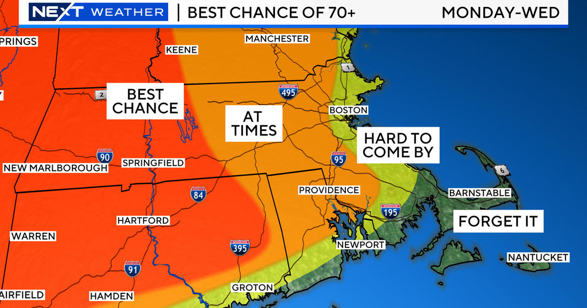
Looking ahead, as a warm frontal boundary pushes northeastward through the area on Sunday, there will be varying amounts of clouds and some sunshine. There could be a brief period of snow over some of the northern mountains before switching to showers up there Sunday afternoon. Around the Boston area, a freshening southerly wind will boost temperatures to the upper 50s to lower 60s Sunday afternoon. As a storm progresses down the St. Lawrence River Valley, its attached cold front will sag southeastward into southern New England and become quasi-stationary on Monday and Tuesday. This poses a problem because the boundary may provide a focus for some scattered showers to form and that is a possibility for later Monday afternoon. Hopefully, any of that action would hold off until the conclusion of the Red Sox Home Opener vs the Baltimore Orioles. Additionally, a light pressure gradient favors the development of a sea breeze so while it could warm up into the 60s inland, it will probably be in the upper 40s to middle 50s over the coastal plain and the temperature at Fenway Park would be somewhere in the range of 55 to perhaps 60. Warm air aloft suggests temperatures could reach 70 on Tuesday but that pesky front and onshore wind will be a deterrent. Afer Tuesday, it appears that the cold ocean will really take control as a raw east-northeasterly wind freshens and periods of rain and drizzle occur the second half of next week. As energy arrives from the west, the wet weather will become more widespread and it could even become cold enough to support some snow and sleet across parts of northern New England! Now that is a typical spell of spring weather for us here in New England while much of the rest of the eastern United States will enjoy above to much above average temperatures. Bottom line is the ocean can be our friend and it can be our foe.
Todd Gutner posts a fresh blog late this afternoon or early this evening and I shall return tomorrow morning.
Make it a great day!


