Another Snow Storm? It Depends Where You Are
BOSTON (CBS) - It sure feels like a hint of Spring out there today! We haven't seen a great deal of the sun lately, but Tuesday was a good reminder of how warm the late-February sun can make it feel.
It really doesn't feel like there should be snow in the forecast, and for many it actually isn't!
As you know, we can certainly go from 40-degree temperatures one day to snow the next in New England with ease. But this time, there just isn't a strong source of real cold air to tap. For that reason, most of us will see mainly rain on Wednesday.
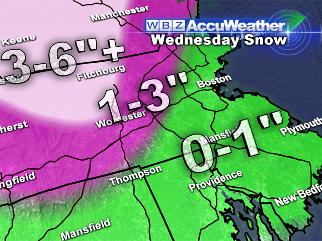
The precipitation will begin between 4 and 7 a.m. on Wednesday morning. The coast will see rain almost immediately. With a pretty stiff east wind off the relatively mild Atlantic Ocean, the coastline will have little to no chance of seeing any snow accumulation from this storm.
The same will hold true in the nearby suburbs of Boston as well. From 128 to 495, north and west of Boston there will be some mixing with rain and snow and perhaps even a slushy inch or so during the day on Wednesday.
Watch Todd Gutner's Forecast
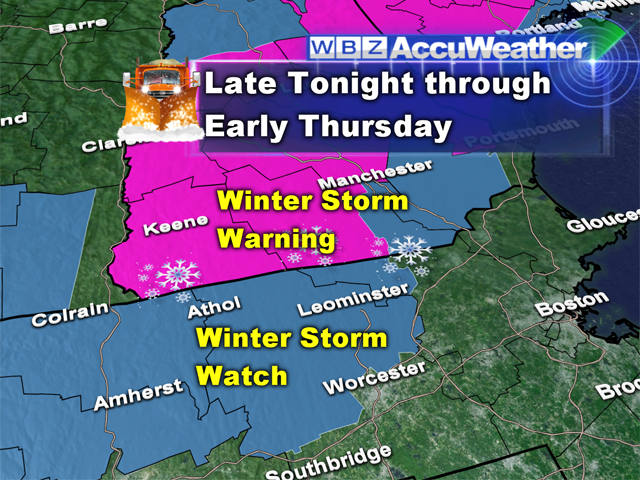
The best chance of any significant snow accumulation from this storm will be north and west of 495, particularly in the higher elevated areas of Northern Worcester County, Southwest New Hampshire and all of Central and Northern New England. If you live in any of these areas with a little bit of elevation, you will see between 3-6" of very heavy and wet snow. In fact, the farther north and west you go and the higher in elevation you live the better chance you have of seeing snow totals of even greater than 6".
This storm will be another bonanza for Ski Country. Many resorts in northern New England will get a foot of snow on top of the already impressive late season totals!
The rain and snow will taper off Wednesday evening but will not completely shut off for a few days. We will be stuck in a relatively unsettled pattern on Thursday and Friday with periods of mainly light rain during the day and light snow at night.
In fact there may even be some light snow accumulation in southern New England late Thursday night and during the Friday morning commute.
While no significant snow storms are in the pipeline for now, temperatures will remain near or below normal for the foreseeable future well into next week, holding Spring at bay for a while longer.
Follow Terry on Twitter @TerryWBZ


