Surge Of Warmth
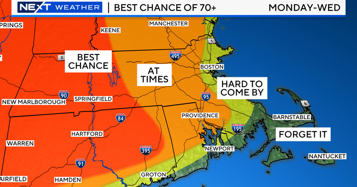
There is a wedge of warmth on the way and it will be introduced by showery rains later tonight into the morning commute. A warm frontal boundary will push into southern New England tomorrow morning but its momentum will likely wane during the day resulting in a stall somewhere across north central MA into southeastern NH or extreme northeastern MA. The highest chance for air in the range of 60-65 degrees exists across southern CT, RI and southeastern MA up into the Boston area. Any areas farther and farther north and west of Boston will face a decreasing chance of that warmth. Boston's record high for December 10 is 64 degrees set in 1907. It is unlikely that will be reached but it cannot be completely ruled out. It is more likely that places in Plymouth County and Bristol County will have that temperature. I am leaning to 62 in Boston then dropping off northwestward to the upper 40s to near 50 over north central MA into southeastern NH. North of that, it will be colder than that. In fact, sufficient cold air is draining into northern New England and northwestern MA now to heighten the risk of a mix of frozen precipitation later tonight so the National Weather Service has issued a Winter Weather Advisory. The mix will switch to all rain up there tomorrow. In the warm sector, the south-southwesterly wind will freshen to 15-30 mph with some higher gusts possible over Cape Cod. As the day progresses, a cold front will be advancing eastward from NY. It is destined to transit through our region tomorrow evening with a projected arrival at Gillette Stadium just before the Pats/Texans Game is completed. I expect middle 50s there for much of the game with a risk of a drop to the upper 40s by 11pm to midnight. Plan on some showers anytime during the game but the heaviest rain may occur with the warm front late tonight.
After tomorrow's interesting day, the weather will be tranquil and bright for the rest of the week. A ridge of high pressure will build in to control the regime with light wind. Overnight lows will be in the 20s with daytime highs in the seasonable lower to middle 40s for the most part. The ridge will settle southward to allow a southwesterly breeze and slightly milder air over the top on Friday. A cold front racing southward out of southern Canada will pass through Friday evening with patchy clouds and that will be followed by cold high pressure building southward from Quebec for next Saturday. Meantime, a strong disturbance charging southeastward from the eastern Pacific into southern California at midweek will cross the central and southern Plains by Saturday then into the Great Lakes by Sunday. Its associated frontal boundary will provide a slug of rain here a week from tonight. Looking way ahead, the next weather maker will pursue a route a bit farther south as Greenland blocking unfolds. Speculatively, it could shape up to be a big rain storm for us around the 19th of the month. It bears watching because if the system is driven farther south by the block, snow would become more of a factor especially across northern New England. Longer range guidance continues to indicate about 3 potential storms from about December 16-25. It remains to be seen which, if any, of them will be snow producers. We are officially on White Christmas Watch!
Melissa Mack delivers her latest WBZ AccuWeather Forecast in the morning andTodd Gutner follows later in the day.
Make is a great week.


