Series of Storms
Mother Nature is keeping us on our toes! It's an active weather pattern with fronts that are spending ~24-36 hours near southern New England before departing offshore.
Check: Current Conditions | Weather Maps | Interactive Radar
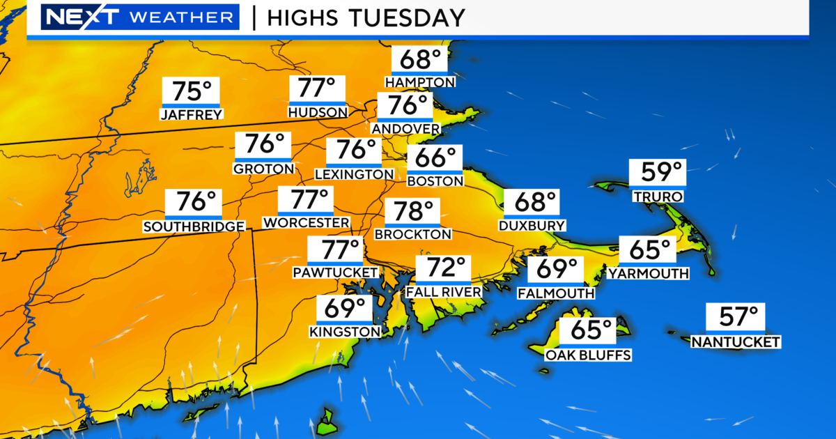
Today will be another beauty decorated with sunshine, late-day clouds, and low humidity. Highs will reach 85-90 for interior neighborhoods, while the S.Coast/Cape Cod/Islands/Cape Ann will be in the lower to middle 80s.
A cold front moving in from our west will create a mostly cloudy sky by tonight.
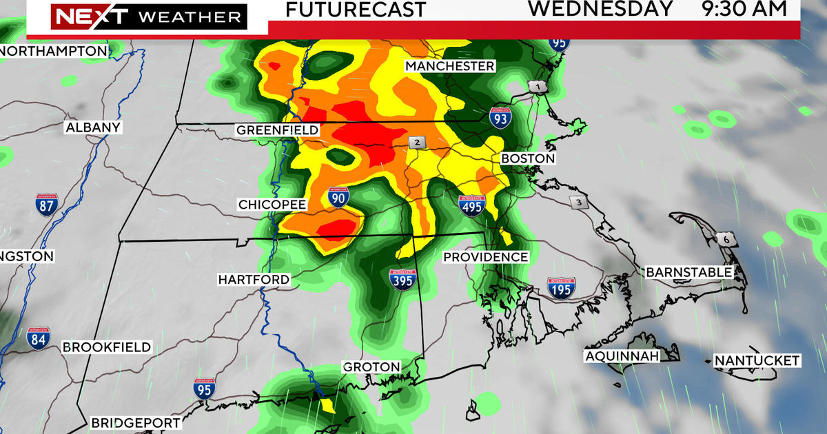
Wednesday will be mostly cloudy with scattered showers and storms arriving from late-morning and lingering into the evening. The majority of the upper level support is north and west of Boston during the day. Highs will reach the lower 80s.
The NAM is depicting a more potent shortwave to produce heavier downpours for southeastern Mass. on Wednesday night.
With the slow departure of the cold front, a lingering shower is not out of the question on Thursday morning.
Otherwise, Thursday looks pretty dry with a slim chance of a spot afternoon storm with a cool pool of air aloft through about 2 p.m. The newest NAM model shows a calm wind transitioning to a light north-northeast breeze. If this rings true, many coastal communities will have highs in the 70s.
Friday will begin with sunshine and end with more clouds. The 06z run of the NAM as well as the GFSx now show a chance of a few evening showers and storms with the cold front moving quicker than the 00z run. The EURO 00z run still staves off the rain until midday Saturday. When looking at past weather systems this summer, it leads me to believe that the odds are more likely that the front slows down as opposed to speeding up.
This weekend may end up like the past weekend.
The EURO shows showers and storms developing midday Saturday. It also keeps a chance of rain in the forecast through midday Sunday.
We will have to watch the speed/eastward progress of this frontal boundary. The NAM and GFSx have the showers and storms developing from Friday evening through early Saturday. Then, they depict a drier Saturday afternoon and evening with the cold front moving and stalling offshore instead of stalling across Southern New England. The GFSx also shows a drier and brighter scenario on Sunday. Let's hope this comes to fruition for a beautiful late summer weekend.
Night sky observers can check out this link for details of this week's night sky.
~Melissa :)