A Split Week
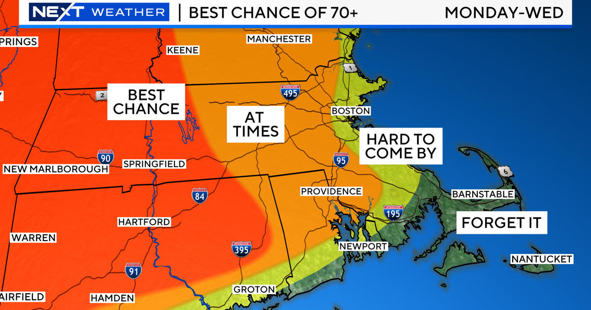
An upper level disturbance will be yielding scattered showers and a few thunderstorms as it crosses the area overnight. The air will be muggy and the temperatures will fall off to average lows in the lower 70s. This system will exit enabling developing sunshine tomorrow with a mix of clouds from time to time with only a minimal risk of any showers and storms. It should pop up to near 92 except local onshore breezes will keep some beaches cooler with a high tide just after 10 in the morning. Heat rebuilding in the Midwest will stream into the Northeast on Tuesday with near record high temperatures probable. Boston's record of 98 degrees set in 1999 could be challenged. Presently, I am predicting that many communities top out at 97 degrees with a brisk southwesterly wind freshening to 15-25 mph. This will keep south-facing coastal areas cooler with highs on the South Coast including much of Cape Cod, the outer part of Cape Ann and the ME coast in the upper 70s to middle 80s. The humidity will remain essentially high through the period. A cold front will be advancing southward from southern Canada triggering some thunderstorms over the northern mountains Tuesday afternoon but none elsewhere. As this front continues its journey toward the Boston area Tuesday night, the showers and storms will fizzle over the rest of northern New England then refire across southern New England mainly near and south of the MA Pike Wednesday afternoon. Expect drier and more stable air to flow into VT, NH and ME Wednesday so no more showers up there. Temperatures may still spike to near 90 on Wednesday in the Boston area despite the prevalence of clouds.
Looking ahead to the second half of the week, I can't contain my excitement. Another mass of invigorating air will visit our region from Canada. We are so blessed to receive these occasional breaks of relief. The humidity will be low from Thursday through Saturday with a slight uptick next Sunday. The days will be generally sunny to no more than partly cloudy with highs of 80-84. The nights will become comfortable with lows in the 55-60 range in most of the suburbs and near 65 in the larger urban centers. The likelihood of a sea breeze suggests that mostly 75-80 degrees will be more common at the beaches. How sweet is that? Gotta love it!!! I can guarantee that one week from today will be far different from the July 22 of last year when Boston recorded its second highest temperature ever on record at 103 degrees! Next Sunday on 7/22, it should be closer to 85 in the city. Thank goodness!
Melissa Mack delivers her AccuWeather Forecast in the morning and Todd Gutner follows later in the day.
Make it a great week!


