Road Trip: Adams, Massachusetts
While many people flock to the coast for their summer vacation getaway, how about taking a trip west, to a spot where you can truly enjoy nature's beauty.
Imagine yourself hiking through miles of trails, breathing in the fresh, crisp air as you scale your way to the top of the highest point in Massachusetts. This trip is an outdoors enthusiast's ideal getaway. Welcome to Adams.
GETTING THERE:
Distance from Boston: About 150 miles
Travel Time: About 3 Hours
MOUNT GREYLOCK
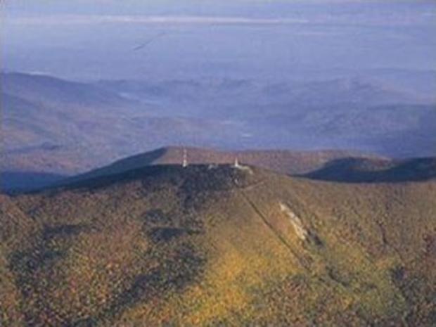
Take a real adventure while on vacation. You can head to the northwest corner of Massachusetts, to Mount Greylock State Reservation. Hikers can chose from 60 miles of trials on the reservation, including a seven mile walk up Mount Greylock -- the tallest peak in Massachusetts. Once you reach the summit of the mountain, you will see the War Veterans Memorial Tower, where authors such as Hawthorne, Melville and Thoreau were known to hang out.
If you are not one for hiking, you can jump on a mountain bike, or in the winter time, enjoy some backcountry skiing.
Parking is free and trail maps for the reservation are available either at the park or online.
ASHWILLTICOOK RAIL TRAIL
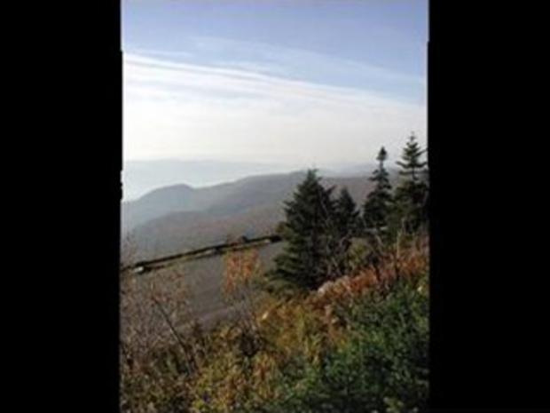
Ride along the Ashuwillticook Rail Trail for a breathtaking view of Mount Greylock and its surroundings.
Bikers and walkers can use the trail, created along a former railroad corridor. When the rail service was abandoned in 1990, the path was converted into an 11.2-mile paved recreational path starting in Lanesborough and finishing in Adams.
During the winter hours, the trail is open for cross-country skiing and snowshoeing.
"CHIEF GRAYLOCK"
While in Adams, make sure you take the time to take a look at "Chief Graylock."
This breathtaking piece of natural art sits in the side of Mount Greylock and is best seen from downtown Adams. The face was a result of landslides and rain over the course of almost 100 years. It all started in 1901, when a landslide wiped out part of the mountain -- leaving a gaping hole locals called "Chief's Steps."
The final evolution of the mountainside happened in 1990, when it rained for four days and four nights. Rocks and trees rolled off the side of the mountain as a result of the wet weather. And when the rain cleared, locals thought they could see a giant face in the mountainside.
Some thought the it looked like an Indian chief, so the landmark was given the name "Chief Graylock" -- a chief that was well-known to this part of Massachusetts in the 1600s.
Head west and enjoy the outdoors, but make sure you leave the hectic schedule at home.