Mix Of Light Snow, Ice And Rain Forecast For Evening Commute
BOSTON (CBS) -- After a quiet weekend, a nearby system will bring back rain and snow chances to the area Monday. This comes after sunshine over the weekend was helpful in melting some of that ice from last Friday. This is also not a big storm, and precipitation will be the main hazard. No big wind concerns, no coastal issues and no hard freeze to deal with. The impacts will also not be as widespread, but a wintry mix of light snow, ice and rain may create some slippery roads for portions of central Massachusetts into New Hampshire.
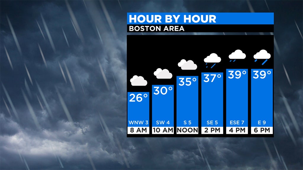
A developing system off the southeastern states will move up the coast on Monday and slide south and east of New England, brushing the area with a wintry mix. Despite a few snowflakes to start, much of eastern Mass. will be dealing with mainly rain as temperatures rise through the day. However, light snow to a mix is expected for interior locations. There may even be a period of drizzle or freezing drizzle before the snow. Any precipitation that falls on very cold, bare surfaces could lead to icy conditions with temperatures near or even slightly above freezing. Patchy coatings to a couple of inches of new snow is possible, along with a light glaze of ice. If you travel north, higher accumulations are possible which is great for the ski resorts.
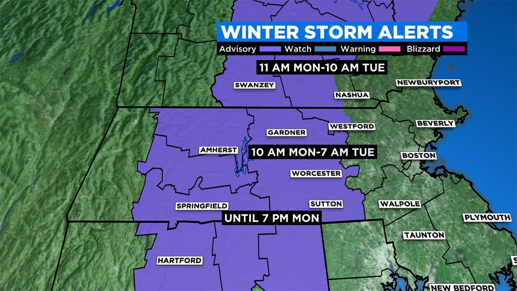
A WINTER WEATHER ADVISORY has been issued for northern Connecticut and central Massachusetts, including the eastern slopes of the Berkshires and into New Hampshire for Monday through Tuesday morning. The greatest impact is likely after sunset through the early morning Tuesday commute.
Travel may become impacted during the Monday afternoon and evening commute as snow transitions to a mix and untreated surfaces become slick from light accumulations mainly west of 495. The worst of the conditions are more likely in the higher terrain, where temperatures are slower to rise through the day. Slippery spots are possible through the night into Tuesday with potential hazardous conditions lingering through the Tuesday morning commute.
As this system pulls away, there may be a few flurries or light snow during the predawn hours Tuesday, but showers will come to an end from west to east during the morning, with the last of the showers exiting the coast midday. Temperatures will rebound to near or justly slightly above normal. The weather pattern will remain quiet for much of the week with mainly dry weather and highs near 40.


