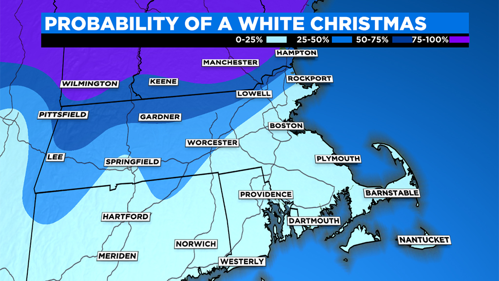
Boston May Have A Chance At Its First White Christmas In Over A Decade
BOSTON (CBS) - The movies are full of snowy scenes around Christmastime, and for sure we've had some December snowfall in recent years. Even some BIG December snowfall last year and the one before it. And yet, a White Christmas in Boston remains elusive. Whether by bad timing or big meltdowns, the city (and generally speaking, the coastline) has not had one since 2009. In fact, you're more likely to have a Christmas Day in the 60s during this young century than you are to have snow coating the landscape while kids rip open presents in the morning.
The old school definition of a White Christmas is one where there is at least 1" of snow on the ground at 7am on Christmas Day. For my money, any snow on Christmas should probably count too. If we broaden it out to those rules, then 2017 and 2002 also both enter the books. Both featured snowfall that began later in the day, after 7am. And odds are higher across interior sections of the state where towns avoid the mild influence of the ocean and have more elevated terrain to work with.
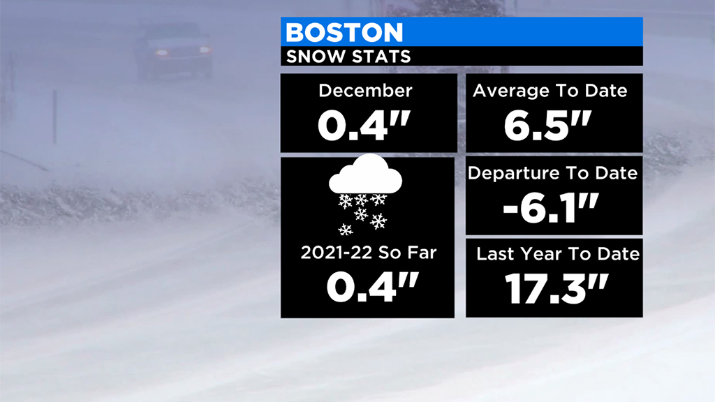
This year, we've all noticed the quiet start to winter with very little to no snowfall and extremely mild temperatures. Up to this point, our chances haven't looked good. BUT…we're not out of the running yet! There's one more system that brings some hope for snowy ground and flocked trees.
On Friday morning, a weak area of low pressure will glide down across southern New England and could provide just enough magic to turn our skies into a brief but festive snow globe. By no means a powerhouse storm, this is more of a gentle, powdery snow that should bring a coating to 1" to the landscape. No major travel issues are expected, except for a few slick spots (with temperatures in the 20s, it should stick to untreated surfaces fairly easily). It reminds me of Christmas Eve 2018, when we got a similar sugar coating during an otherwise lackluster winter month.
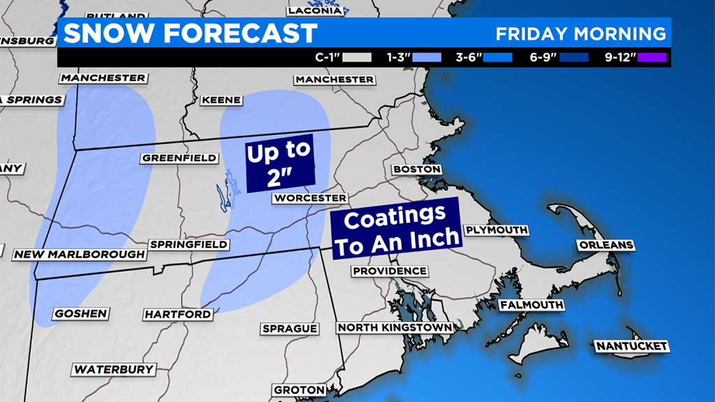
And this is what we've got to hang our hat on. If you want at least an inch on the ground, you have to hope that this system 1) overperforms a bit 2) lasts until Saturday morning. Since we're dealing with a meager winter solstice sun angle and highs Friday will remain largely in the 30s, most of what falls should linger into Christmas Day.

There's already snow on the ground in New Hampshire, Vermont, and Maine which isn't going to be melting, so any travels north will look more wintry than what we have here in southern New England over the weekend. A White Christmas is locked in for those locations!
On the big day itself, another weak front will try to push into the area. At this time, it doesn't look like anything more than some scattered rain and snow showers with the best shot of snowflakes on Saturday being toward New Hampshire/northern Massachusetts and raindrops near and south of Boston. One thing to monitor though is a risk of some freezing rain/an icy glaze in the morning, which could impact holiday travel for parts of the area. We'll keep you updated!