Severe Thunderstorms Possible Monday Afternoon And Evening
BOSTON (CBS) - The first day of school for many districts feels more like mid-summer as heat and humidity lock in place on Monday. Following a mid-summer trend, thunderstorms are expected Monday afternoon and they could be severe.
TIMING:
As a cold front moves from west to east through the afternoon, Worcester County and areas west will likely get the first indications of storms after 1 p.m. From I-495 to the I-95 corridor, expect these storms to pop up between mid-to-late afternoon. By 8 p.m., most of the region should be rain free and the threat will have diminished.
WHERE:
Highest risk seems to line up with central Massachusetts as the front moves across the region. Due to the daytime heating, there will be more available instability west of I-495 near the middle of the afternoon. Eastern Mass. and coastal areas won't have as much of an impact but they shouldn't put their guard down.
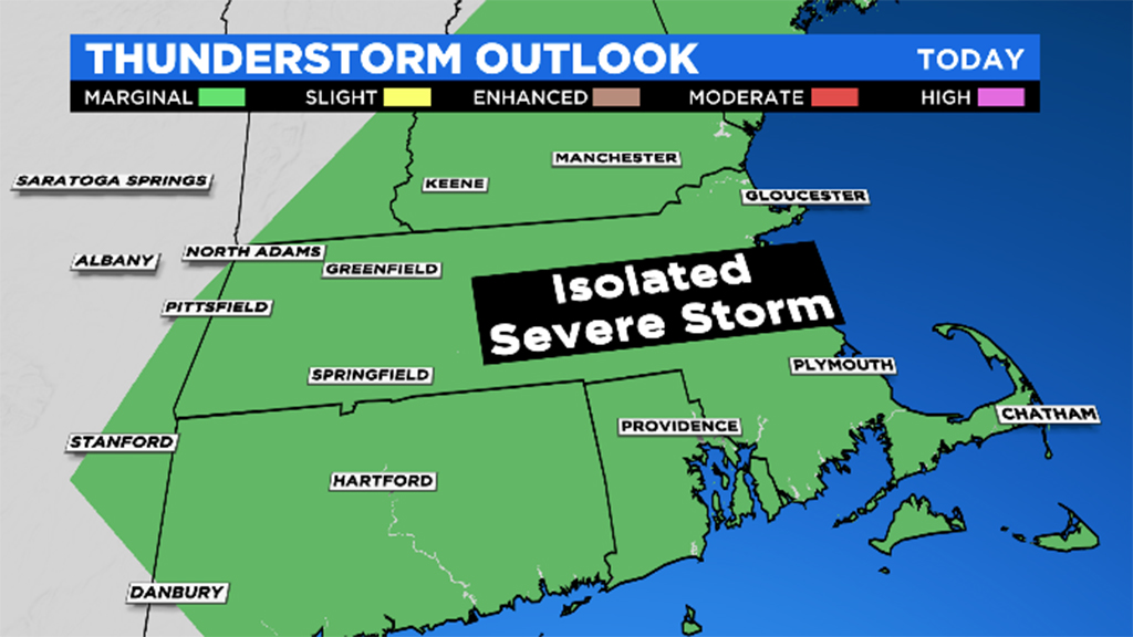
Pop-up storms are still possible around the greater Boston area and north of the city. There's less of a concern for the South Coast, Cape, and Islands.
IMPACTS:
As is typical with cold front passages, heavy rain, gusty wind, and cloud-to-ground lightning will be the predominant threats. This atmospheric set up doesn't seem to support rotational wind (i.e. tornadoes), but could lead to straight line wind damage. Especially with the recent rain and tropical systems we've had, downed trees and power lines are possible later Monday.
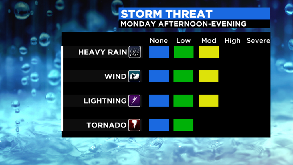
This event should result in "isolated" concerns but the concern is there. Be prepared for these storms and if you hear the thunder, make sure to head inside and stay safe!