Snow-Covered Roads, Black Ice Will Slow Monday Morning Commute
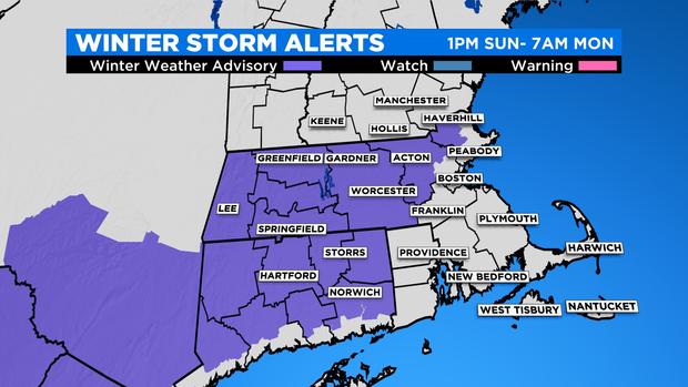
BOSTON (CBS) -- A Winter Weather Advisory continues for parts of Connecticut, western and central Massachusetts, east into western Middlesex and western Essex counties. Travel impacts are expected with snow-covered roads and developing black ice.
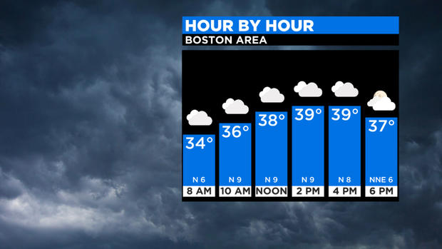
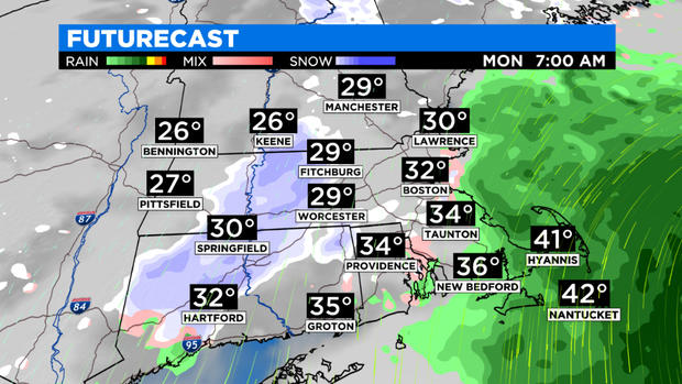
An intensifying coastal storm will continue to pass south of New England overnight into Monday. This storm doesn't have all the ingredients to make it a blockbuster event. A piece of energy and associated cold air is disconnected from this coastal low making it hard to produce high snow totals. Temperatures are also marginal, meaning just cold enough in some spots for a heavy, dense snow to accumulate. In Boston, while snow has fallen, surface temperatures continue to hover around freezing making for a sloppy mess on the roads.
There may be some compaction and even melting of the snow with surface temperatures near or above freezing at times. However, keep in mind the combination of light snow and rain and falling temperatures overnight across parts of the state may lead to areas of black ice. Untreated surfaces, secondary roadways may turn slippery by the Monday morning commute.
TIMING
Showers moved in Sunday afternoon and picked up to a steady rain/snow Sunday evening across the area. As the storm intensifies overnight, the heaviest precipitation will remain offshore with just scattered rain/snow showers likely overnight. There may be some bursts of snow that quickly drop visibility, so keep that in mind if you have travel plans. There will still be lingering snow showers and rain showers for the Monday morning commute as the storm pulls away. Expect most activity to wrap up through the morning. We don't completely dry out Monday afternoon and evening at the coast as rain/snow showers may continue thanks to this low nearby. Onshore winds may lead to a few raindrops and snowflakes with little to no accumulation as temperatures will be above freezing.
RAIN
Rainfall amounts will range from .5" -1" for parts of southeast Massachusetts, along with the Cape and Islands. The highest totals will be closer to the center of the storm.
SNOW
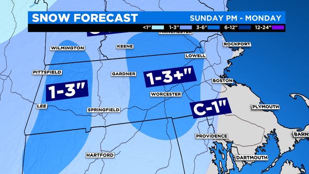
With the current track, most of the area will see minimal snow amounts, a slushy coating to an inch or two. The lower end will be along the immediate coast of the north shore and parts of Southeast Massachusetts. The heaviest snow is expected inland where temperatures are below freezing and across the higher terrain. This includes Metro-west through the Merrimack Valley into southern New Hampshire, the Worcester Hills, and the 495 Belt into northern Rhode Island and northeastern Connecticut. The consistency of the snow will be heavy and wet that will make it difficult to move. Great for snowball making, not so great for clean-up.
WIND
Northeast winds will increase and become gusty Sunday night into Monday. Gusts are likely to range from 20 to 30 mph, with the strongest gusts over the Cape and Islands. No advisories are in place as damaging winds are not expected during this event.
NEXT WEEK
One thing to keep in mind is that this storm doesn't race off quickly Monday night. There will be an atmospheric traffic jam of sorts that will block the system from moving much early next week from the Gulf of Maine.
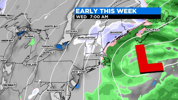
Clouds will stick around for Tuesday and Wednesday with occasional rain/snow showers before improvements arrive later in the week