First Snow Of Season Friday To Be Followed By Below Freezing Temps
BOSTON (CBS) - This week's national weather headlines are unmatched. Between the wildfires in California, the ice storm in Oklahoma, and tracking Hurricane Zeta it's tough to focus on one. For us in southern New England, the remnants of Zeta will lead to our first snow flakes of the season.
TIMING:
As Zeta's left-over energy slides south of southern New England, it will look eerily like a nor'easter. Initially, steady, heavy rain will arrive Thursday afternoon. These showers continue overnight and switch to light snow prior to sunrise Friday.
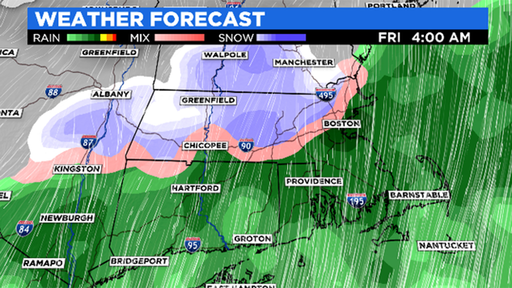
A wintry mix persists through the morning hours. This event is expected to wrap up by the early afternoon Friday.
SNOW TOTALS:
While there is still some variability on exact amounts, slushy, wet accumulation is most likely for interior spots. Highest amounts will likely be recorded north of the Massachusetts-New Hampshire border, with 3 inches+ possible from Nashua to Manchester.
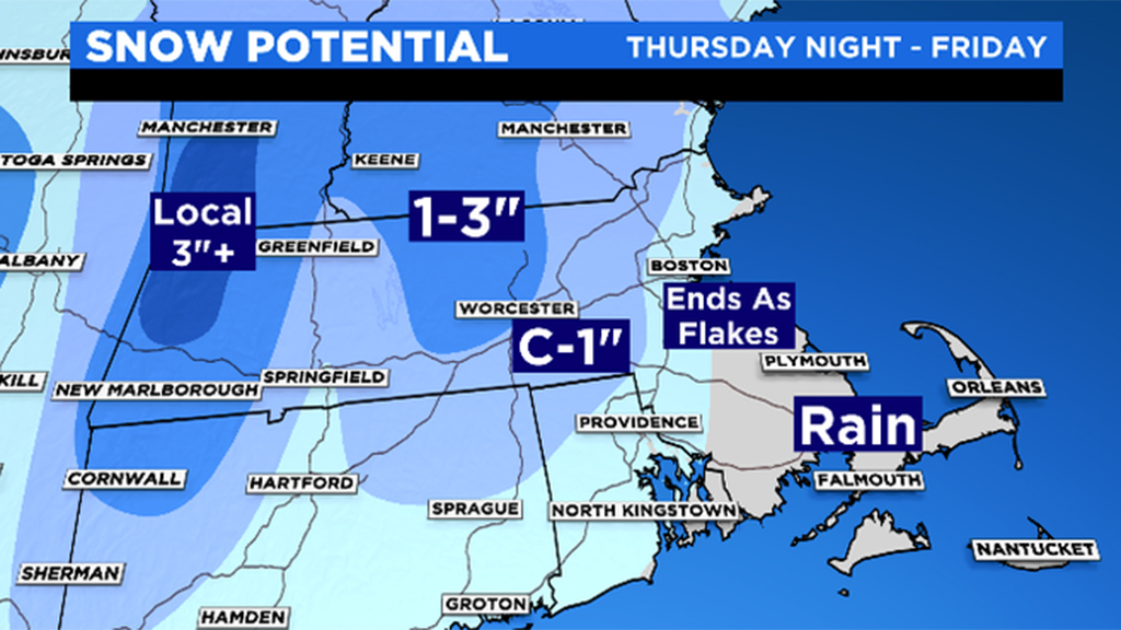
The 495 belt should receive a coating with some in Middlesex County recording one inch. From 128 to coastal locations, this will mainly be a rain event but a dusting can't be ruled out for grassy areas.
IMPACTS:
This won't be a shoveling or plowing event, but it will certainly make for a slow morning commute. Slick roads are expected across the board and that will be the case most of the day as temperatures stay in the 30s.
With the leftover moisture and the 20's arriving Friday night into Saturday, icy conditions are possible.
Stay with the WBZ-TV Weather Team as we continue to track this first taste of winter!