Severe Thunderstorms Could Bring Damaging Wind, Hail, Tornado Risk Thursday
BOSTON (CBS) - While Hurricane Laura tears through Louisiana, there is the potential for unrelated severe thunderstorms in southern New England Thursday afternoon.
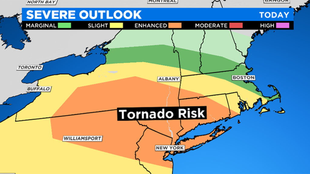
The storms are expected to bring showers, strong wind and hail and there's the possibility of an isolated tornado.
A boundary layer has been set up for the northeast with warm, humid air moving into eastern New York and cool, dry conditions in southern New England. This difference in air mass will force showers and storms to stream in for the northwest as early as 9 a.m. The location of the front will be the tricky part. The majority of the energy should remain to the southwest, from NY to CT to RI. This type of atmospheric set up supports a possible spin up or isolated tornado. That isn't the main concern in Massachusetts but the location of this front is very important. If it moves slightly northeast, Massachusetts could see a tornado. The best case for that will arrive from late morning to early afternoon.
The major threat to Massachusetts will be damaging wind and hail. After recent severe storms, limbs, branches and trees have likely been weakened. Thursday's storms could produce gusts up to 60 mph leading to more damage. The most likely locations will be towards southern Worcester County and western Mass. Those east of I-495 will still tap into the activity, however, it shouldn't pack as much punch.
Isolated showers may linger after sunset, but the bulk of the energy will have moved on at that point.
A quieter, brighter, and warmer Friday is in store! Stay with the WBZ-TV Weather Team for continuous updates throughout the day.