Several Inches Of Snow Possible For Parts Of New England
BOSTON (CBS) -- The year 2020 has been the warmest year on record so far in much of the Boston area. Snowfall has been essentially nonexistent, but that could change this week.
There are two snow threats on the way, but both of them will yield little to no snow close to Boston.
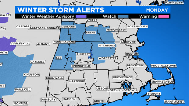
A different story north and west of the city. The National Weather Service has issued a Winter Storm Watch for central and western MA into VT and NH for the highest risk of accumulating snow on Monday. Roads may be slippery and visibility low at times.
TIMETABLE:
Sunday will be dry and cool. Enjoy the sunshine. Clouds will increase Sunday night into Monday. If you are looking to get outside, Monday morning through midday will be your best bet for drier weather.
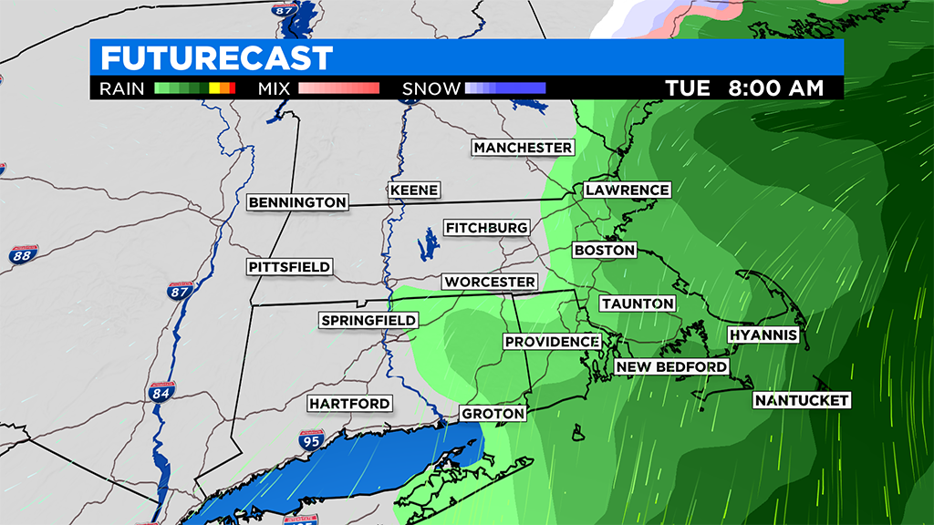
Expect snow and rain to shift eastward into New England on Monday afternoon. It should arrive in the Boston area between 4 and 6 p.m. Initially, there will probably be a bit of wet snow in the Boston to Providence corridor, perhaps up a coating or a bit more on grassy surfaces before a turn to rain.
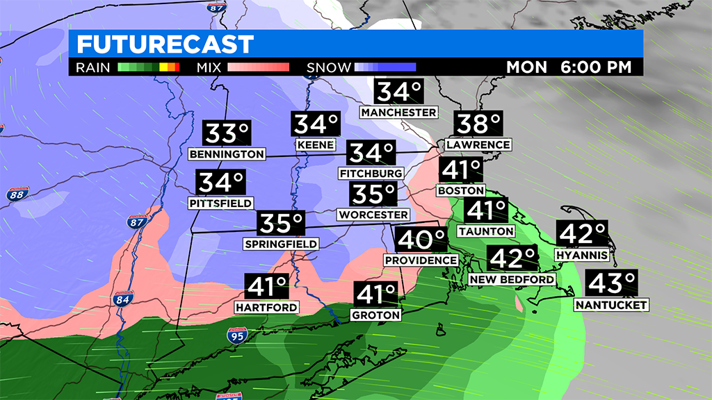
The rain line will proceed north-northwestward during Monday evening.
Higher elevations of central and western MA, could see limited visibility as heavy, wet snow comes down during this time. Hazardous travel is possible.
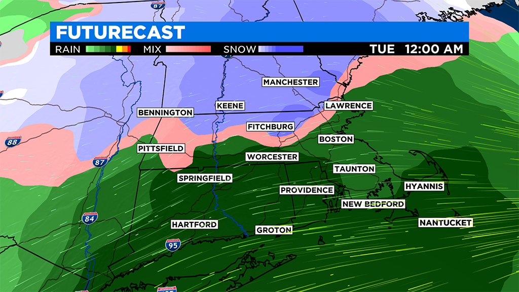
The snow and rain will be heaviest during the evening, and then taper off in the early morning hours of Tuesday, ending as drizzle and spotty showers near daybreak.
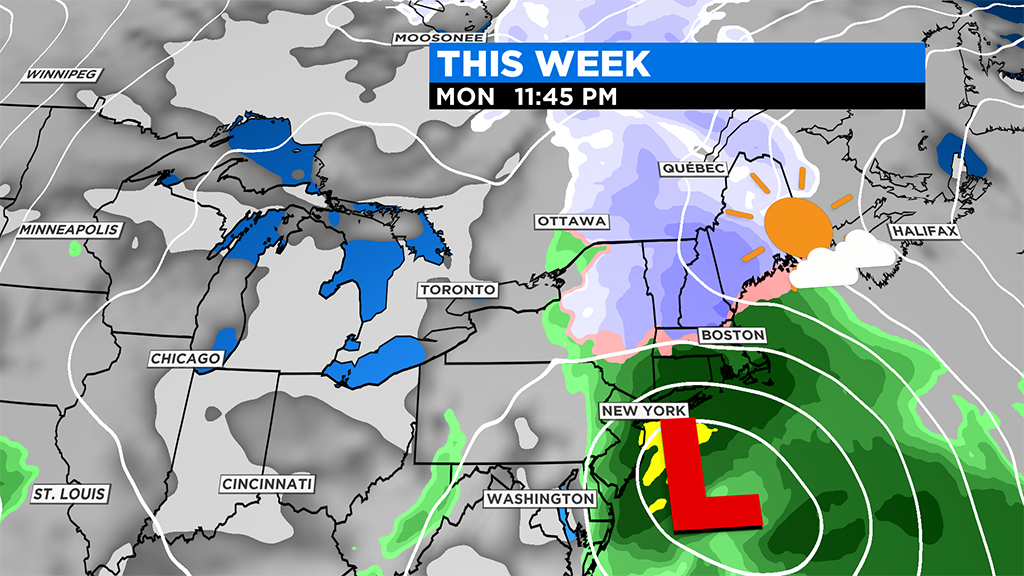
The second storm will arrive by noon on Wednesday. This too will produce mainly rain near and south of the Mass. Pike, with lower amounts of snow than from the late Monday storm farther west and north.
EXPECTED SNOW AMOUNTS:
Mostly rain will fall over Cape Cod up into eastern Plymouth County, with just minor snow in the air up to a coating on grassy surfaces, trees and vehicles in the Boston area. Farther west and northwest of that corridor, the amounts of snow will build up to near 2 inches in some of the western suburbs before going to rain ranging up to 5 inches or more over north central Massachusetts, westward and northward especially over higher elevations.
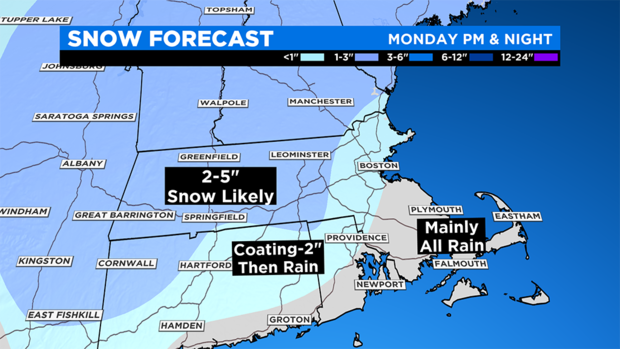
Locally higher amounts of 6-8" are possible where it stays all snow and comes down heavy at times.
Keep up with the latest forecasts on WBZ-TV, CBSN and CBSBoston.com.