Boston Weather: A Little Snow, Then A Shot At 70 Degrees
BOSTON (CBS) - Mother Nature reminded us that, yes it is indeed still winter Tuesday morning. Most areas woke up to very light snow. Snowfall amounts ranged from about 1 inch for parts of Bristol County and areas south of the Pike this morning, to a dusting in Boston and those north of the city. (Spring officially arrives Thursday)
TODAY
Precipitation has transitioned to all rain with the bulk of showers over southeast Massachusetts. These showers will exit the area later this afternoon and early evening, while the rest of the region will remain cloudy. We can't rule out a shower or two, but most will stay dry. We will see some clouds begin to break apart from west to east by the evening, which could quickly boost temperatures. Highs this afternoon will be in the 40s, with areas in western Massachusetts nearing 50.
NEXT 24 HOURS
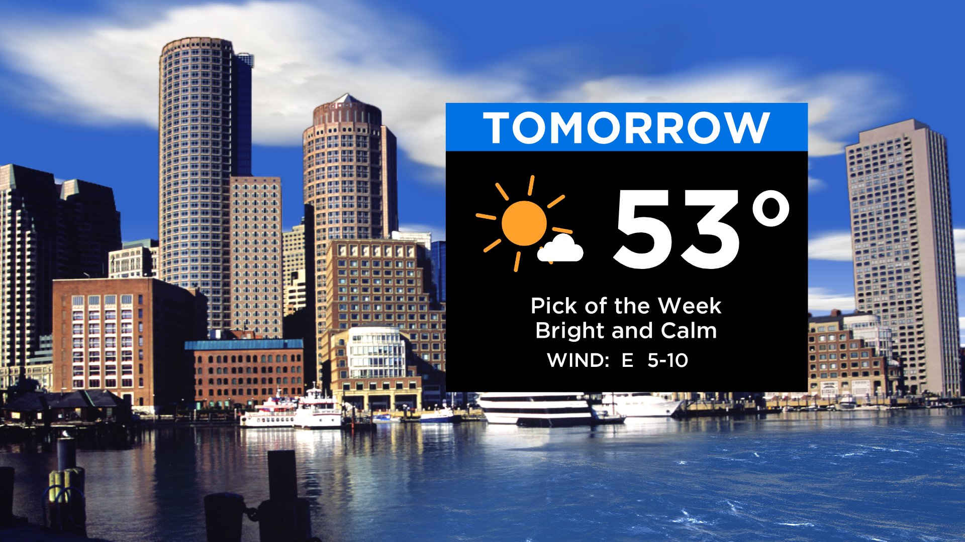
Skies will continue to clear tonight as high pressure moves in. Winds will shift to the west-northwest with temperatures falling back into the upper 20s to mid 30s. As the area of high pressure moves overhead for Wednesday, it will be a nice and calm day on tap. It will be relatively mild with highs in the 50s. Normal highs this time of year are in the mid 40s. Expect some high to mid-level cloudiness through the day, but it will be dry.
NEXT STORM SYSTEM
Sadly, enjoy the nice weather while you can; the end of the week turns unsettled. Spring officially arrives on Thursday at 11:50 p.m. This is the earliest Spring Equinox in 124 years. It will look more like winter than spring however, as our next frontal system will bring a wintry mix Wednesday night into Thursday morning before changing over to rain.
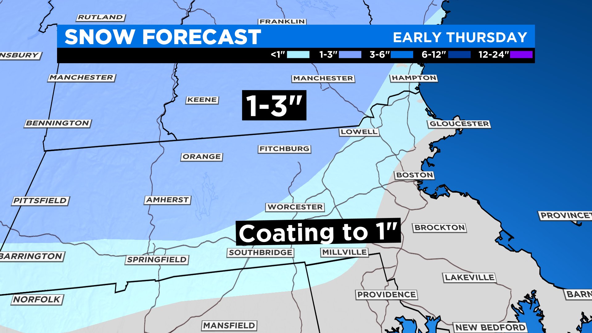
Right now the best chances of some snow will be through the interior, with a few inches possible in the Berkshires to southwest New Hampshire, and lesser amounts in central Massachusetts and the Worcester Hills, with patchy coatings north and west of Boston. There is still some uncertainty on the strength of the low that passes by. The strength will determine how much colder air gets dragged down into the area, leading to how much snow will accumulate before a likely changeover to rain. Stay with WBZ on amounts and timing as new information arrives. I do expect precipitation to taper by the afternoon and evening. Highs on Thursday will be in the 40s.
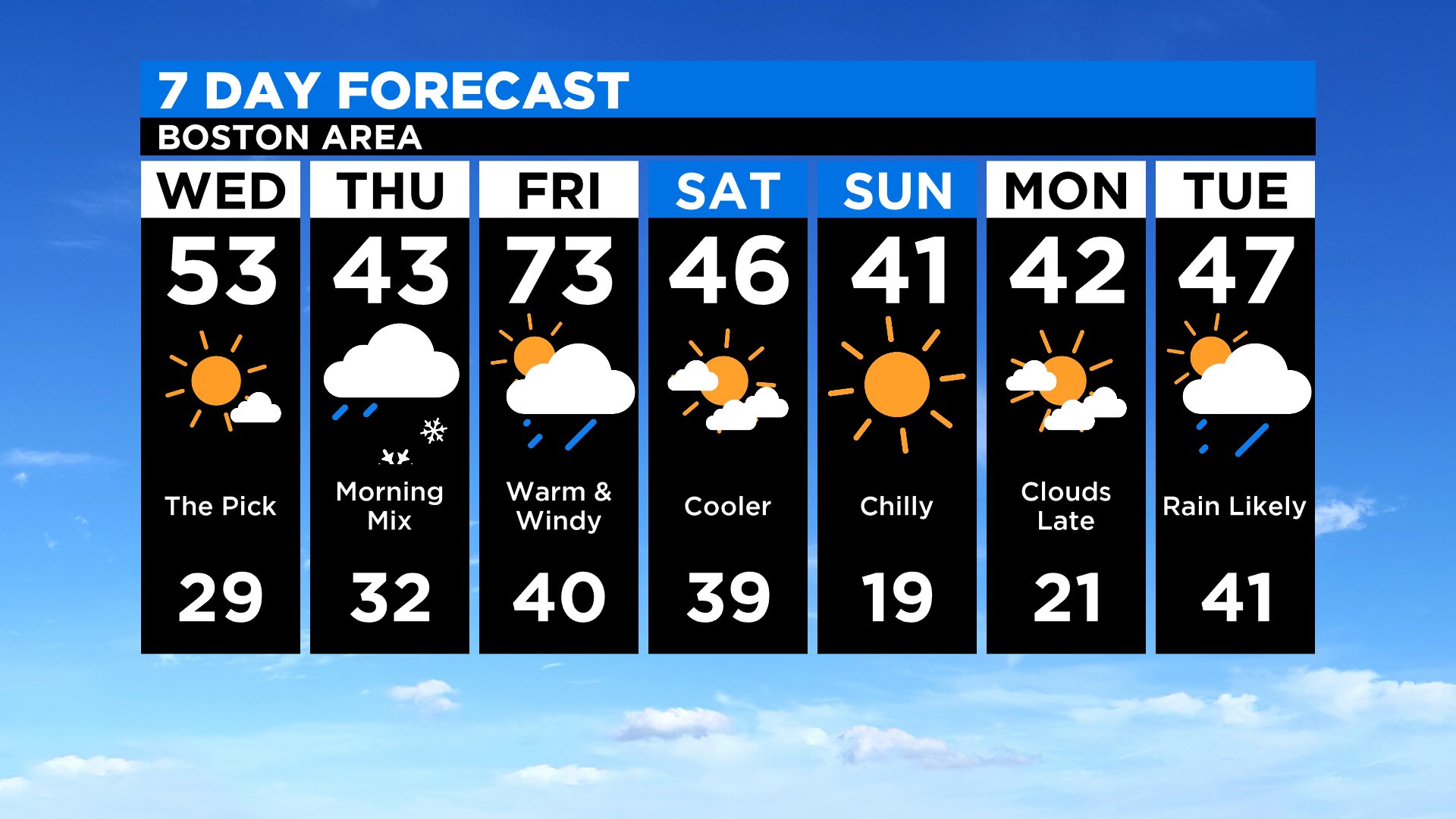
Thursday night, a warm front will approach the area, meaning more rain chances into Friday. Expect a very mild and breezy day with showers at times, although there will be some dry times too, especially in the afternoon and evening. Temperatures will soar into the 60s, if not reaching 70 in spots.
A cold front will approach the area late Friday night into Saturday, clearing the showers, but bringing in much cooler air for the weekend. Expect a big drop in temperatures from Friday to Saturday with highs in the upper 40s Saturday afternoon. It will be even cooler on Sunday with afternoon temperatures in the low 40s. At least high pressure will be in control, meaning dry and quiet conditions for the weekend.