Snow, Rain, Sleet, Ice Mix Will Make Mess Of Thursday Morning Commute
BOSTON (CBS) - What a mess. While the incoming late-week storm may not be much of a snow-maker, it is sure to dump a whole bunch of just about everything else. It's actually a very typical storm based upon the current overall weather pattern which features abundant cold to our west and warmth to our south. New England finds itself smack dab in the middle of two very different air masses both jockeying for position and dominance, like being between two bullies pushing at each other on the playground. It can (and will) be messy hanging out in the middle.
This storm will be a long one, featuring several rounds of varying precipitation. Let's take it step by step:
PART 1
The storm arrives between 1 and 5 a.m. Thursday. And, right from the start, there will be a variety of different precipitation types.
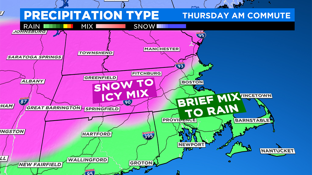
It comes in as plain rain from the South Coast to Cape Cod and the Islands and into a good deal of southeastern Mass. up to Boston. If there is any sleet mixed in, it won't last long in this area.
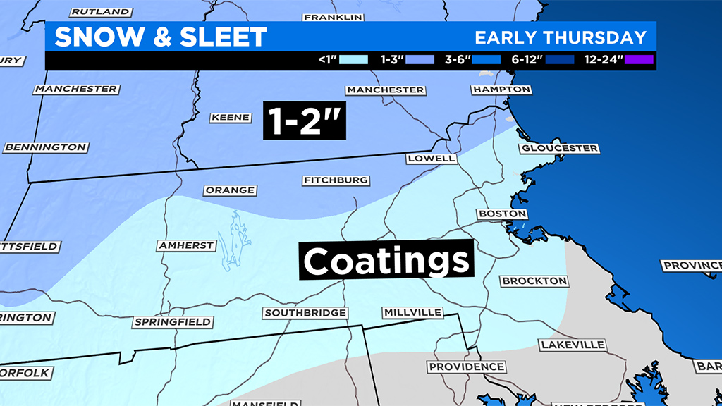
North and west of I-95, the storm will arrive as a mix of snow and ice. Any snow would be quite brief, just an hour or two at most before milder air aloft changes the flakes to ice pellets. By dawn there shouldn't be much, if any, snow falling in southern New England, perhaps just a few patches left in southern New Hampshire. Between 5 and 9 a.m. Thursday it will be mainly sleet falling northwest of I-95 and plain rain to the southeast.
After 9 a.m. Thursday, the first wave of precipitation is already tapering off after less than 0.5 of an inch of liquid precipitation. Temperatures will rise above freezing in all but the highest elevations in the Berkshires and northern Worcester county. The remainder of the daytime hours will be mainly dry with just a few sprinkles.
PART 2
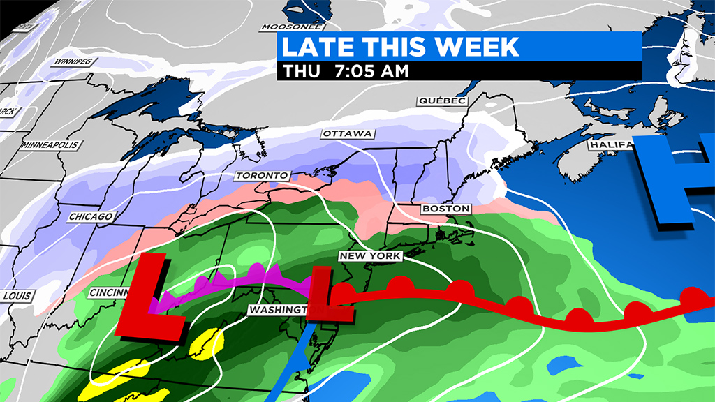
The heaviest wave of precipitation moves in Thursday night between 10 p.m. and 1 a.m. and this time it is all rain. Waves of heavy rain continue into early Friday morning as temperatures warm into the 40s in parts of eastern and southeastern MA. Areas well to the northwest (in northern Worcester County, and parts of SW New Hampshire) may hover closer to the freezing mark, but likely will be just mild enough for rain instead of ice.
This wave will be much heavier than the first, dropping 1-2" of water in some areas, especially south of the Pike. Heaviest rain expected between 5 a.m. to midday Friday.
PART 3
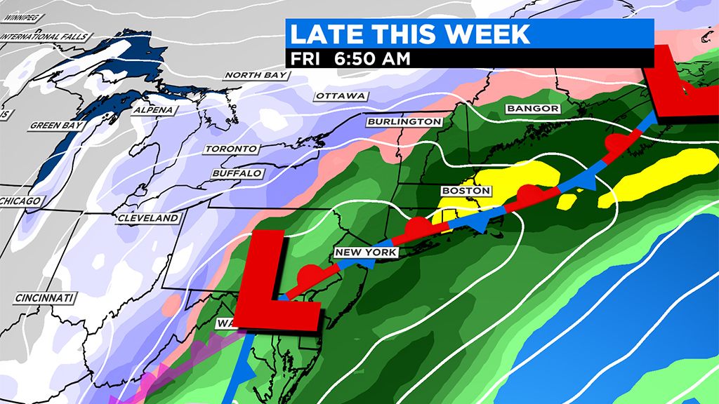
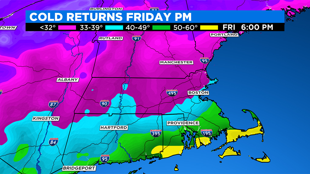
It appears there will be one last gasp to this storm. Some lighter precipitation will likely continue through the day on Friday and at the same time, colder air will begin to funnel in from the northwest. This will change the leftover light rain to a bit of ice and snow Friday afternoon and evening. While we don't expect much accumulation or impact, this is something worth watching as it may have some bearing on Friday evening's commute. In addition to some light ice or snow falling, we will also have to contend with dropping temperatures (below freezing) from north to south Friday afternoon and evening, icing up all untreated surfaces.
Clearly this is a complex system with a multitude of impacts and precipitation types across our area. Stay tuned for frequent updates on WBZ-TV, CBSBoston.com and CBSN Boston over the next few days.