Burst Of Snow Expected For Early Thursday Morning Commute
BOSTON (CBS) - New month, same ol' tune.
We started the month of February much like we left January - warm. After the third mildest January on record, February has been "in like a lamb"with three days averaging double digits above the temperature norms.
But, while it may look and feel much like January, some major atmospheric changes are afoot. A longstanding trough bringing harsh cold and snow to Alaska is being replaced by a ridge in the jet stream, flipping the winter script up that way. Why do we care about Alaska? Well, some of the same forces responsible for the harsh cold up there in January were also largely responsible for the relative warmth across the lower 48, ushering in a mild, Pacific-based air mass. This flip in the script over Alaska will now allow more cold, Arctic-based air to enter the general flow of the United States.
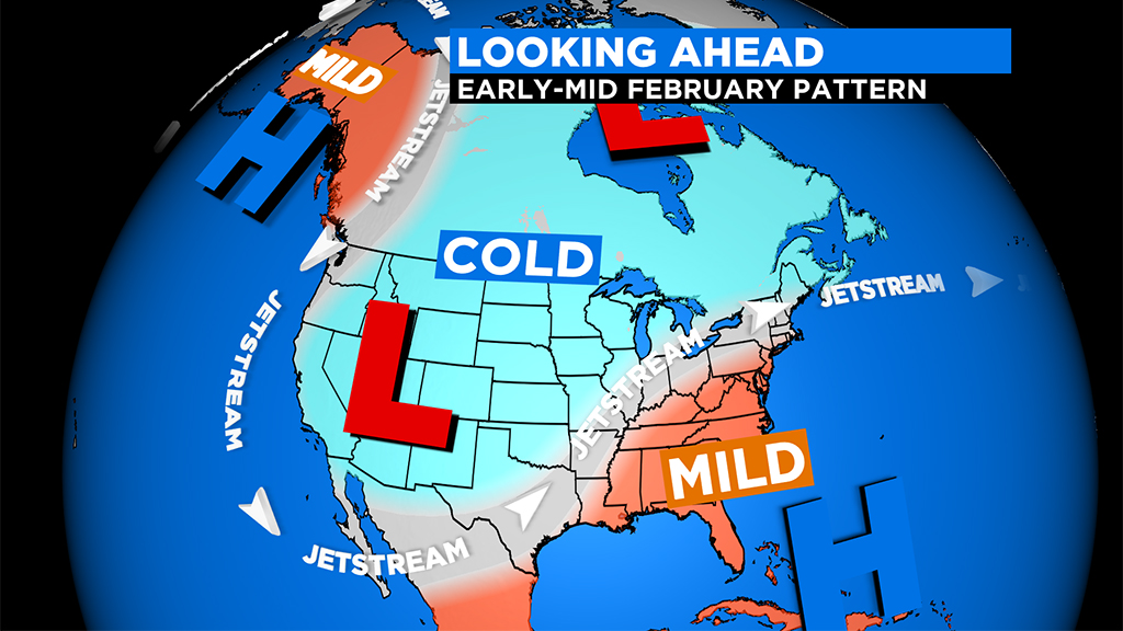
At the same time, a few thousand miles away, a persistent ridge is setting up over the southeastern U.S., which is already spiking temperatures to parts of the East Coast, making it feel more like spring.
In between, right in the middle of these two conflicting air masses, a battle zone is setting up. And, as luck would have it, we are smack dab in the middle of this impending fight. There will be no sitting out on the sidelines, we are going to live in the storm track for a while.
This pattern is not typically one that is conducive to a lot of big snowstorms for southern New England. The cold air is centered too far to our west and there is just too much warm air really close by. Being on the edge of a pattern like this typically means lots of wintry mix-type events and that is exactly what we are forecasting later this week.
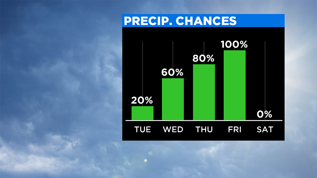
TIMELINE:
TUESDAY-WEDNESDAY will feature a few spotty showers but nothing significant. A good deal of clouds both days, with temperatures generally in the 40s.
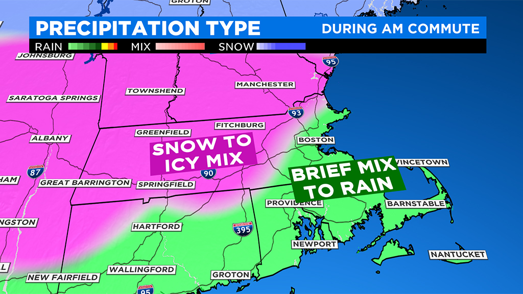
EARLY THURSDAY is the most impactful time frame for weather this week. Any quick burst of snow is likely between 3 and 7 a.m. Thursday. There is a very small window with enough cold air at all levels of the atmosphere to produce snow and that window will rapidly close as milder air works in above.
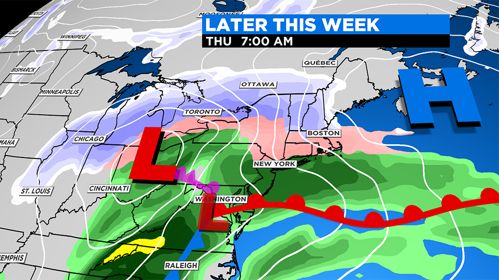
After a few hours of snow for some, precipitation will change to an icy mix and then to plain rain for most in eastern Mass. Areas north of the Pike and especially in northern Mass. and southern New Hampshire will hold on to the snow the longest and have the best chance to reach low-end, plowable snow amounts.
Having said that, with the storm still two days away, there is a reasonable chance that the milder air works in so quickly that there is very little chance for any real snow or ice accumulation, something we will watch closely.
THURSDAY PM: By midday Thursday and into the afternoon, temperatures are warm enough for light rain.
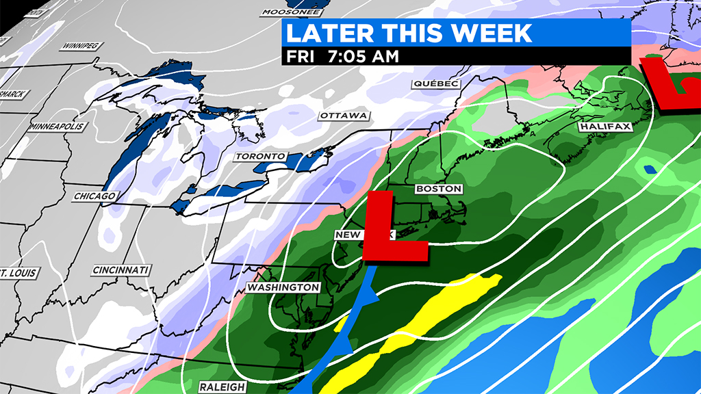
FRIDAY: One final piece to this storm arrives late Thursday night and the rain becomes steadier and heavier overnight and into Friday morning. Heaviest will end during the commute and only lighter, spottier showers remain thereafter.