Heat Advisory, Saturday Scorcher Will Lead To Afternoon Storms
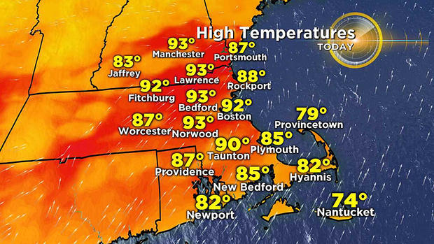
BOSTON (CBS) -- For many of us, Saturday will be the hottest and most humid day so far this year. After reaching 90 degrees on Friday for the first time this year at Boston's Logan Airport, it will likely climb higher to 92 or so Saturday.
Areas near Boston and west-northwest from the city will be in the most uncomfortable zone. The predicted high temperatures of 90-94 linked with the oppressive humidity with dew points up to the middle 70s will make it feel like about 100-102 degrees. Consequently, this spiked heat index has prompted the National Weather Service in Norton to issue a HEAT ADVISORY from 1-5 p.m. in the shaded orange zone.
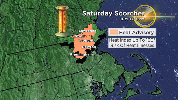
Avoid heat illnesses such as heat exhaustion or the more serious heatstroke. Stay well hydrated, take it easy and seek shade as much as possible. Thankfully, occasional breaks in the steam heat occur in New England and we will enjoy an enormous change Sunday as cooler and much drier invades the region and lasts through Wednesday. Summery temperatures in the 80s will still exist away from the delightful ocean breezes. As this transition emerges, some boomers are bound to be triggered this afternoon and evening.
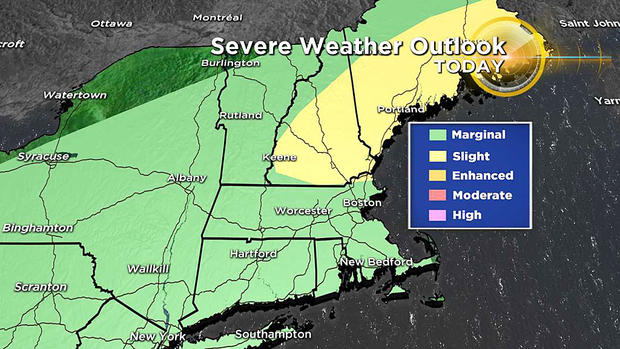
While the Storm Prediction Center has much of N.H. and M.E. in the slight risk for severe thunderstorms Sunday afternoon, southern New England is a step lower in a marginal risk. Storms producing damaging wind and hail cannot be ruled out but most of the parameters suggest that in this steamy environment, the primary risk from any storm is the potential torrential rain producing localized flooding.
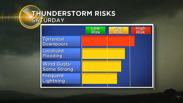
Dangerous cloud to ground lightning bolts also tend to be more common when the dew points are in the oppressive zone over 70 degrees. Keep in mind that these storms will be scattered so the impact will be sporadic.
There might be some isolated showers & storms west of the I-95 corridor before 4 p.m. but the main action should be unfolding between about 4-11 p.m. These timeline snapshots illustrate when most of the activity will be occurring across the region.
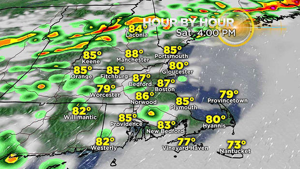
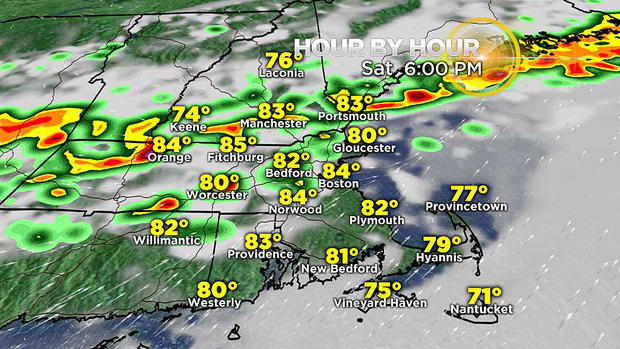
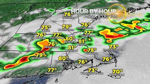
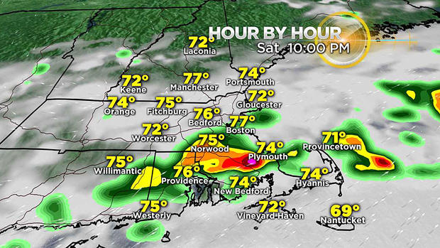
Use this information as a guide and do not expect the depicted storm positions to be absolutely precise at each posted clock time. As you can easily see, the showers and storms will become more organized farther north and west of Boston later this afternoon and that slice of scattered convection will shift southeastward through the evening and should be dissipating or moving offshore by late evening over southeastern MA and Cape Cod. After today, showers and thunderstorms will not return until Thursday afternoon.
I'll provide storm updates here at cbsboston.com and on WBZ-TV and social media later today and this evening.
Keep an eye on the sky and have a happy and safe rest of the long 4th of July Weekend.