Weak Nor'easter To Bring Cold Rain, Wind And A Little Snow For Some
BOSTON (CBS) - A developing Nor'easter will bring a chilly rain, gusty winds and even some higher terrain snow to parts of New England Monday night.
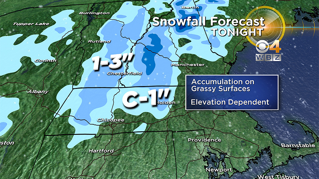
While the impacts will be low with this storm, the idea of snow falling from the sky may surprise some people. It's May and it feels wrong for even talking about that four letter word S-N-O-W, but coatings were reported in western Mass. on Mother's Day and it's possible once again with our next system heading our way.
There will be a southward dip in the jet stream early this week that will allow for colder air to invade and persist across the region. This jet stream will also help steer our next storm system to pass just south of the region.
It will be a cool and cloudy afternoon. Onshore winds will keep temperatures in the low to mid 50's, about ten degrees below normal for mid-May. Low pressure will strengthen as it pushes off the mid-Atlantic later Monday. Rain chances will increase from west to east in the late afternoon. By the evening commute expect wet conditions. Rain will turn steady Monday night and continue through early Tuesday.
Cold air aloft will allow for the precipitation Monday night to change over to a wintry mix in some parts of New England. Mainly across the mountains, but there could be some patchy coatings as far south as the Berkshires and Worcester Hills. Even if some of the snow sticks overnight on the grassy surfaces, temperatures in the 40's on Tuesday will limit any accumulations. This looks to be a minor event with minimal impacts. The farther north you travel, a better chance for a few inches, especially across the higher elevations of central and northern New England.
As the storm intensifies, a gusty northeast wind will increase over southern New England Monday evening. Only because this storm will deliver northeast winds, can we coin this storm a nor'easter. A nor'easter can be strong or weak, and this one doesn't look to be very powerful. The strongest winds gusting 25 to 40 mph will be possible overnight through early Tuesday, especially at the coast. The early Tuesday morning high tide (Boston 7:51 a.m.) will need to be monitored for any splash over or minor coastal flooding, but the threat remains low right now.
As the storm wraps up on Tuesday, most of the rain and snow will push into northern New England with just a few lingering showers possible to the south. It will remain cool and cloudy with low pressure nearby.
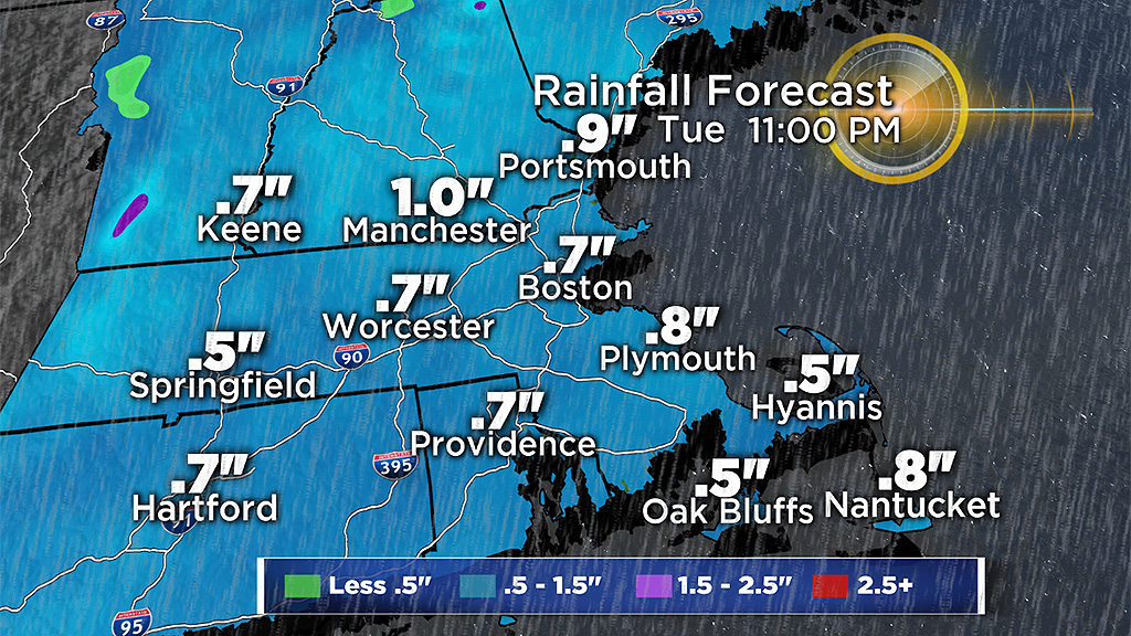
The last of the showers will exit the region Tuesday night into early Wednesday. Total rain will be under an inch for most, but where we see some downpours Monday night, there could be isolated higher amounts.
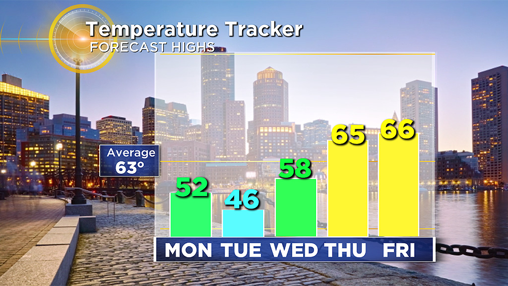
It will turn milder later in the week and right now, the weekend is looking good!