As Quick Hitting Storm Leaves, Wind And Temperatures Go Up
BOSTON (CBS) - Well your morning commute certainly won't be a fun ride, especially if you leave over the next couple of hours.
Rain is falling steadily and heavily right now, and has even mixed with some wet snow in central Massachusetts, where a coating is possible on grassy surfaces of central and northern Worcester County. Otherwise, any mix with snowflakes won't impact the roads and will be a talking point Wednesday morning more than anything.
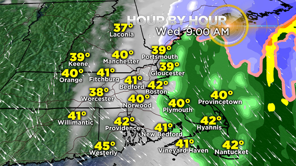
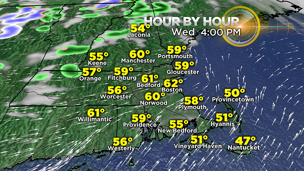
Precipitation will wind down between 7 and 9 a.m. from west to east, with rapid clearing arriving after that. Expect sunshine and warm temperatures later on, with highs around 60!
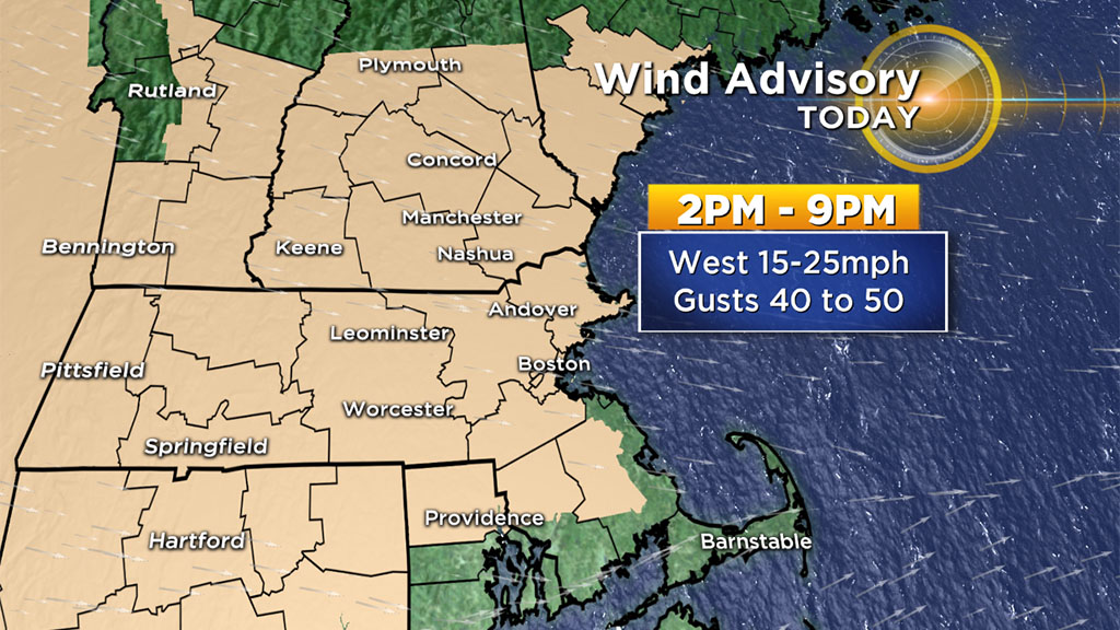
On the backside of the strengthening coastal storm, our wind shifts to blow out of the west by this afternoon, gusting 40 to 50 mph for many of us.
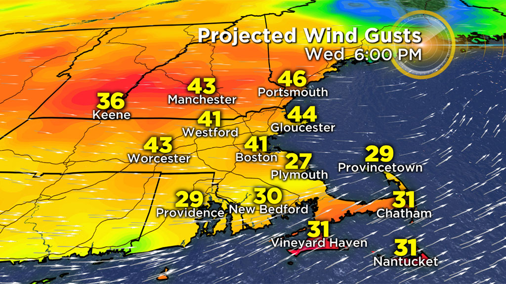
An isolated gust over 50 mph is possible in the high terrain of central MA. This will result in pockets of wind damage.
While still breezy Thursday, our wind won't be as strong and temperatures will be more seasonal.
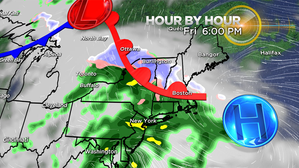
Our next disturbance arrives later on Friday and may start as a very brief wintry mix before changing over to rain so stay tuned!