Winter's Last Gasp? Several Storm Chances Ahead
BOSTON (CBS) - Winter's last gasp? The next 7-10 days may end up being the most volatile period of the entire winter season. Granted, that isn't saying much this winter, with Boston sitting at only 10.5 inches (8th least snowy on record). The next 10 days will certainly be colder than average and not just for New England, but for a large portion of the United States. Couple that with a very active and stormy pattern and maybe, just maybe, winter lovers will have something to remember before the season comes to a close.
There is so much going on from wind, to cold, to several storm chances, let's break down each event and rank their potential impacts.
Damaging Winds
After destructive winds Monday, Tuesday will be a gusty day, but much less destructive, with gusts generally between 35 to 45 mph with a few isolated gusts to 50 mph possible.
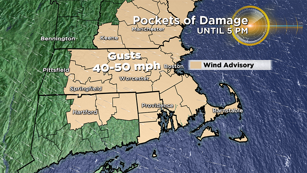
Additional pockets of damage and outages will be possible, and the gusts will slow cleanup efforts.
Impact: Moderate
Mid-Winter Cold Blast
When: Tuesday-Wednesday
What: All that powerful wind will be ushering in some bitterly cold air. Keep in mind that average highs this time of year are in the low 40s and average lows in the upper 20s.
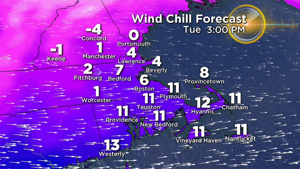
Tuesday AM – Low temperatures 15 to 25, Wind Chill -5 to 10
Tuesday PM – High temperatures 20 to 25, Wind Chill 0 to 10
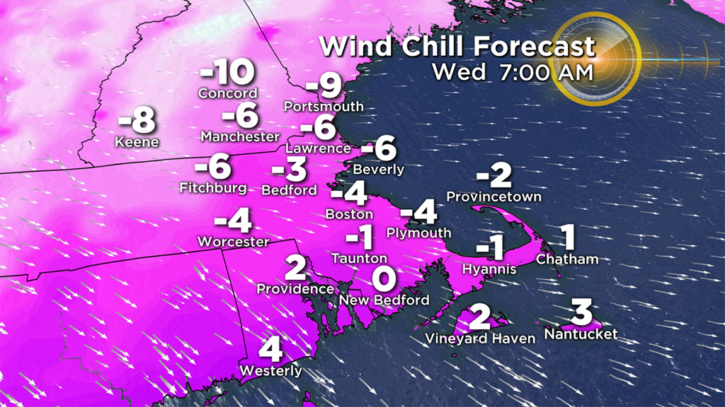
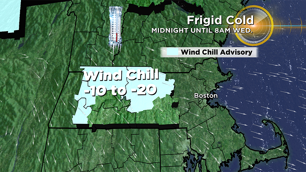
Wednesday AM – Low temperatures 0 to 10, Wind Chill -5 to -15
Wednesday PM – High temperatures 22 to 28, Wind no longer a concern
Impact: Moderate
Storm Threat #1
When: Late Wednesday-Early Thursday
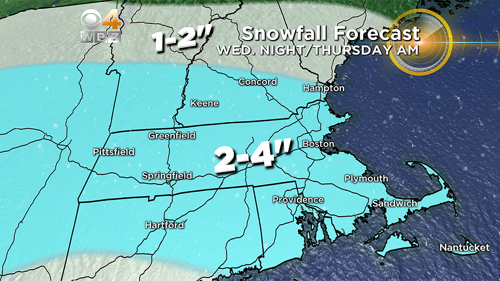
What: A weak, fast-moving storm zips to our south late on Wednesday bringing some light snowfall to the region. No rain or ice threat this time, this is just a light-to-moderate overnight snowfall.
Snow will break out from west to east between 6-9 p.m. Wednesday, picking up in intensity a bit during the overnight. Expect the snow to taper off during the early morning Thursday, to just leftover flurries by mid-morning. Looks like a general 2-to-4 inches event, light and fluffy, easily movable snow.
Impact: Moderate
Storm Threat #2
When: Saturday
What: This one initially looked like an "inside runner," meaning another one of those mix to rain events. But subsequent model runs have indicated a southward push and a colder solution. The jury is still out here but odds are now favoring of a wintry mix or an all snow scenario. However, if the southward trend were to continue, this may end up being a fringe/miss as well. Again, stay tuned.
Impact: Low to Moderate
Storm Threat #3
When: Mid Next Week
What: Perhaps the storm with the most potential is the farthest one away. I want to be careful not to hype this one too much as with any potential storm that is more than 7 days away there is a great deal of uncertainty here.
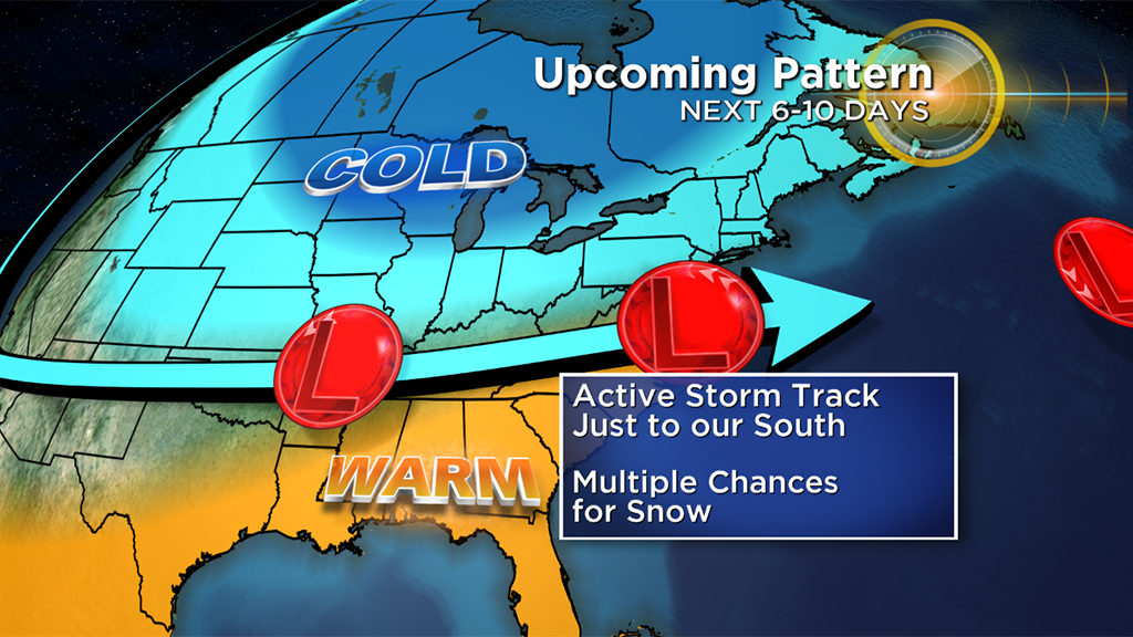
So why the peaked interest in this storm over others? Well, typically the bigger storms tend to arrive as patterns are changing. Most models are indicating a significant pattern shift mid-to-late next week going from cold/wintry to mild and spring-like.
Meteorologically speaking, it seems like the perfect time for a larger storm along the East Coast. I wouldn't expect a blockbuster as there remains no blocking up in Greenland to slow it down at all. And who knows, this far out, anything (or nothing) could happen.