Freezing Rain To Impact Travel Wednesday Night, Thursday Morning
BOSTON (CBS) - I have heard more than a few folks asking the question, is winter over? After a fairly easy December and January and temperatures in the 60's to start February, it is certainly fair to ask. The short and simple answer is no. Not yet anyhow.
While we don't expect March and April to be anywhere near as brutal as last year, we do still anticipate some wintry weather in our near future. Look no further than Wednesday night.
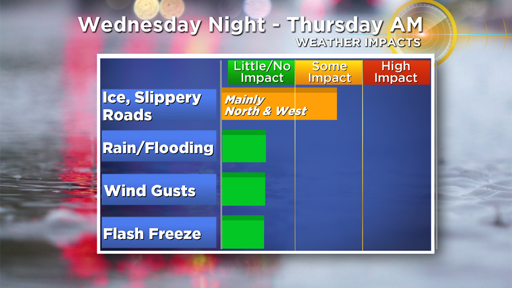
Once again, it will not be a major storm and there won't be any snow (stop me if you have heard this narrative before), but there will be some ice in parts of our area late Wednesday and early on Thursday.
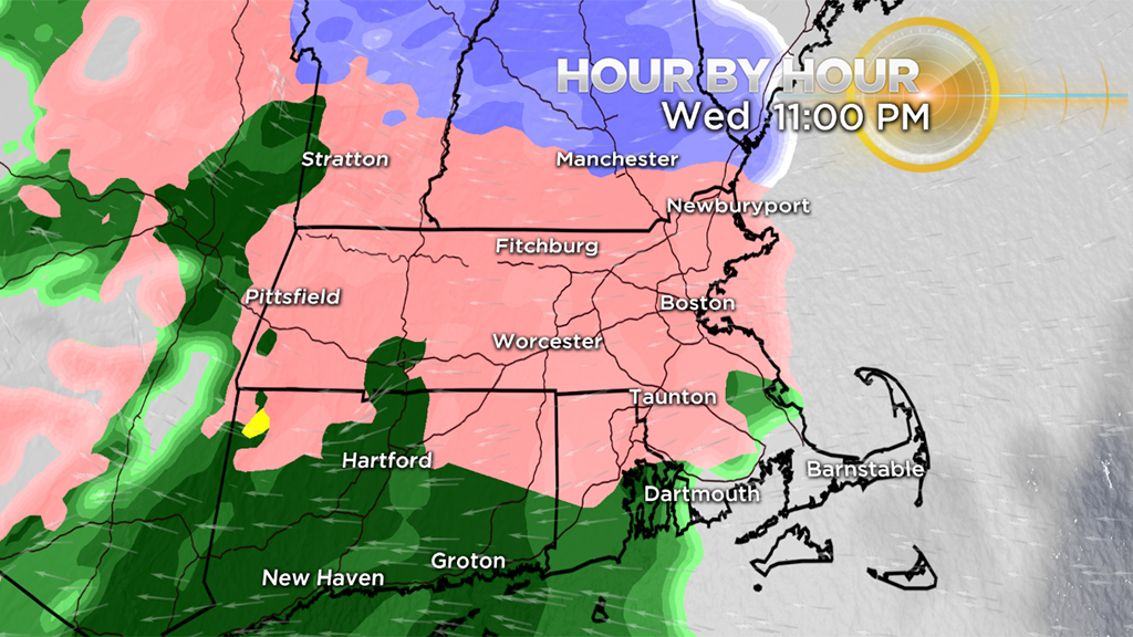
The daylight hours of Wednesday will be dry but much colder, about 25 degrees colder than Tuesday! Clouds will increase in the afternoon and evening and the rain/freezing rain arrives between 8-11 p.m. Most of the precipitation that falls overnight (through 5 a.m.) will be freezing rain.
This goes for our entire area north of Cape Cod as temperatures at ground level will likely hover a few degrees below freezing.
A reminder that freezing rain is much more troublesome than sleet. Freezing rain occurs when you get a layer of mild air above ground level (over 32 degrees) and a thin, cold layer of air at the surface (below 32 degrees). The rain hits the cold ground and freezes.
Untreated roads, sidewalks, driveways, decks can become instant skating rinks.
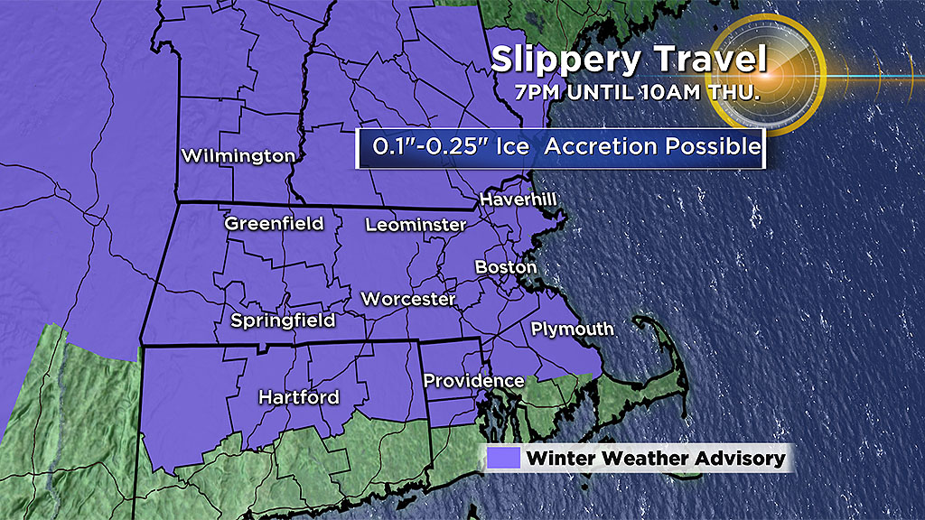
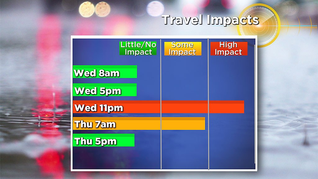
Peak concern for icing occurs between 11 p.m. Wednesday and 7 a.m. Thursday.
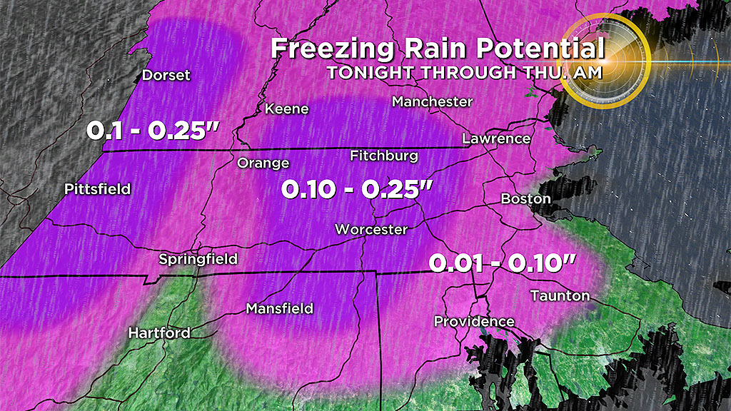
In eastern Massachusetts, there may be up to a tenth of an inch of ice accretion, while in central and western Mass., ice amounts could approach 0.25 of an inch.
Temperatures will begin to tick upwards by dawn. Most of eastern Massachusetts will be between 32-34 degrees by 7 a.m. on Thursday. The icing may continue in the Worcester Hills, parts of southern New Hampshire and in the Berkshires as temperatures are likely to take a bit longer to rise above 32.
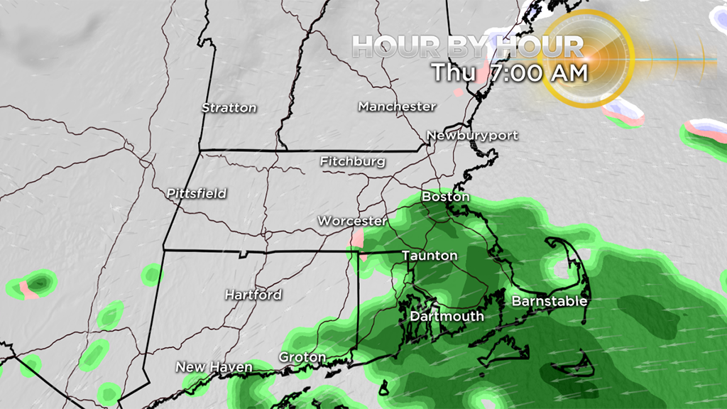
By late morning/midday Thursday the precipitation will taper off and most of southern New England will be safely above freezing.
There are no wind, inland flooding or coastal flooding concerns with this storm.
In classic New England fashion, we get another surge of warm air on Friday. Temperatures will surge into the 50's ahead of a cold front while periods of rain sweep through.
Then, back to winter again this weekend. Highs will be stuck in the 20's on Saturday.


