Polar Vortex To Bring Dangerous Wind Chill Values To Boston Area
BOSTON (CBS) - Thankfully, the core of the cold air mass over the Midwest is NOT headed here, but instead up into eastern Canada. Don't get me wrong, it is pretty darn cold here but we are only getting fringed by this Polar Vortex over the next few days.
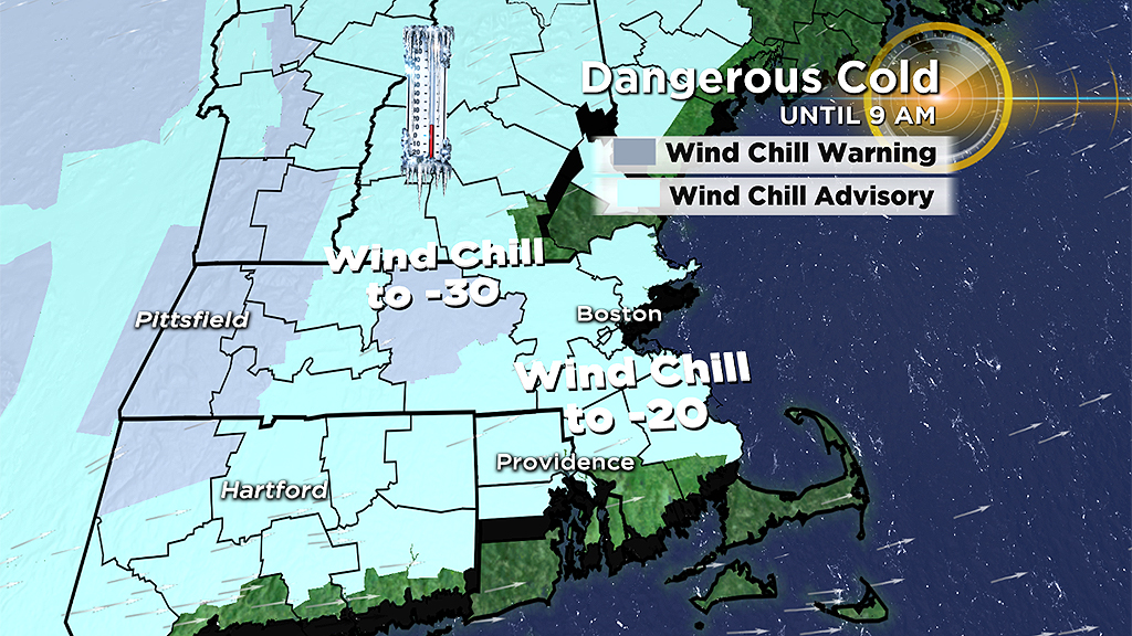
Let's step through the cold and wind over the next few days:
Thursday 7 a.m.
Boston: 5 degrees, wind chill -12
Worcester: -7 degrees, wind chill -20
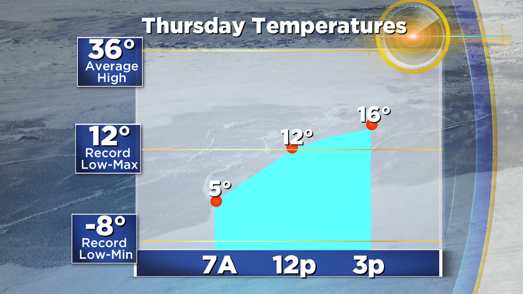
Thursday Afternoon
Boston: high 16 degrees, wind chill 0
Worcester: high 10 degrees, wind chill -5
Friday (lighter winds)
Boston: low 8, high 25
Worcester: low -3, high 18
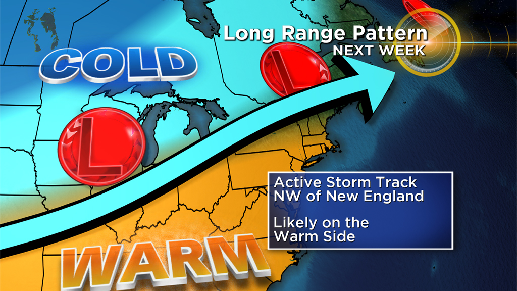
Over the weekend, we get back to near average temperatures, in the 30s. And as it looks right now, next week looks quite mild (January thaw in February?).
There will be a shift in pattern across the country as the jet stream takes a dip in the west and a ridge builds in the east. There could be several storms passing to our west next week (meaning rain) and there is a decent shot at temperatures rising in to the 50's for a few days!