Heavy Rain, Melting Snow Likely To Cause Flooding Thursday
BOSTON (CBS) - From snow and ice to rain and flooding there have been some wild weather swings this week!
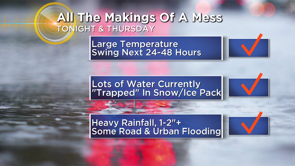
This is classic pipe-bursting, pothole-forming weather with lots of hazards to be aware of in the next 24-to-36 hours.
TIMELINE
Through Wednesday night:
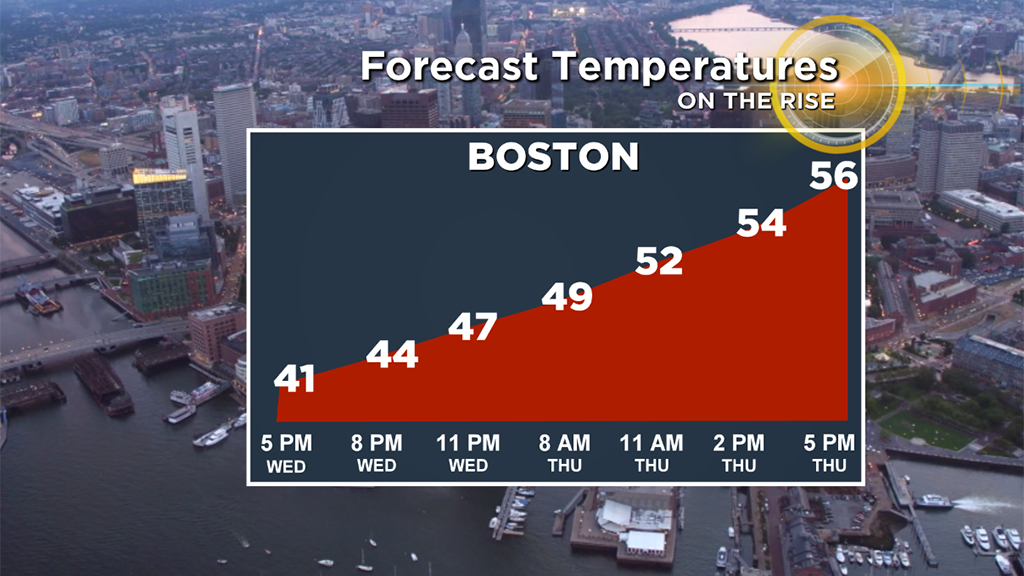
Temperatures slowly rise through the 30's and into the 40's with a few scattered, light rain showers. A gentle start to the melting process.
Thursday morning commute:
Temperatures actually continue to rise Wednesday night and Thursday morning. It will feel like spring as you head out the door Thursday with temperatures nearing 50 degrees!
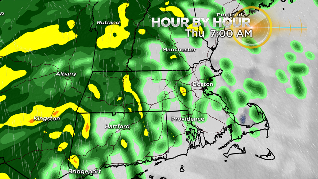
Scattered rain showers early in the morning will gradually become more numerous and heavier by the end of the commute.
Late morning through afternoon Thursday:
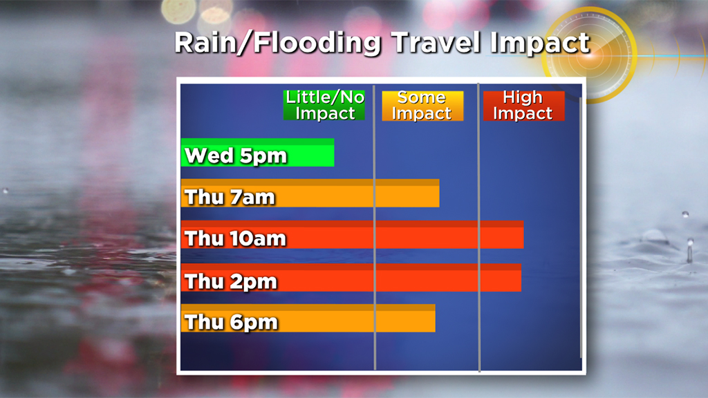
This is the peak of the storm. The heaviest rain falls from about 10 a.m. to 4 p.m. on Thursday. It will come down in buckets at times, possibly even with some embedded thunderstorms.
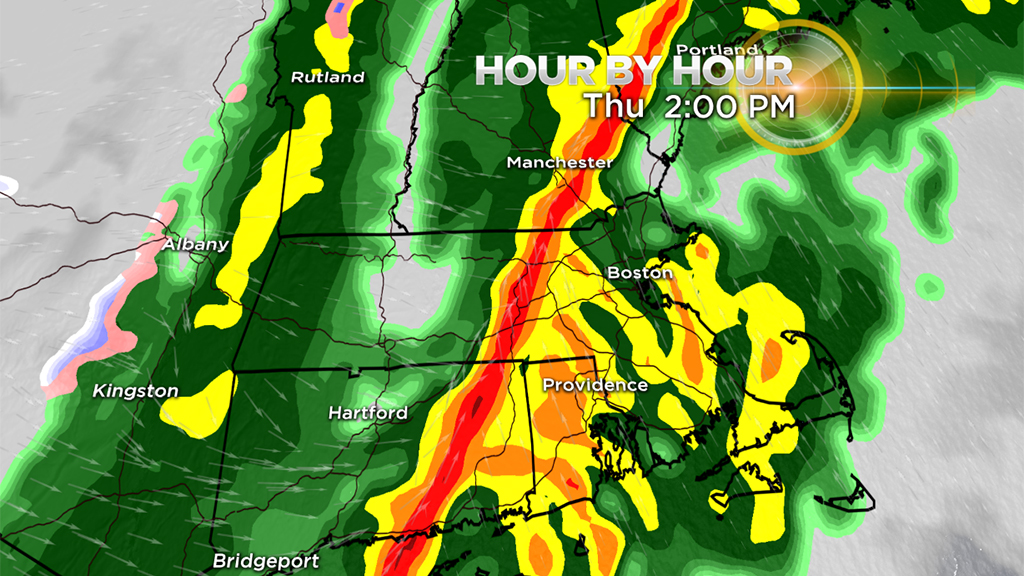
Most models are indicating one particularly heavy line of downpours pushing west to east between 1 and 4 p.m. This line would likely come with some very gusty winds as well.
Thursday evening:
Rain quickly tapers off between 4-6 p.m. and the winds switch from the south-southwest to the northwest, bringing in cooler air once again. Not expecting a flash freeze as the temperatures will only gradually fall back overnight.
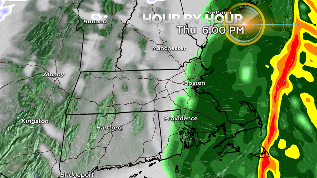
Although, the entire region will drop below freezing by Friday morning again.
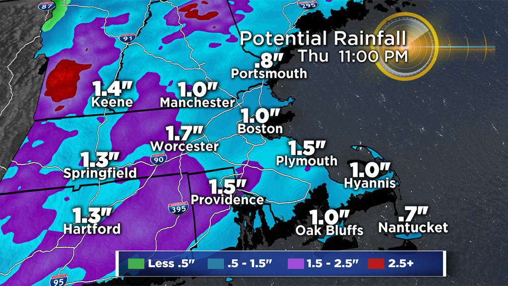
HOW MUCH?
Generally looking at between 1-to-2 inches of rain for most of southern New England. In some spots totals up to 3 inches are possible.
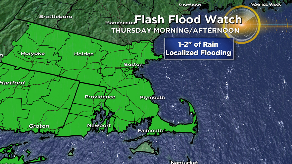
FLOODING CONCERNS
The heavy rainfall combined with the snow melt will almost certainly lead to areas of flooding. There will be areas of significant urban street flooding and also some scattered small river/stream flooding.
WIND
There will be some fierce winds a few thousand feet above the surface (strong low-level jet stream just above our heads) on Thursday. Thankfully, most of those winds will stay aloft (not mixing down to the ground level).
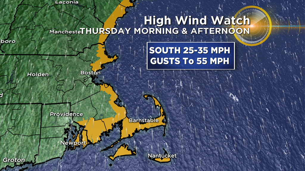
However, parts of southeastern Mass. will likely receive some powerful, potentially damaging southerly winds during the day on Thursday.
Peak Gusts:
45-55 mph in southeastern Mass.
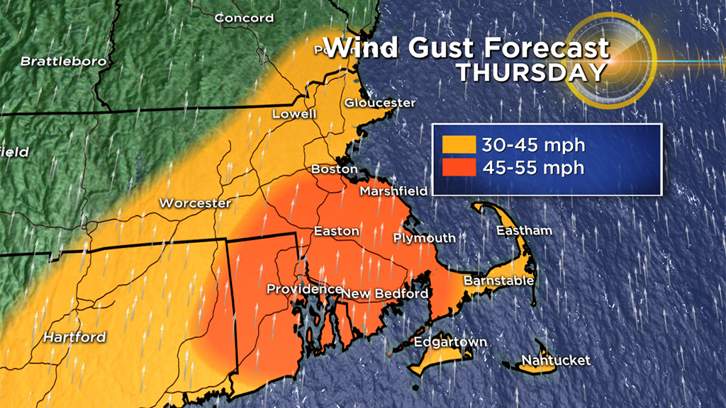
30-45 mph in areas north of the Mass. Pike in central and eastern Mass.
WHAT'S NEXT?
Quiet and cold heading into the weekend. We will be watching a general time frame between late Sunday and Tuesday of next week as several pieces of energy rotate out of Canada and around a trough forming in the east. It remains to be seen whether any of them will combine with the southern jet to form a significant storm or not. Odds do not currently favor any major snowstorms in the time period.
Follow Terry on Twitter @TerryWBZ.


