How Long Will The Snowless Winter In Boston Continue?
BOSTON (CBS) - The cold has arrived, but the snowflakes remain elusive. Outside of a few snow showers it has been a banner year for the 'keep it in the hills and away from here' crowd. Great news for ski country, local DPW budgets, heating bills, commuters, and schools. Bad news for southern New England snow-hounds looking for some action. The million dollar question is how long the atmospheric truce will last.
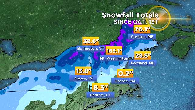
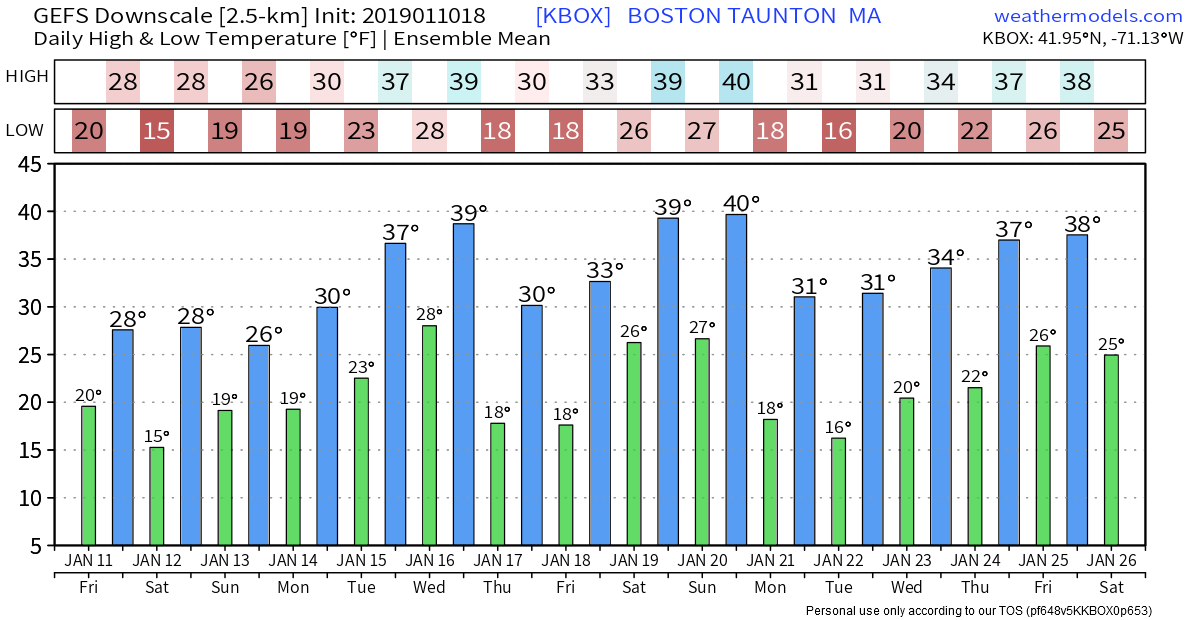
Plenty of snow up north so far, but very meager across southern New England with nearly nothing at all since mid-November. Graphic: WBZ-TV
A look at the numbers to date is pretty astounding in terms of futility. We're heading deep into winter now, so we can almost treat the mid-November storm as an oddball early-season event. It still counts for the seasonal totals, of course. But let's look specifically at what we would actually call winter and how that has panned out.
The start of climatological winter is December 1st, and no one near Boston has had to shovel at all during that time. This may not be entirely shocking for coastal residents but surely it feels weird for those across the interior.
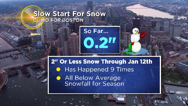
Here are the numbers to date:
Boston: 0.1"
Blue Hill Observatory: 0.1"
Worcester: 0.5"
Looking at the pattern ahead, there are pretty much no chances of snow at all during the next 7 days. We may get a flurry near the South Coast Sunday morning or a passing snow shower next Wednesday along a cold front. But certainly nothing appreciable. If we accept the forecast as truth (bear with me here, hah!) then those numbers will remain the same through January 17th.
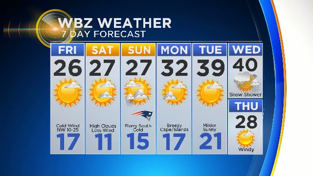
Cold and dry is the name of the game until at least next weekend. Graphic: WBZ-TV
Where do they stand? For all three sites, it would be the least snowy first half of climatological winter on record. If you look at it from the perspective of the entire snow season (including November), they rank 1st in Boston, 10th at Blue Hill, and 13th in Worcester. Not as impressive, but considering all of it came during one night with few people on the road the underlying story has been an extremely low impact snow season that no one has really even had to think about.
Temperature-wise during the first half, we are sitting at the 13th warmest winter on record in Boston. So will both the temperature and snow story change in the near future?
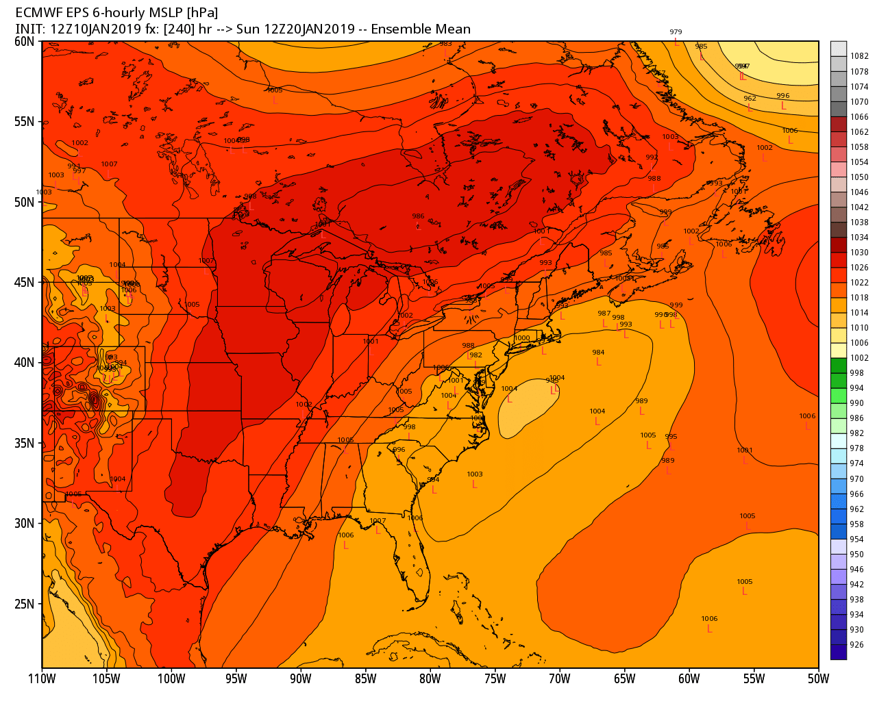
The next 1-2 weeks look seasonably cold instead of the general mild pattern we've been in since mid-December
The former absolutely will. A colder regime is taking up residence which we'll particularly feel Friday through Sunday. It's not unusual cold, but it's been a long time since we had a truly chilly stretch. This is the first time Boston will have back-to-back days in the 20s since this time last year! It'll start to take a chunk out of our mild lead. And looking ahead, there don't appear to be any significant warm-ups. More ridging is expected to develop across western North America which should keep us generally chilly to downright cold at times into early February. So that part of the equation is shifting.
A good look for storminess *next* weekend but suppression is definitely a possibility in this pattern. Something to watch.
Snowfall, as always, is a trickier call. There's nothing remotely brewing until at least next weekend. While the 'signal' of storminess is there, you can hardly take something 9-10 days out to the bank. We could see anything from an insider runner to something suppressed to our south take shape during that time. But if you're looking into the magic 8 ball it's our next opportunity for anything of interest.
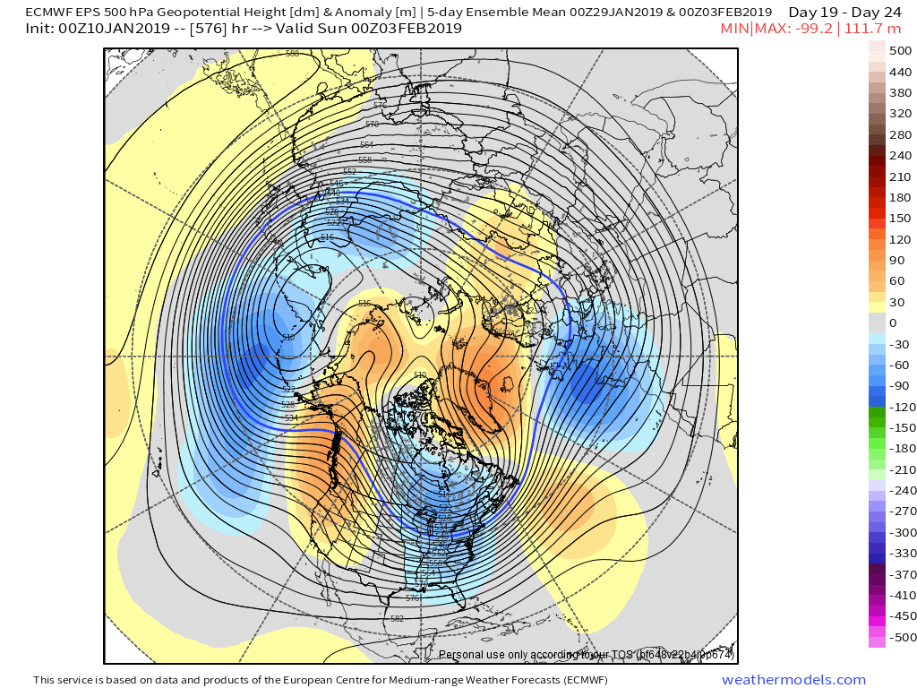
The Thursday Euro Weeklies continue to show a fair amount of high latitude blocking in the 'right' places for snow and cold. While it is a long range look, there's good reason to believe this could pan out for at least a couple weeks.
Longer range, there are indications of an elevated snow and cold risk late month into early February. A pretty classic look with the western North America ridge, a deep eastern trough, and some blocking over Greenland. It's the best look we've had for snowy conditions so far this season, and is not entirely surprising considering it coincides with the snowiest time of the year. It's also how many El Nino winters progress (milder and less snowy starts, colder and stormier finishes) so considering that and the climatology it makes sense. It nearly always snows during the first week of February. How much we get out of it is always a crapshoot that comes down to timing, rain and snow lines, etc that are impossible to know at such a range. But if you are looking for something of interest, this is it!
How much ground will we make up during the second half? We're basically Patriots 3 Falcons 28 at this point. Boston has never had a season of above average snowfall with a start this slow. But there's a first time for everything and there are a couple different roads we can take. The first is one we have traveled several times in the past 10-15 years. A weak to moderate El Nino that shifts into a very snowy gear and buries us. Those were 2002-03 (52.9"), 2004-05 (66.7"), 2012-13 (59.6"), and 2014-15 (105.1"). Or we can repeat 2006-07, which also featured a similar polar vortex split and lots of poor luck (16.3"). All those totals are post-January 15th.
Truthfully, they're both still on the table. Winter is a very long season here and we can pick up snow in a hurry. At the very least, we know it will be a condensed winter since we won't really have dealt with anything until after mid-January. So at least there's that. I also like our chances to avoid a super-delayed spring this year and not repeat the last couple. It was 'good' to get the polar vortex split out of the way early in the season (instead of last year, where it did not occur until mid-February and helped give us a brutal March into April). We may be able to go through some northern hemisphere blocking periods before springtime. Fingers crossed, anyway!