Freezing Rain, Snow Could Create Treacherous Travel
BOSTON (CBS) - Overnight, areas of fog, drizzle, thunderstorms and snow moved through the area as low pressure will strengthen along the Maine coast Wednesday. Slow improvements are expected after a damp start to the day.
Periods Of Freezing Rain Through Dawn
For our area, mainly rain showers will move through before sunrise creating damp conditions for the morning commute. There are some inland spots near or below freezing allowing for freezing rain. All it takes is a thin layer of ice to create hazardous conditions. Untreated surfaces may be slippery.
Snow Accumulation Will Occur Mainly In Elevated Areas
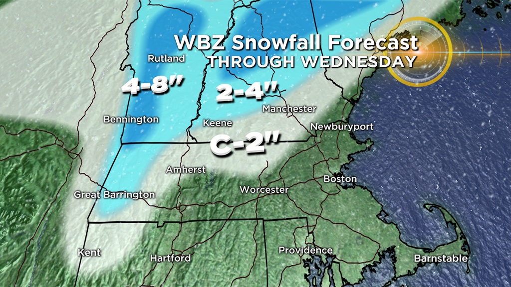
The band of showers early Wednesday morning comes with a band of snow, potentially briefly heavy, in the Berkshires, Green and Whites. Even areas north of route 2 in Worcester County has seen a changeover. Not expecting more than a coating to 2" in northern Worcester County and most of southern New Hampshire. However, several inches of snow may accumulate in the Berkshires, and Mountains of Vermont and New Hampshire by early Wednesday morning. Close to a foot is possible over some of the higher terrain of southern Vermont. A few snow showers may be possible through midday and into the afternoon through central and northern Mass. as low pressure pulls away. Travel will become difficult the further north you travel in New England with a continued threat of snow.
Gusty Winds Pour In Behind the Storm
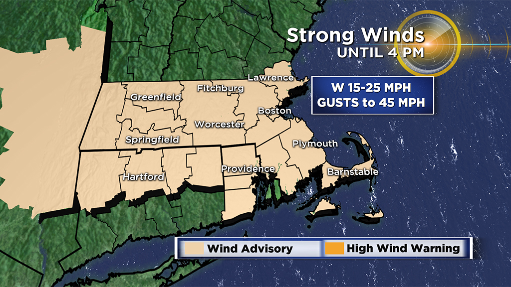
Strong to even damaging west to northwest winds will develop later Wednesday morning and into the afternoon. There may be some isolated tree damage and power outages. Winds will gust between 20-45 mph across most of the area, with the strongest winds from about 10 a.m.to 3 p.m. They will decrease a bit Wednesday night but remain active through most of Thursday (closer to 12-25 mph).
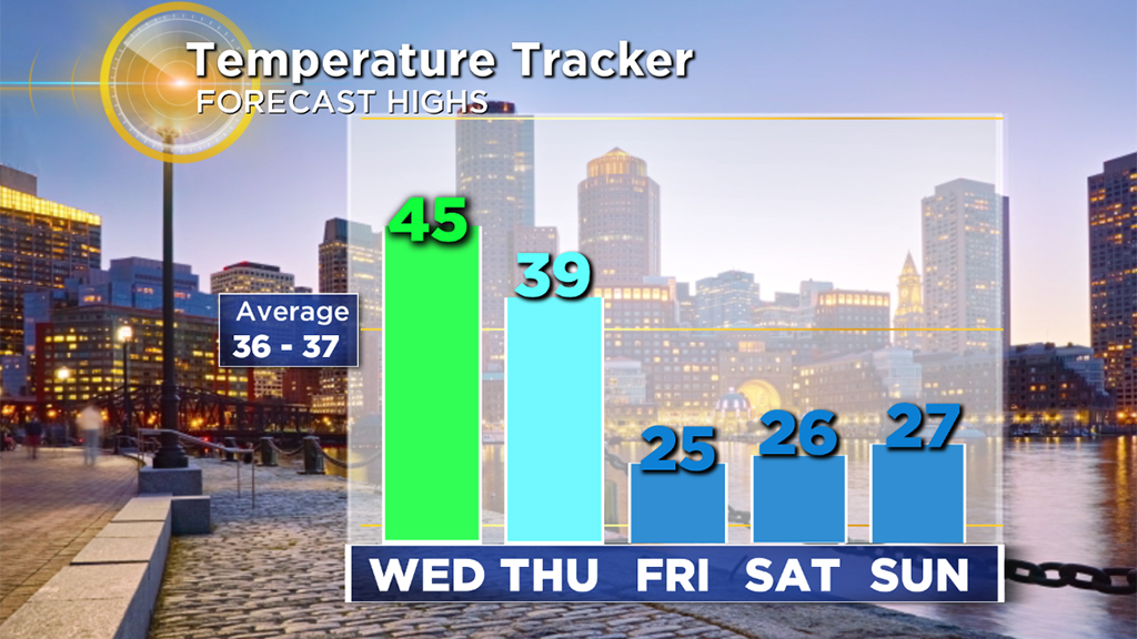
And Then Comes The Cold
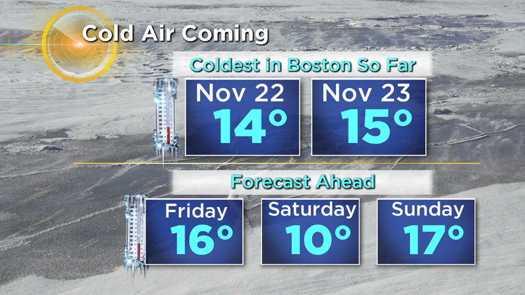
Those gusty winds will usher in some of the coldest air yet this season…in fact it will likely be the coldest airmass we have felt since Thanksgiving. High temperatures will be stuck in the 20s Friday through Sunday. Overnight/early morning low temperatures will drop into the single digits and teens during this timeframe.
Oh, And What About That Weekend Storm?
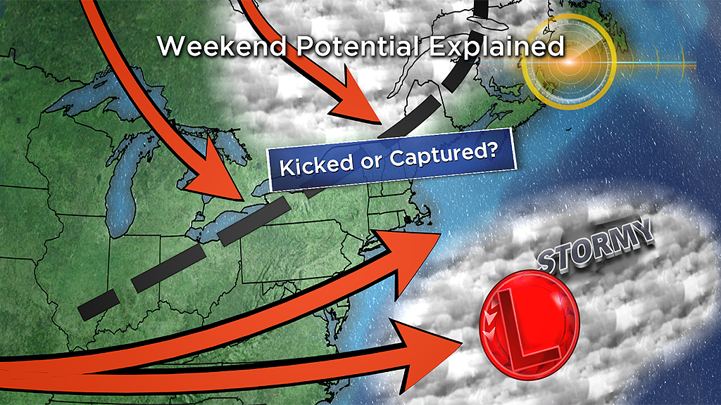
There is some potential for a winter storm here on Sunday and Monday. Odds continue to favor a miss to our south, but we cannot yet rule out a closer pass or direct hit. We will get a better read on this system in the next 48 hours as it comes ashore in southern California on Thursday. Again, odds are very much in favor of just a fringe (light snow) or complete miss, but definitely something to watch.


