Snow Could Be Coming Tuesday Morning
BOSTON (CBS) -- Winter is coming. OK, that may be a bit dramatic. I mean, technically, winter has been here a while, but thus far we are severely lacking in one crucial element -- snow. But that may soon be changing. . .
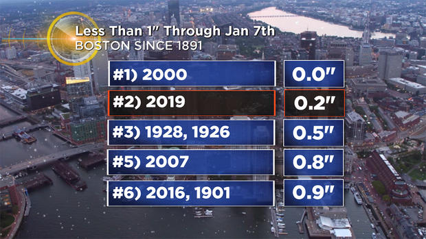
To say that it has been a slow start seems like an understatement. The 0.2" of snow that Boston has recorded thus far is more than 11" below the average for the date. Same idea in Worcester. . . although they have recorded a robust 9.3" thus far, that is also nearly 10" below the average to date. And, with no snow coming through Monday, this season will go down as the 2nd least snowy though January 7th in Boston's recorded history!
So, what does it all mean? Are we going to skip winter altogether this year? The answer to that would be a resounding heck no! Need I remind you of the winter of 2014-2015? Perhaps you had already blocked that one out? Boston had less than 5" of snow through mid-January that season and then the floodgates blew wide open. We finished with a mind-boggling 110.6" of snow when all was said and done. . . a new record for Boston.
Let me be clear, we are NOT forecasting a repeat of that this year (we may never see anything like that again in our lifetimes). The takeaway being that winter is FAR from over. . . in fact, things may start ramping up as soon as this week.
With a gusty NW wind, it will feel like the single digits on Monday morning.
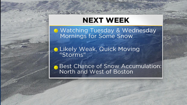
At the same time, a relatively weak storm system will dart southward from Canada, through the Lakes and head straight for New England. This is going to be a very small, weak, quick moving event (I hesitate to call it a "storm") . . . BUT could this be the "ice-breaker" leading to a colder/snowier pattern? Perhaps.
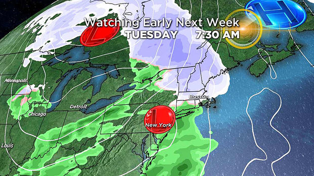
Right now, light snow will arrive early Tuesday morning before transitioning to rain. This, of course, may lead to travel impacts for the Tuesday morning commute with low visibility and slick roadways.
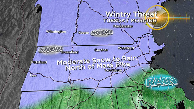
Further north and west you travel through Worcester County, western MA into New Hampshire and Vermont, there is a better bet of accumulating snow before the changeover. I expect any minor accumulation to change to rain by midday across parts of MA.
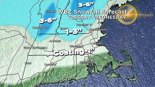
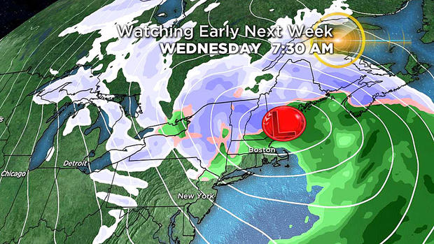
Another disturbance moves through Tuesday night into Wednesday bringing yet another risk of rain and snow. It looks like central and northern New England will have the best chances of accumulating snow from that system with steady rain for the Wednesday morning commute for much of southern New England except for the higher elevations and Berkshires. Behind those "storms," it is likely that we remain cold for an extended period of time. . . from there we shall see. But it is important to note that larger-scale atmospheric factors are starting to line up in a more favorable fashion for snow here in New England as we head deeper into January and February.