Tropical Rain & Record Warmth Visit For One Last Time In 2018
Find Eric Fisher on Twitter and Instagram
For a good chunk of this year, the weather discussion was all about humidity and rain. Constant high dewpoints. Downpours. Tornadoes spinning up in a tropical atmosphere. Record rainfall for autumn. And then it got cold. Real cold! The past 30 days or so have felt very much like winter even if you don't count it as winter until December 21st. So ironically, on the winter solstice, it will feel like those tropical days one last time (by December standards, anyway).
A fire-hose of tropical moisture getting ready to take aim at New England on Friday
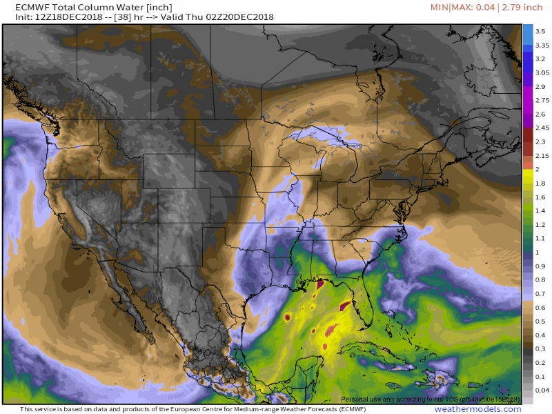
What we have brewing is a very anomalous setup. A disturbance will once again dive DEEP into the south, setting up a strong meridional flow. This means that we've got a formidable S-N flow which will be capable of sending lots of tropical air northward into New England. One measure of how much water vapor is in the column of air above you is 'precipitable water' or PWAT for short. On Friday, we'll be running about 400% of normal and near all-time marks for December in the Boston area. That air will be juicy!
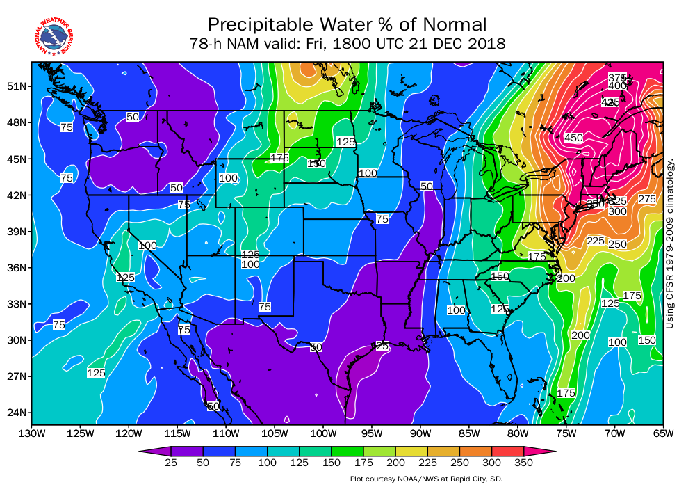
PWAT % of normal on Friday afternoon. Source: https://www.weather.gov/unr/uac
So what will it mean for us on the ground? As a strong low-level jet develops and a warm front lifts north, we should see a band of torrential rain take shape with embedded thunder possible. The rain starts to fill in Thursday night, and then gradually travels east during the day on Friday drenching those in its path. It looks like a dead ringer for 1-3" of rain, but with such an anomalous setup I would not rule out some isolated 3-5" totals in spots. Areas of street flooding and minor river flooding will be likely.
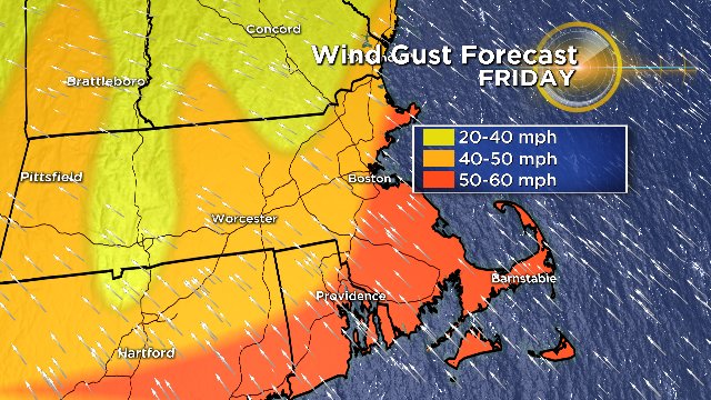
Potential wind gusts on Friday. Graphic: WBZ-TV
Speaking of that low-level jet, some of it should be able to reach the ground and bring a risk of damaging wind gusts on Friday. This will be most likely where surface air is the warmest and there is less of an inversion in place, and that should be across southeastern Massachusetts to the Boston area. Highs here look capable of reaching 60-65F, and wind gusts may peak in the 50-60mph range out of the south-southeast. We'll be on the watch for areas of scattered damage and power outages. It will be more difficult for these stronger winds to reach the surface farther west across the interior, although some of the higher elevations may also see some damaging gust potential.
Graphic: WBZ-TV
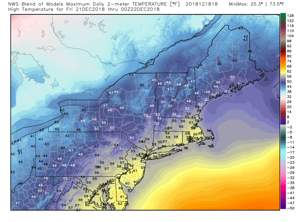
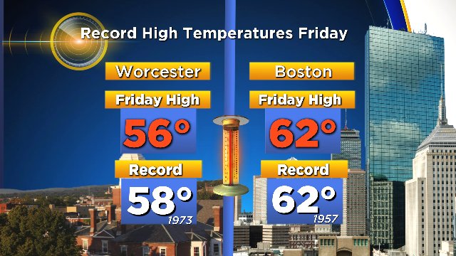
Are those temperatures pretty darn warm for late December? You betcha. We should end up close to or beating the record highs for the date. I posted the model blend for forecast highs on Friday above and I think they're a little on the conservative side. Not only will it be mild, but very muggy outside on Friday into Friday night.
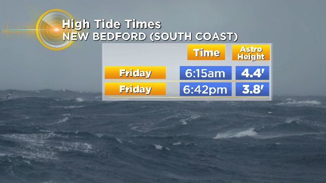
Friday's high tides along the South Coast. Graphic: WBZ-TV
We'll also be watching for coastal flooding. The strongest winds will be out of the south-southeast and in general the highest risk of coastal flooding will be along the South Coast with this storm (a little different than our typical nor'easter type events). Minor coastal flooding is likely with a lot of chop over the open waters.
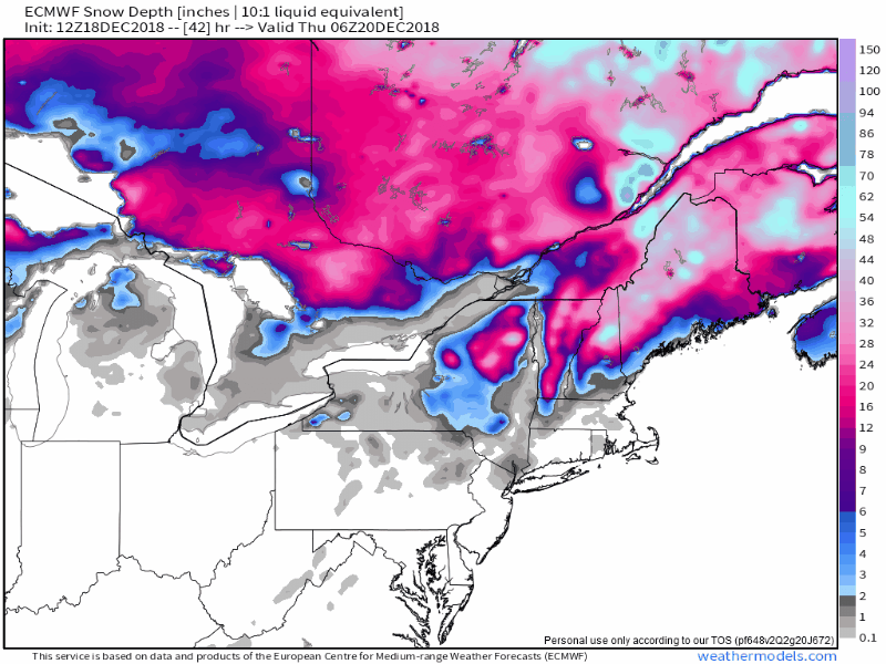
Modeled snow depth through the weekend across the Northeast. I feel like this is actually pretty optimistic on the amount that will still be left, if dewpoints of 50F can make their way north during this storm. I would wager there won't be any snow anywhere in southern New England by Saturday afternoon.
That muggy air is very good at destroying snow cover, and that will be an issue across northern New England. I don't think this storm will last long enough to get rid of all of it where there's over a foot on the ground, but there should be significant loss Friday into Saturday. Dewpoints in the 40s to low 50s will make for fog-eatin snow conditions plus rain on top.
There is some concern over flooding due to this snow loss combined with the rain. Across Vermont and New Hampshire it looks like 1-2.5" of rain will be possible, and there's a a couple more inches locked up in the snow-pack that could be released. There's also river ice that built up over the past couple of weeks during the cold conditions, so ice jams can exacerbate any issues with runoff from rain and snow melt. I would definitely keep a close eye on the water situation over the next couple of days as we get closer to the event. Any trend toward heavier or more widespread rainfall would be a problem.
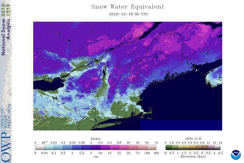
Water equivalent in the snow pack up north as of Tuesday morning. Source: https://www.nohrsc.noaa.gov/nsa/
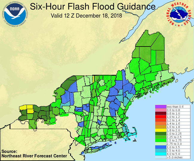
Flash flood guidance shows a risk, particularly across Vermont


