Switch Flipped: Fall Takes The Reins
Find Eric Fisher on Twitter and Instagram
Remember when it was in the mid 80s the other day? You won't for long. Summer never checked out and stayed much longer than usual this year, but it can't go on forever. A big pattern shift has taken place and those very warm humid days are finished for the season. Goodbye AC, hello fireplace.
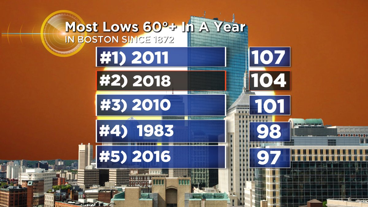
We've been at the top of nearly every warm record list this summer and early fall. Graphic: WBZ-TV
That being said....what's heading in is just what's more typical for this time of year. We've been waiting a long time to cool down. Saturday we'll finish a record long wait for the first 50F reading in Boston. The same can be said for the wait for 40F in Portland, ME (another record set). We've had the 2nd most 60F+ nights on record for a year. We've had the most 70F+ dewpoints for a year. We've had the 2nd warmest fall to-date on record. We haven't had any frost in SNE yet. So stepping back to seasonably cool weather is going to feel like a very large shift.
What's driving it? The strong, anomalous ridge of high pressure that has anchored itself over the eastern U.S. since late June is finally breaking down. We're also seeing the Pacific start to take the wheel and stir up change. A deep trough will set up just south of the Aleutians with a building ridge over the western U.S. and western Canada. This is a pattern called the +PNA, or Pacific North American pattern. It helps to send cold air down into the Midwest and East Coast. Most guidance shows this holding on for quite some time (weeks, potentially) and so that's why we expect autumn to stay in control from here on out.
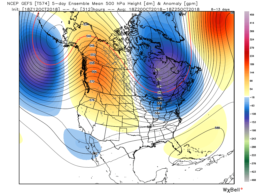
Instead of the big east coast ridge, we now have an trough-ridge-trough setup that will help keep the east quite cool and shift the warmer weather to the western U.S/Canada
There will be some other interesting things taking shape over the next several weeks. With lots of cold in the Midwest and seasonable chill in the east, there will be a tight thermal gradient setting up near the coast. Water temperatures are WAY warmer than average, and so this will be a zone to watch for potential coastal storms late in October (perhaps into November as well). One thing that would be help produce these coastal systems would be a little more blocking over the North Atlantic. We've been on an unprecedented run of +NAO, North Atlantic Oscillation, which is showing signs of breaking down. Later in the month, both the Euro EPS and the GEFS are showing rising heights over the North Atlantic which could slow the flow down some and then produce coastal storms. Definitely something to keep an eye on going forward. A Halloween howler?
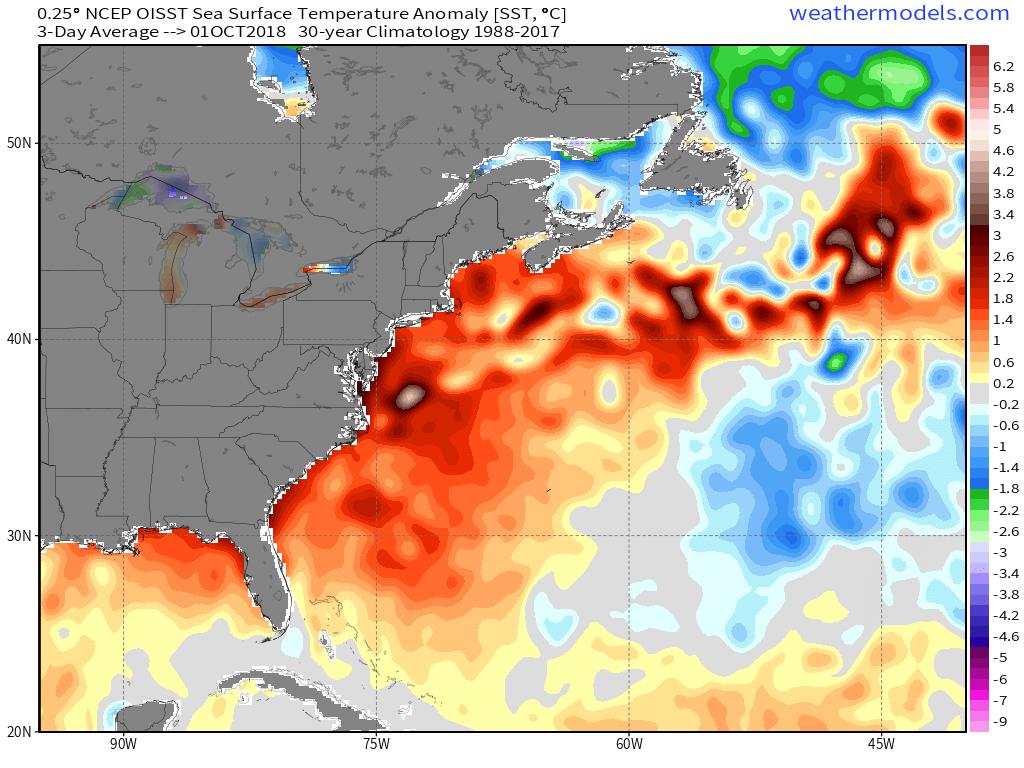
Sea surface temperatures are running very warm after all of the summer and early autumn warmth across the western Atlantic
Otherwise, in terms of max temperature, it looks like a slew of 50s and 60s ahead. Average highs are in the 50s to low 60s next week and average lows are in the 30s to low 40s, so this is not very surprising news. But again it'll feel like a wholesale change with more jackets and boots and fewer shorts and flip flops.
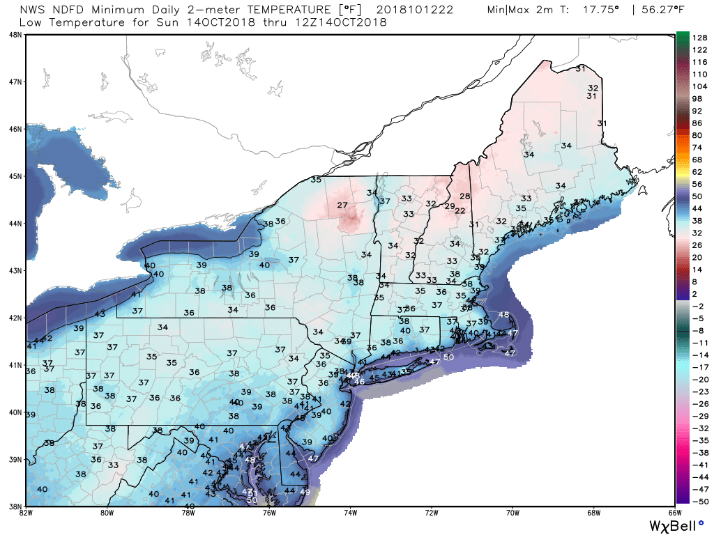
Sunday night lows will bring the first frost chance of the season for southern New England
For gardeners, there are a couple chances for frost. The first is Sunday morning (the 14th) where temperatures should bottom out in the 30s to low 40s. It doesn't look like a killing freeze, but the coldest spots may reach 32F-35F and so sensitive plants should be covered or brought inside if you want to keep them going. The patchy frost would be most likely for interior areas away from the immediate coast and away from city centers.
Then a higher chance of frost looks to be possible late next week. The coldest air of the year will be moving in, so if we get a calm and clear night Wednesday Night/Thursday night the frost chance would be high with the potential of a killing freeze in parts of the area. We're getting to the time of year where most gardens are just about done anyway due to the waning daylight so I'm sure people won't be too bent out of shape about a late October freeze! But time to bring the tropicals in for the cold season.
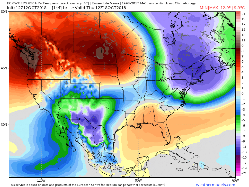
A more substantial cold shot looks possible late Wednesday into Thursday of next week and may mark the end of the growing season for many
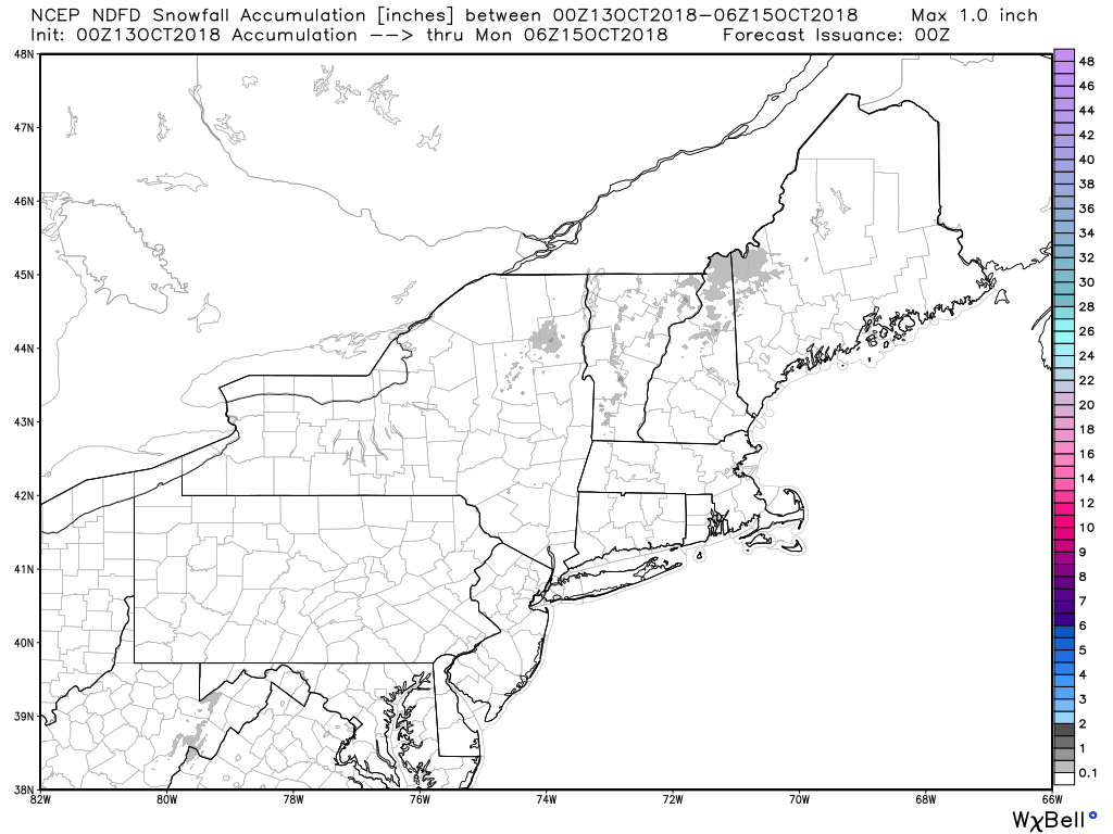
How about snowflakes? Yep, they're possible! The air mass may be just cold enough for wet flakes in the Berkshires and Greens Saturday morning (the 13th) and if we're lucky some 'snowliage' shots near the highest peaks. Not expecting much but it's a sign of the quickly changing times. Then with a strong front late next week (the same one above) there could be some snow showers across the higher elevations...particularly toward northern New England. Nothing big brewing at the moment.
Look closely and you'll see it ;-)