Weather Alert: Flash Flood Watch In Southeastern Massachusetts
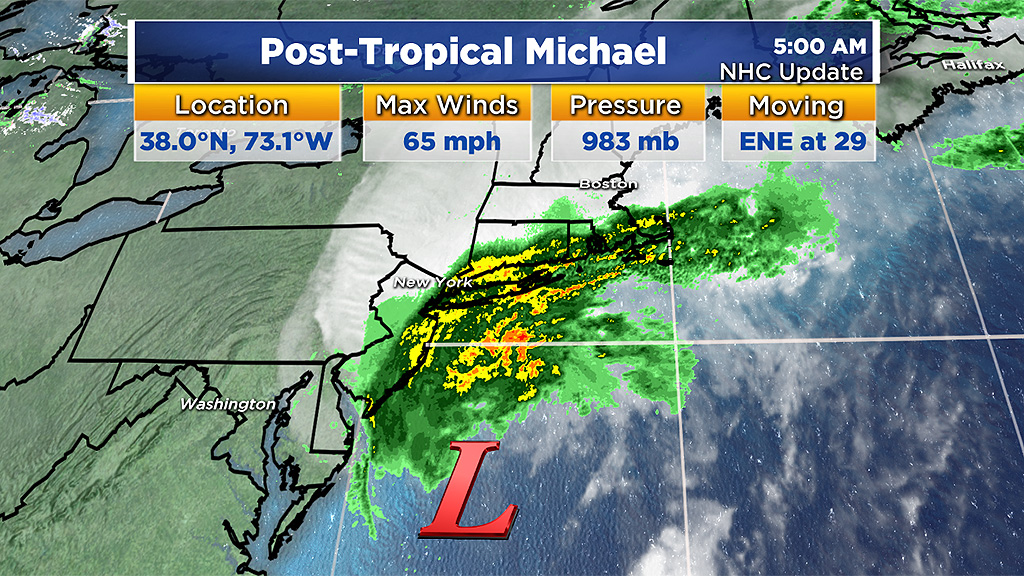
BOSTON (CBS) - The storm formerly known as Hurricane Michael has now become a post-tropical cyclone. The National Hurricane Center has issued its last advisory on the system as it zips off to the east-northeast at 29 mph, and will pass well southeast of Nantucket Friday.
The moisture associated with these remnants will continue to impact parts of southeastern Massachusetts Friday morning though, keeping the risk of flash flooding in the forecast for these areas.
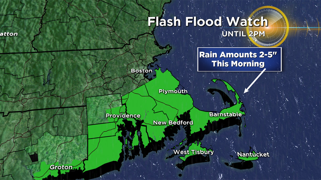
Expect areas of heavy rain and torrential downpours from the South Shore to Cape Cod during the morning. The northwest fringe of the rain may extend into Boston and MetroWest briefly, but the intensity of the rain will be much lighter in these areas. The downpours will shift offshore between 9 and 11:30 a.m. from the South Shore to outer Cape respectively, with rapid clearing arriving from the west after that.
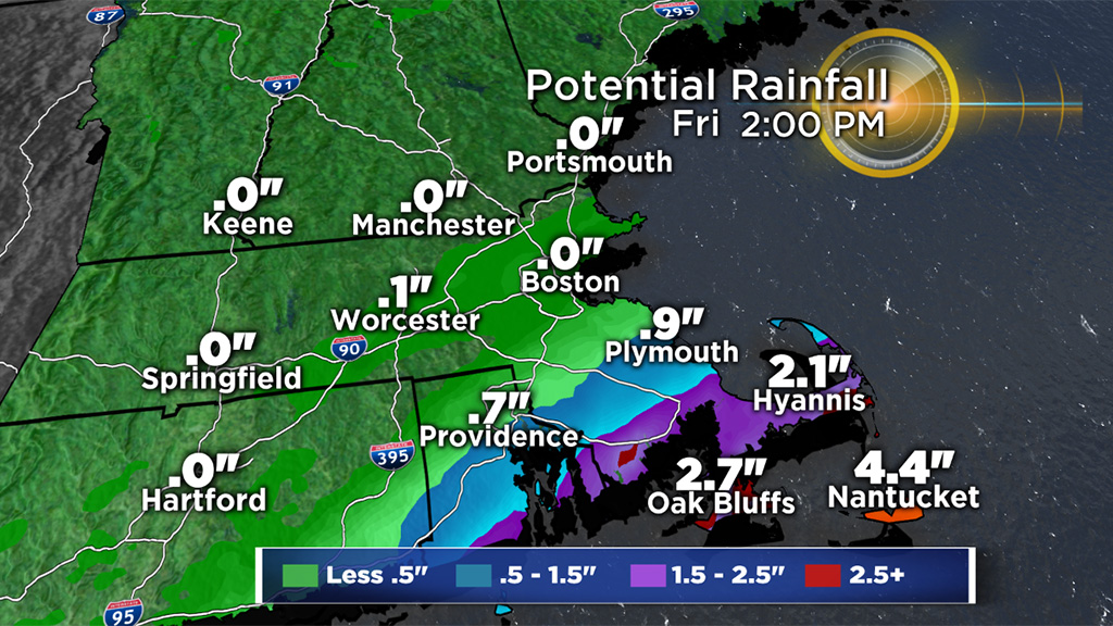
Rainfall totals will be highest over Cape Cod where 2-to-4 inches is anticipated (locally higher totals of 5 inches are possible). Street flooding, urban flooding and localized flash flooding will be possible.
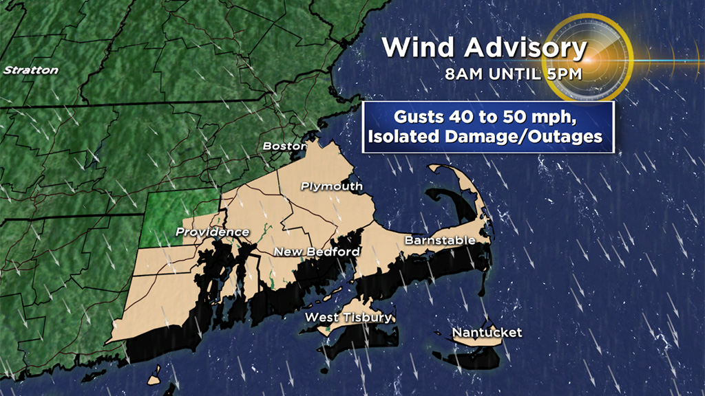
Strong wind gusts will also be a concern Friday on the backside of the storm center. Gusts ranging from 25-to-45 mph will be widespread in southeast Mass., with gusts 40-50 mph on Cape Cod and the Islands.
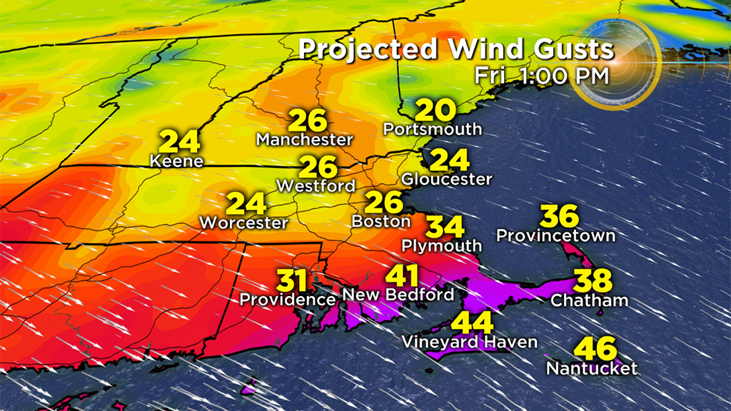
Wind advisories are in effect in these locations until 5 p.m. this afternoon. Isolated pockets of damage and outages may result.
We'll keep you posted if and when any warnings are issued.


