Plowable Snow Likely For Much Of Massachusetts This Weekend
BOSTON (CBS) -- It sure doesn't feel like snow right now does it? This week has felt more like March than February and I'm sure you noticed those 60s in the forecast for next week. Heck, if we didn't know any better we might be inclined to stick a fork in winter. But, alas, we DO know better.
Calling for an end to winter in mid-February in New England would be just plain silly. And, right on cue, it now appears likely that we will have a plowable snow event for a large portion of the area Saturday night.
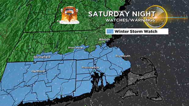
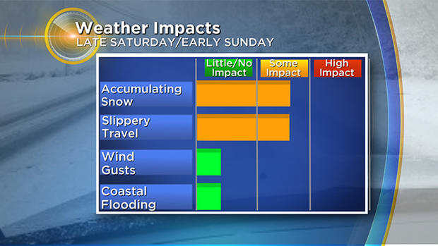
While we don't anticipate a major impact given the timing and lack of any significant wind or coastal issues, this weekend's snow will cause some treacherous travel on the roads and require some cleanup Sunday morning.
TIMELINE:
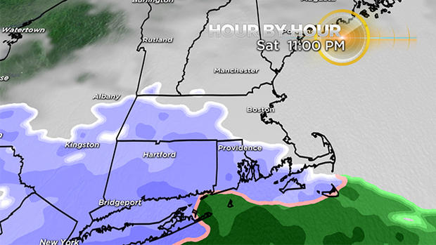
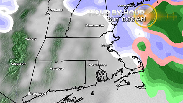
The snow arrives between 9 p.m. and midnight Saturday night from southwest to northeast. Any Saturday dinner plans should be OK, however if you find yourself hanging at the bar late into the evening, you may encounter a snowy ride home.
The majority of the snowfall will occur overnight, tapering off between 6-8 a.m. Sunday. Visibility will be rather low at times within some of the heavy areas of snow (most likely south of Boston), and snow rates could reach an inch an hour at times.
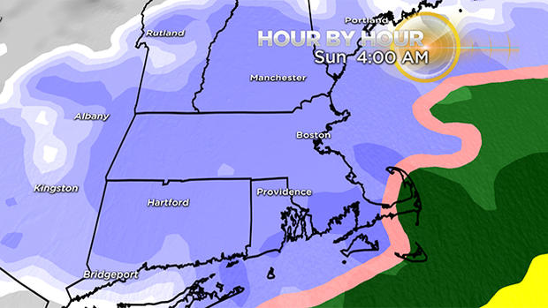
The storm is another fast mover. . . last flakes in Worcester around 6 a.m. and at the coast around 8 a.m.
HOW MUCH:
3"-6" For areas along the Mass Pike from Worcester to Boston and all areas south down to the Cape Cod Canal.
1"-3" Most areas north of the Pike, certainly north and west of I-495. Also for the Outer Cape and Nantucket due to some mixing with rain.
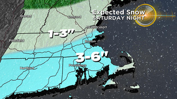
This is not a big snowfall for the northern ski areas, just some lighter snow and perhaps an inch or two up that way.
OTHER CONCERNS:
Thankfully, no significant wind is expected with this event and no coastal flooding either.
If the storm tracks a bit closer to Southern New England, we could get into a fairly heavy snow band for a time. This could push final snow totals a bit higher than forecast (perhaps up to 8" in spots). While this is not currently our forecast, it remains a possibility. Given that the snow will be of the heavier/wetter variety, especially to the south of Boston, if 8" were to fall there may be some isolated power outages.
WHAT'S NEXT:
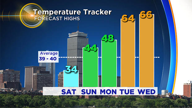
Whatever snow does accumulate will not be sticking around long. By Sunday afternoon temperatures will rise into the 40s and next week looks exceedingly mild. In fact, we will likely challenge some record high temperatures by Tuesday and Wednesday of next week! Bye bye snow.
Follow Terry on Twitter @TerryWBZ


