Plowable Snow Coming Wednesday North And West Of Boston
BOSTON (CBS) - Well, that was quick.
After a massive snow melt, greens and browns were the primary colors across southern New England this weekend. But as fast as the snow disappeared, it is about to make a comeback. A one-two punch of snow is coming in the next few days and our landscape is about to be transformed again, back to white.
Episode 1 – Monday
You can't really call this one a storm.
If you look at a weather map around New England there's no discernible low pressure area. In fact, you will probably notice an area of high pressure seemingly dominating our weather, parked over eastern Canada.
So what gives?
This is a private party on Monday. Not too dissimilar from the lake effect snows that occur in places like Buffalo, New York in early winter, the snow on Monday will be highly localized and mainly right along our coastline. We mentioned that large high pressure to the north, there is also a wave of low pressure well out to sea, in the middle (right along our coastline) there is a weak frontal boundary with just enough moisture and lift along it to produce some snowfall. Most of the snow that falls Monday will be light, intermittent and focused right along the coast.
What we have to watch for though, are some very localized, ocean-enhanced, heavier bands of snow which could put down several inches quite quickly. Best chance for this to occur would be over Cape Ann and the South Shore (Plymouth County).
Timing: Off and on all day. Tapers late Monday night around midnight.
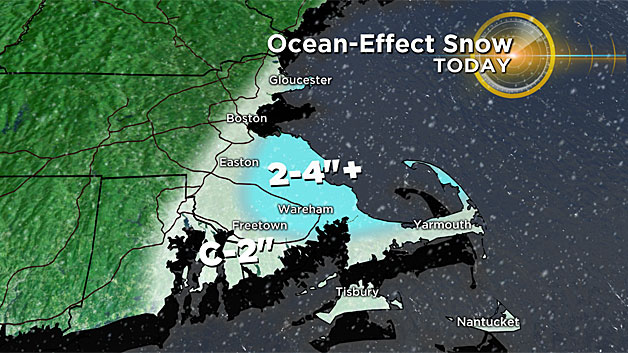
Amounts: A general coating to 2 inches across all of eastern Mass. inside of Route 128/I-95 with some localized areas of 2-to-4 inches on Cape Ann and Plymouth County. Can't rule out a few spot totals to 5 or 6 inches.
Episode 2 – Tuesday Night - Wednesday
This will be a much more typical and widespread precipitation event. It's likely to produce plowable snow for a good portion of the area north and west of Boston.
The main question with this one will be a rain/snow line.
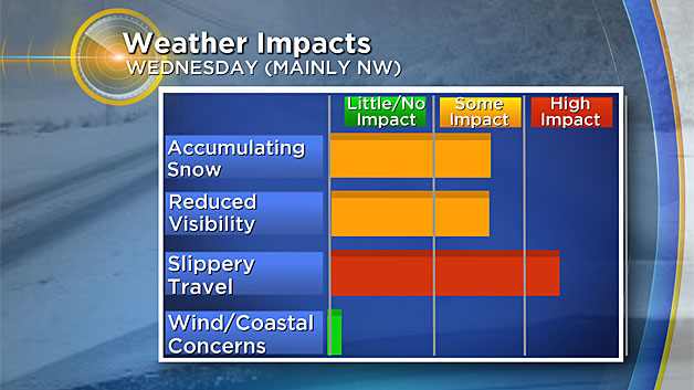
Temperatures from Boston to Providence and areas south and east will likely be too mild for much if any snow accumulation. No real wind or coastal concerns either. The main impact will be from snow accumulation and slippery travel.
Timing: Light snow starts as early as Tuesday afternoon and evening in parts of central and western Mass. and continues lightly overnight. Not much accumulation until Wednesday. The snow becomes steadier and heavier after midnight and continues through Wednesday morning.
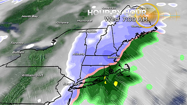
Snow covered roads north and west of Boston will make for a challenging AM commute and likely cause numerous school closings. Rain is likely over southeastern Mass. for most of Tuesday morning.
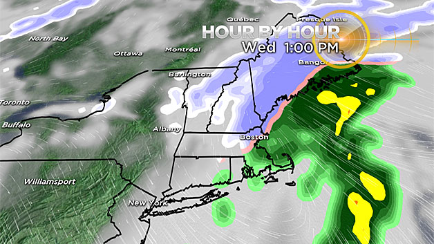
By afternoon the precipitation is already winding down, likely completely shut off before the PM commute on Wednesday.
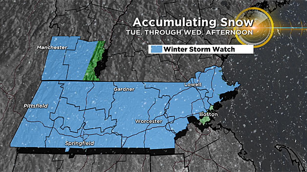
Amounts: Widespread 3-to-6 inches north and west of Boston to the Providence line (northwest of 128). This includes most of inland Essex County, Middlesex County, Worcester County and all of southern New Hampshire.
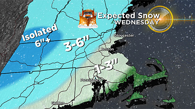
Some spot 7 or 8 inch totals are possible, especially in the Berkshires, southern Vermont or southwest New Hampshire.
Next Up – The "Real" January Thaw
Whatever snow does fall over the next few days will once again be wiped out, likely most of it gone by the end of this weekend!
Temperatures will rise into the 40's on Saturday and 50's on Sunday and Monday.
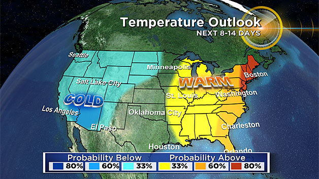
And beyond that, it appears as though, for the most part, temperatures will be above average through the remainder of January.
Follow Terry on Twitter @TerryWBZ