Brutally Cold Start To 2018, Storm To Bring Snow Thursday
BOSTON (CBS) - Happy New Year! The calendar may say 2018 now, but the same arctic air is in place that ended 2017.
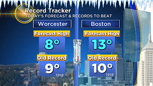
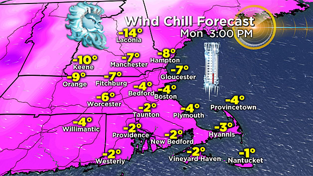
Record cold high temperatures are possible Monday in some spots (Worcester, for example) and our wind chill will stay in sub-zero territory through the day.
It won't be quite as brutal Tuesday, with wind chill values in the single digits at the warmest time of the day.
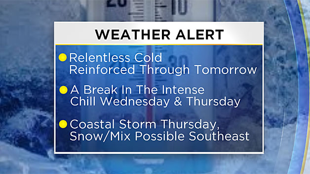
Some moderation is on the way for Wednesday as temperatures climb well into the 20's and lower 30's - something we haven't seen in more than a week. The wind will be significantly lighter on Wednesday too which will make a substantial difference.
Now in terms of snow, we're monitoring a significant coastal storm which will likely bring accumulating snow to southern New England Thursday.
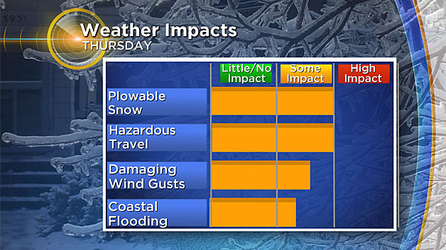
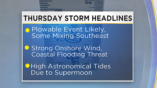
How much snow falls is dependent on the exact track of the storm center. It is just too early to give a projected range given the uncertainty. Many details will be ironed out in the next 24-to-48 hours, so stay tuned for frequent updates. This storm will also bring additional threats to the region: damaging wind gusts and coastal flooding.
Behind the storm, another blast of arctic air will move in – and this one could be colder than what we've been experiencing right now!
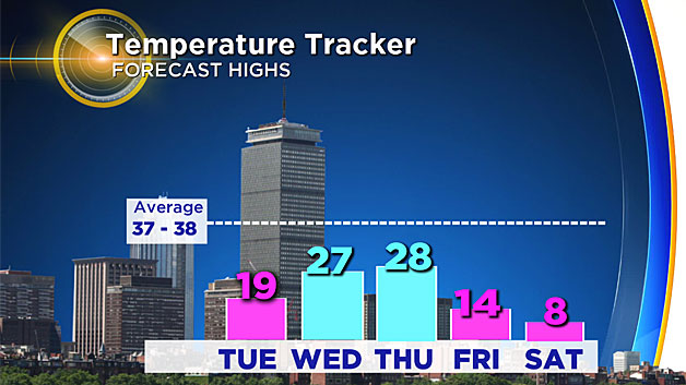
More record cold highs and lows will be broken and dangerously cold wind chill values will accompany this frigid air mass.