Active Week Of Weather With Several Storm Chances
Find Eric Fisher on Twitter and Facebook
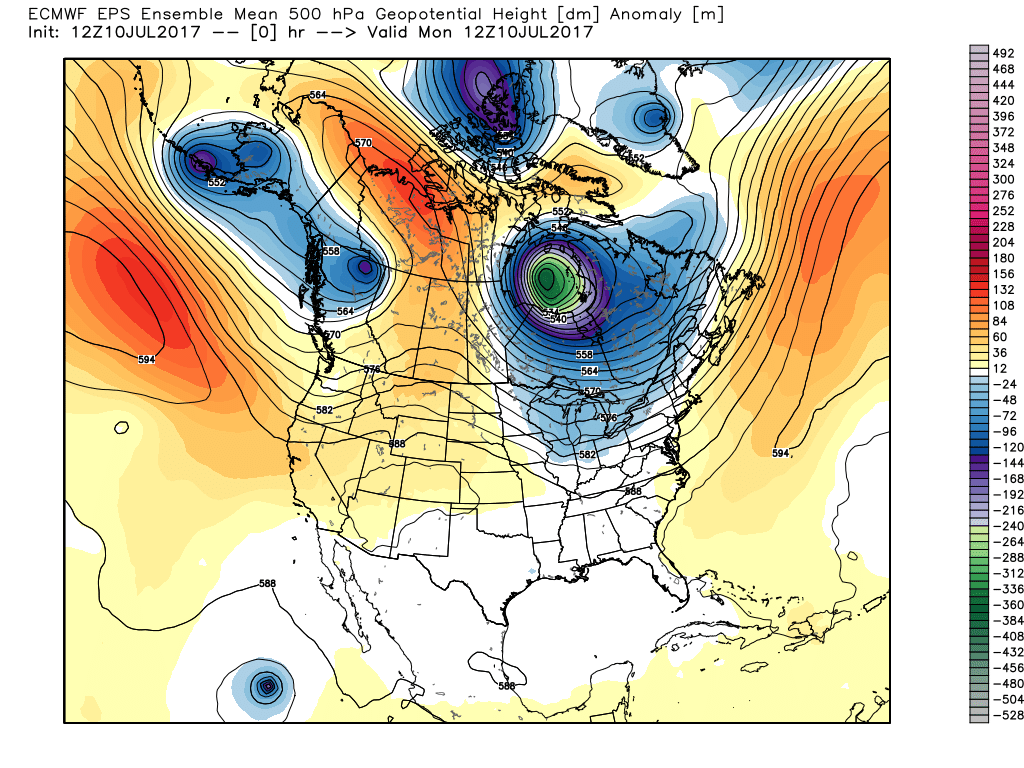
A deep low around Hudson Bay will keep things active in New England for the foreseeable future
Last week? Near perfection until the Friday deluge. This week looks to feature the opposite with Monday being the only quiet/dry day and the rest featuring rain chances in some shape or form. The whole pattern is being driven by a deep area of low pressure around Hudson Bay in Canada that's swinging multiple disturbances around it. it's a pretty classic unsettled setup for us here in New England during summertime. Some days look more active than others, and some are much warmer than others...so let's dig in to how things should play out over the next 5-7 days.
Monday Night/Tuesday:
First up - we're tracking a decaying MCS (Mesocscale Convective System) that will be heading our way from New York State Monday night into Tuesday morning. These are typical of the warm season and we likely won't end up getting severe weather out of it. But there is a good chance of heavy downpours early Tuesday morning, especially from the Boston area northward. A little disturbance in the upper atmosphere is helping these move along and the air will be getting more humid overnight. So any showers/downpours could feature some very heavy rainfall.
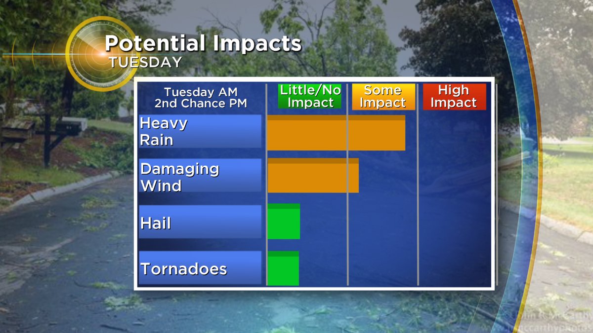
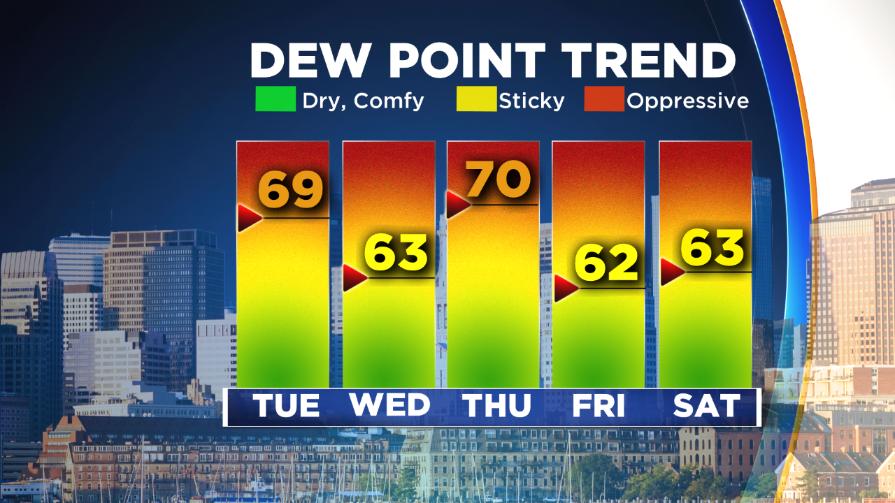
There's a round 2 element to Tuesday's forecast as well. Once the morning clouds and rain break up and move out, some sunshine should boost temperatures into the 80s with dew points in the upper 60s. While the best upper-level support will have exited the area by Tuesday afternoon, there should still be enough instability to get a round of showers and storms to pop up from early afternoon through the early evening. Again, the main risks would be locally torrential rainfall and we could also end up seeing a few damaging wind gusts.
Wednesday:
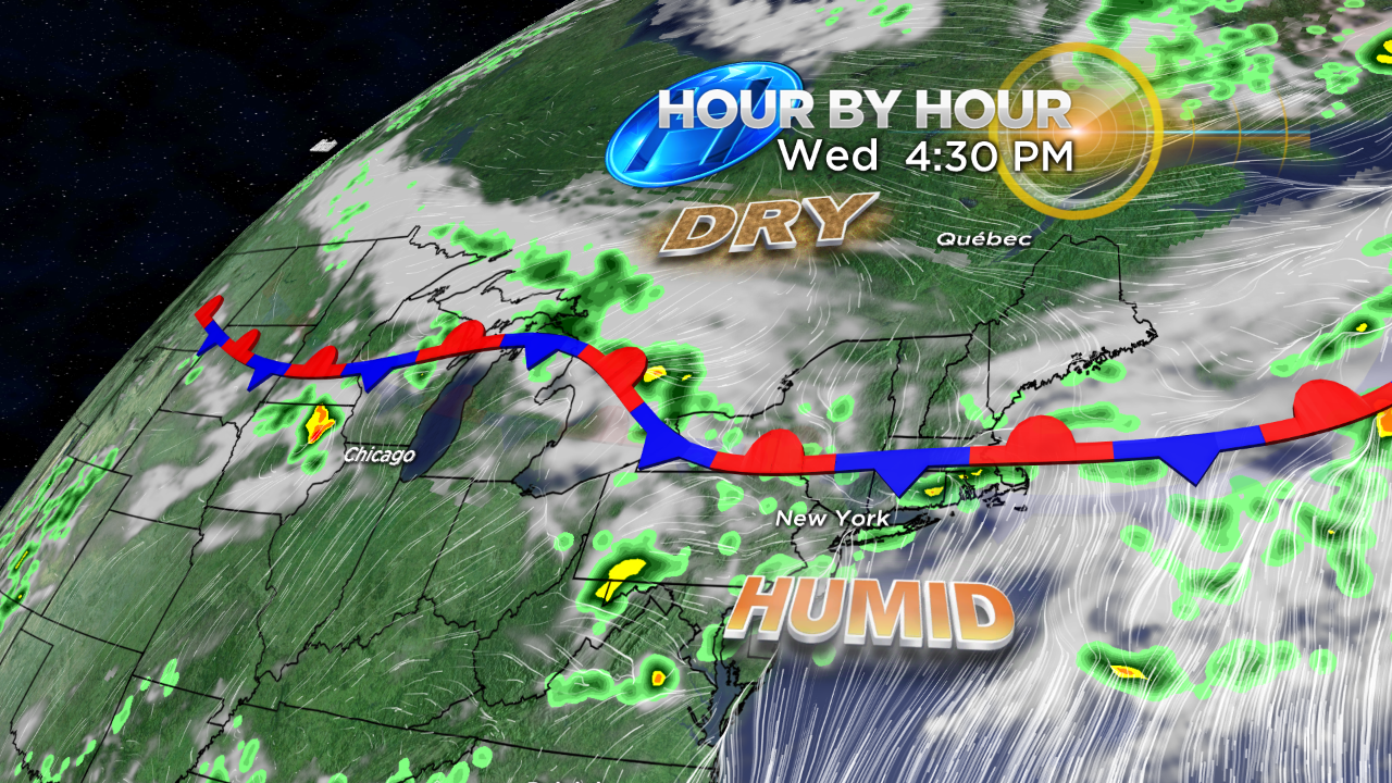
The boundary that comes through Tuesday evening/night will likely stall out on Wednesday, and where exactly it stalls will have a dramatic impact on our mid-week weather. Right now, it looks like the best odds of its placement are around the South Coast. That would keep more cloud cover and some shower/storm chances in the forecast, especially for towns south of the Pike. Drier air should be able to make some inroads north of the Pike, especially toward New Hampshire and Vermont, offering a break from humid conditions. So long as the front gets far enough south and we receive enough sunshine, highs should reach the 80s except 70s along the South Coast and Cape/Islands.
Thursday:
This is the trickiest day of the whole week. The Wednesday front will briefly be moving north again as a warm front, which brings two things into play. First off, we may see another MCS ride down along it Wednesday night into Thursday morning with a round of downpours/thunder. We then have a brief window of warm and humid air to start Thursday with the front lifting north, but then it will crash south yet again during the day with another chance of showers and storms. The timing of this crash will bring a major 'bust potential' to the temperature forecast. If it comes through in the morning, we'll never make it much above 70 degrees. If it comes through in the afternoon, it'll bring a stronger storm risk and a chance to reach into the 80s before turning sharply cooler in the evening. I'd assume there will be updates to the timing over the next couple of days. As it stands, I think we can briefly top 80 before the crash to cooler air and northerly winds, especially for towns south of the Pike.
Friday:
What's up with Fridays lately? Right now, it's not looking very summer-like. Onshore flow should keep temps in the 60s to low 70s! Not only that, but rounds of showers may come along with that cool air. We'll still be watching the same pesky front that will be just off to our south. If it's close to us, it's a wet and chilly summer day. If it can manage to push far enough south then it'll still be cool but at least it would be dry. So it's another day where you can't really bank on the forecast 4 days out because there are likely to be some changes.
There is at least a payoff to all this back and forth. It looks like we should be able to dry out for Saturday to kick off the weekend, though it'll still be on the cool side (70s) with more onshore flow. Then on Sunday we'll be able to get back into the 80s with a chance of some afternoon storms but nothing approaching washout status. So stay tuned for all the updates as we jog back and forth with this front all week and adjust the temperature/rain forecasts when/if necessary.