A Long January Thaw Comes To An End...Will Snow Follow?
Find Eric Fisher on Twitter and Facebook
It's now been a week (and counting) since Boston has managed to hit the freezing mark. A long thaw during an extremely mild month has left Boston Marathon trainers happy and skiers lamenting December's promise. However, a pattern shift is around the corner! Winter air will return to the eastern U.S. starting Friday, but the big question is will any snow come along for the ride? Let's take a look at how January will stack up against the record books and what is laid out ahead of us for February.
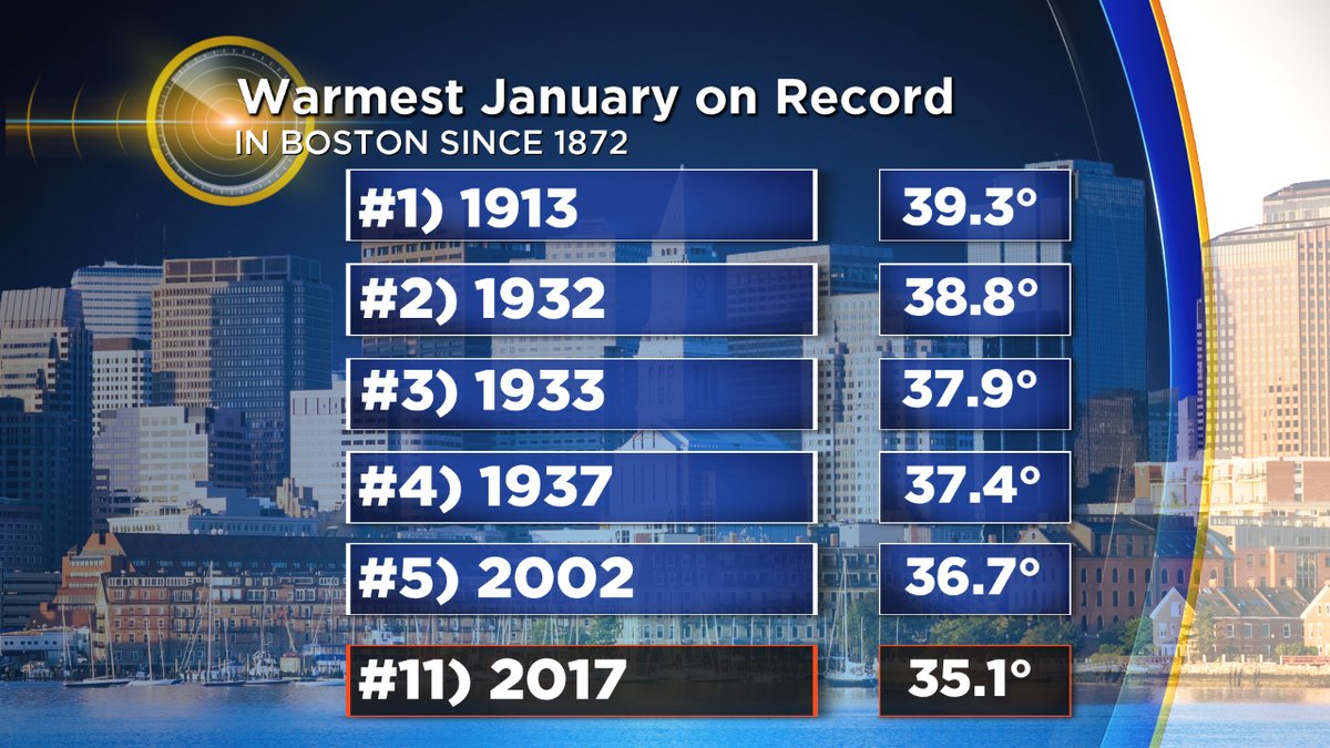
There's an interesting climate-oddity when you look back at the January record books. The top 4 warmest January's in Boston are all before 1940. This isn't the case in any other month of the year. As you'd imagine with a warming climate, all other months on the calendar have recent years in the Top 3 warmest. Nearly all have 1 or 2 of the top spots occurring in the past decade. Why is this the case? I honestly don't know. It's not related to the observation point, because the story is the same at the consistent Blue Hill Observatory in Milton (Top 3 warmest January's are 1913, 1932, and 1937). And we won't be cracking the Top 3 this year, either. Currently, the warmth this January lands us at the #11 spot. A top 10 finish is possible, but not top 5. Any way you slice it, it's still a mild month and few of us have any snow to speak of on the ground.
![]()
How about snowfall....where do we stand there? You may be surprised to hear it's been a pretty typical winter-to-date across the region for snow. Most are right on pace for average snowfall to date, with the immediate Boston area slightly below. Nothing too out of the ordinary though. In fact, we have more snow in Boston through this point in the season than we did in the record-setting 2014-15 winter (though our first blizzard began around midnight on January 27th).
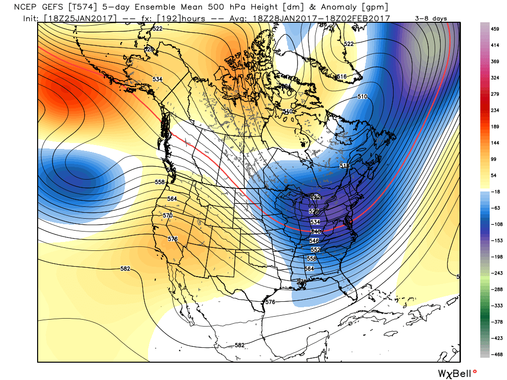
Ridging in the west and troughing in the east will close out January and ring in the new month of February. Source: Weatherbell
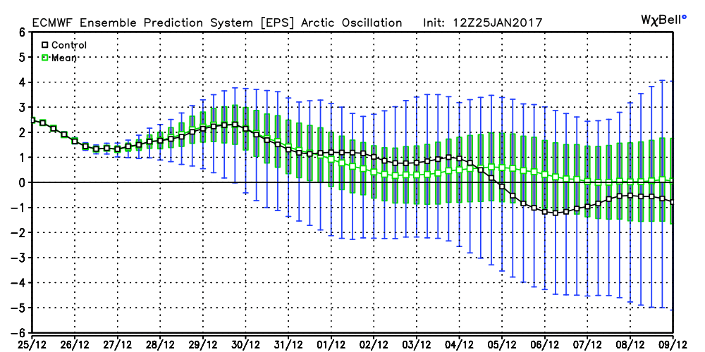
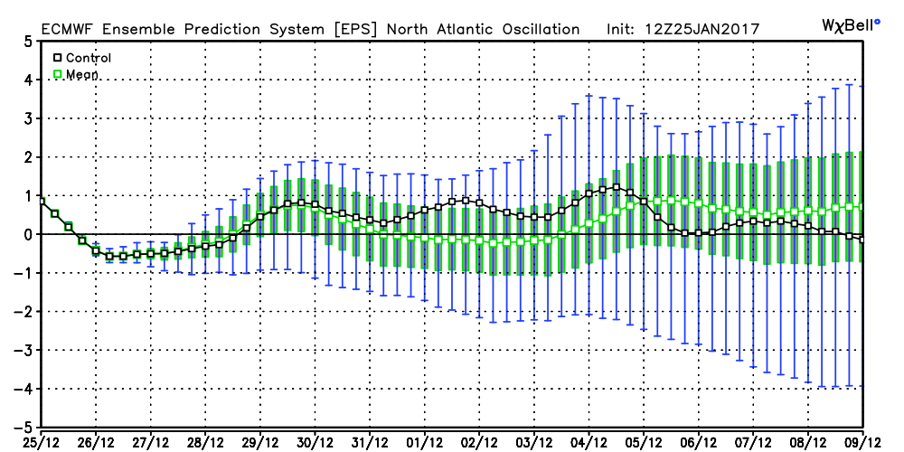
Which brings us to the question of what comes next? Answer: a trough! The jet stream is about to carve out a dip across the eastern U.S., and this is a setup that's expected to hold, more or less, well into February. Colder air will be allowed to come down out of Canada, and we'll return to seasonal norms. Right now it doesn't look like anything overly harsh for us...more your typical early February fare. After this initial cold shot, a period of moderating temps should follow, and then another blast of colder air. All in all, the pattern doesn't favor sustained deep cold. The Arctic Oscillation, AO, is expected to remain positive/neutral and there is very little North Atlantic blocking. With those variables on the table, I wouldn't bank on much frigid arctic air. We'll likely end up with temps close to average for the month in Boston.
Will it translate into snow? That's a bigger question. Snowfall always comes down to timing of disturbances, where a few miles or a few hours can make a huge difference. To start with, at least we'll get some snow into the mountains Friday through Sunday. A broad cyclonic flow with a couple of embedded disturbances will bring snow showers/squalls to the Berkshires and higher elevations of Vermont (and to a lesser extent New Hampshire) this weekend. A nice boost for ski areas after this long mild spell, with colder temperatures aiding in snow making ability.
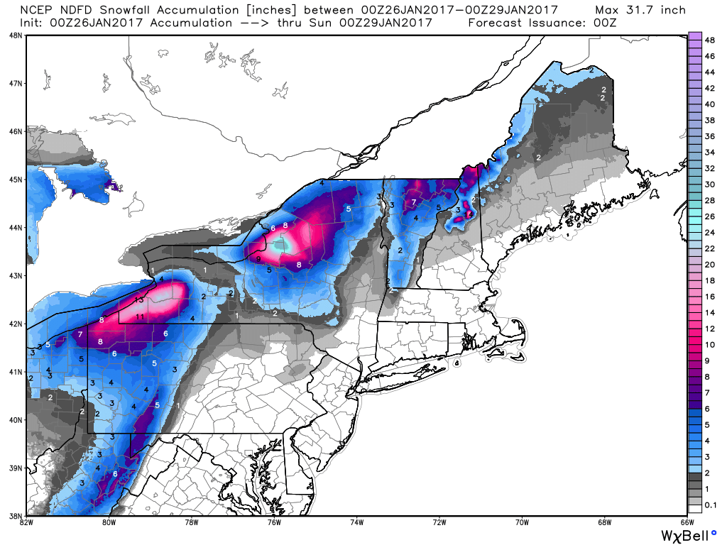
Snowfall through Saturday evening (NWS forecast). There should be some locally higher totals in the Greens, particularly western facing slopes.
After that, I'm eyeing some energy that will approach toward the middle of next week. This one could still pull up to our west and put us on the mild side, or it could head a little farther south and deliver a clipper to southern New England. I like the look of the ridging across the Rockies, and although models are not really putting it all together just yet, I wouldn't be surprised if this trended snowier for us toward mid-week. Something worthy of keeping an eye on.
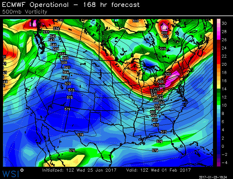
Will this system pull up to our west, slide to our south and provide a light to moderate snow, or dig in deeper and give us a decent little storm? It's worthy of watching as we get closer (looking at the Tuesday night into Wednesday time frame). Source: WSI Energycast
As we head deeper into the month, the pattern looks good but not great for snow chances.The best cold should end up being corralled across Canada, but that's not necessarily a bad thing. Too much driving cold air from the NW can suppress storms away from us. I'd focus on the time frame between February 6th and February 21st for a decent chance of winter storms. We're in 'make or break' time for our winter outlook. February can giveth or taketh away. But I definitely like our odds for snow in February a lot more than January. Just don't expect the insane snow blitz from a couple years ago!