Polar Vortex & A Frigid February
Find Eric Fisher on Twitter & Facebook
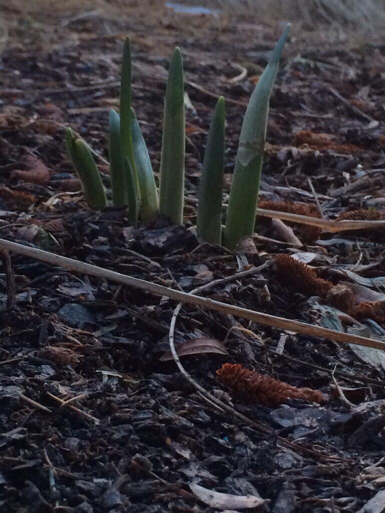
Sent from a viewer in Duxbury...the snow is gone and spring is desperately attempting to get on with its business, forecast be damned!
Well at least we got a *little* break. The weekend was downright glorious compared to much of our winter, with the first back-to-back days in the 50s since a mid-January thaw. So if you were up on a ski slope or walking around town, it was hard not to smile. But if you're not all about winter, this week's forecast may have forced you to throw up a grim facade once more. I look at spring like I do football when your O Line is having issues with crowd noise. False start, another false start. Aggravating at times, just wanting to move forward. Spring in New England has numerous 'false starts' where we briefly warm up only to plummet back down into colder times. Such is the rollercoaster of life and weather in this corner of the country!
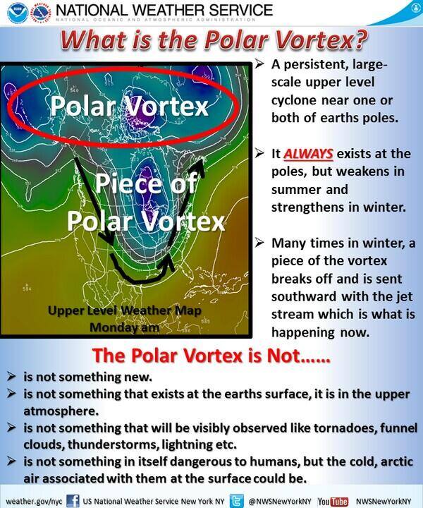
A nice infographic from @NWSNewYork on the fact/fiction of the Polar Vortex
So what's the cause of all this? The polar vortex? Well let's start out with what the polar vortex actually is. It's not a storm system blasting down from Canada. It's not even at the surface. You can't see it, and you can't measure it on the ground. But it can help steer cold weather into different parts of the globe.

The polar vortex is a circulation at high altitude, tens of thousands of feet up in the atmosphere. Above I use the 70mb level to help show this circulation, and where its forecast position is by Thursday of this week. This strong circulation *always* exists, and there's one for each pole. It gets weaker during the summer and stronger during the winter, and helps to 'fence in' some of the most brutally cold arctic air. But it's not always a perfect circle around the pole. Far from it! As it moves around the hemisphere it undulates, creating dips and ridges in the overall structure of it. If it heads south into your corner of the globe, you can usually plan on it to start feeling a whole lot colder.
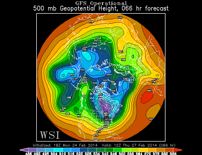
500mb Geopotential heights for Thursday this week. Note how there are numerous 'lobes' of lower heights, but the one north of the U.S. is by far the most pronounced. Source: WSI Energycast
This week, one of these lobes, which can be called Rossby Waves, will dip deep down into Canada. So the source of brutally cold air will be that much closer to the U.S. and easier to tap. Particularly with a ridge over the West Coast and an old cyclone center (same storm that brought severe weather across the country last week) continuing to spin around Hudson Bay, driving packets of energy and cold air around it. So the bottom line is that it's not quite right to say 'the polar vortex is at it again in Ohio' or 'another polar vortex' (since there's only 1 at each pole and it's always there). While it's a fun weather term that's gained a lot of traction this winter due to the extreme cold, it's also had a fair share of misuse.
Close, but not quite.
When all is said and done, the impact on the ground will definitely be felt in the form of temperatures 10 to as much as 40º below average from eastern Montana to the Midwest, the Northeast, and most of the Southeast. That's a whole lot of shivering Americans. The last bastions of warmth will be South Florida and the Southwest - the only spots with above average temperatures. Although, you could also visit Alaska and enjoy their above-average warmth. It just won't feel quite as nice as the 70s and 80s elsewhere :-)

GEFS surface temperature anomaly forecast out through March 12. Source: WeatherBell & NCEP
The really nasty part of this setup is the persistence of it. Most of these locations are the same spots that have already endured an awful winter, the coldest in decades for many cities. So there are a whole lot of folks wishing for an early spring, and whom are not going to get it. Above is a look at the GEFS (ensemble GFS) forecast temperatures anomalies at the ground level through mid-March. Notice the cold in the east and warmth in the southwest? Barely budges. There is so little about this pattern that is expected to change that you can basically just go with a 'whatcha have is whatcha get' forecast. The ECMWF is in very good agreement with this....with little to no change expected through at least mid-March. There are signs it may break down a bit after that, fingers crossed!
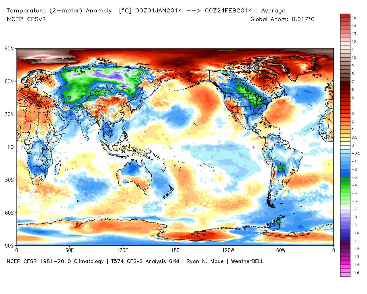
Year-to-date surface temperature anomalies. U.S. sticks out for cold, pole for 'warmth.' Source: WeatherBell
While all this has been going on in the U.S., temperatures have been well above average around the Pole (the freezer door has basically been left open for a very long time). Now keep in mind even temperatures way above average near the North Pole are still extremely cold, and cold enough to freeze. But the above-average 'warmth' and strong winds emptying out all that cold have done a number on Arctic sea ice. It actually was at a record low for mid-February after showing some signs of rebounding back in the fall/early winter.
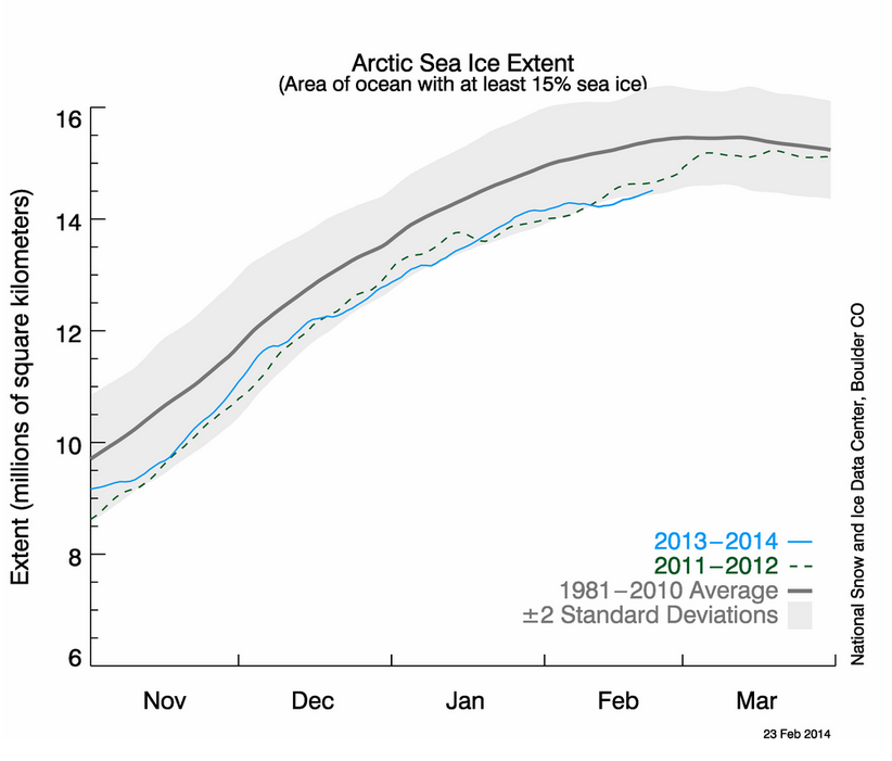
Current Arctic Sea Ice Extent. Source: National Snow and Ice Data Center
Alright so that's the latest on all the cold and overall pattern, here are the daily details....
Tuesday: Another weak disturbance will bring some afternoon cloudiness and a few flurries, especially for the higher terrain. Overall just a cold and blustery day with highs in the 20s.
Wednesday: All signs have, for a change, pointed toward a more OTS (out to sea) scenario for an ocean storm. It should come close enough to bring clouds and some light snow, but all models are suggesting that phasing will not happen for this one. We may pick up 1-3" of fluffy snow across SE Mass with a coating to an inch or so for the interior, but we'll keep an eye on it of course in case things change. Most of the moisture source looks to stay well offshore. It'll be very cold for this one, so snow all the way to Nantucket with actual highs in the 20s.
Thursday: Another fast-moving vorticity maximum swings across the Great Lakes and toward us, bringing clouds and some snow showers/squalls. It also brings the coldest shot of air of all of them in our forecast, arriving Thursday night into Friday.
Friday: Brutally cold by the final day of February standards! 850mb temps may go all the way down to -22ºC, leading to surface temps in the 10s/20s. The record 'low max' for Boston on Friday is 19º set in 1875, and we'll be in the ballpark! Add in the wind and it'll feel as cold as any mid-winter day we've seen.
Saturday: Yet another impulse moves in from the west, bringing more potential snow showers. This may become something more, but for the moment doesn't look big. You guessed it- cold again.
Sunday into Monday: This is the time frame we'll watch for the next potentially significant storm. One will be gathering to our southwest across the Mississippi Valley, and will have more moisture to work with. Timing is still a ? but looks to start moving in sometime between Sunday evening and Monday morning.
And if you don't like any of this stuff, think spring! Here are some more 'uplifting' things to look forward to.