"Eye on Weather: A Winter Preview" Premieres Tonight
Ocean effect clouds and flurries have developed from Cape Ann to the South Shore and Cape Cod this morning…and will drop a coating in a few communities before coming to a close this afternoon. Otherwise, expect gradually increasing clouds from west to east through the day and highs only in the 30s once again. Tomorrow won't be as cold…highs will top out in the 40s under mostly cloudy skies. A disturbance approaching from the south, and another from the west will bring the risk of scattered showers tomorrow…but not everyone will see one and it won't ruin your day.
The start of next week features unsettled weather as a cold front washes out over us. In turn, cloudy skies will be the rule along with some scattered flurries and sprinkles with an increasing onshore wind. We're keeping a close eye on Tuesday as a strengthening storm off the Carolina coastline moves north. The bulk of the storm will stay out over the ocean…but it will likely come close enough to give us a glancing blow. Expect scattered rain showers (potentially mixed with snow across the far interior) and an increasing northeast wind. Behind this system, a warming trend is likely for the end of the week with relatively quiet weather.
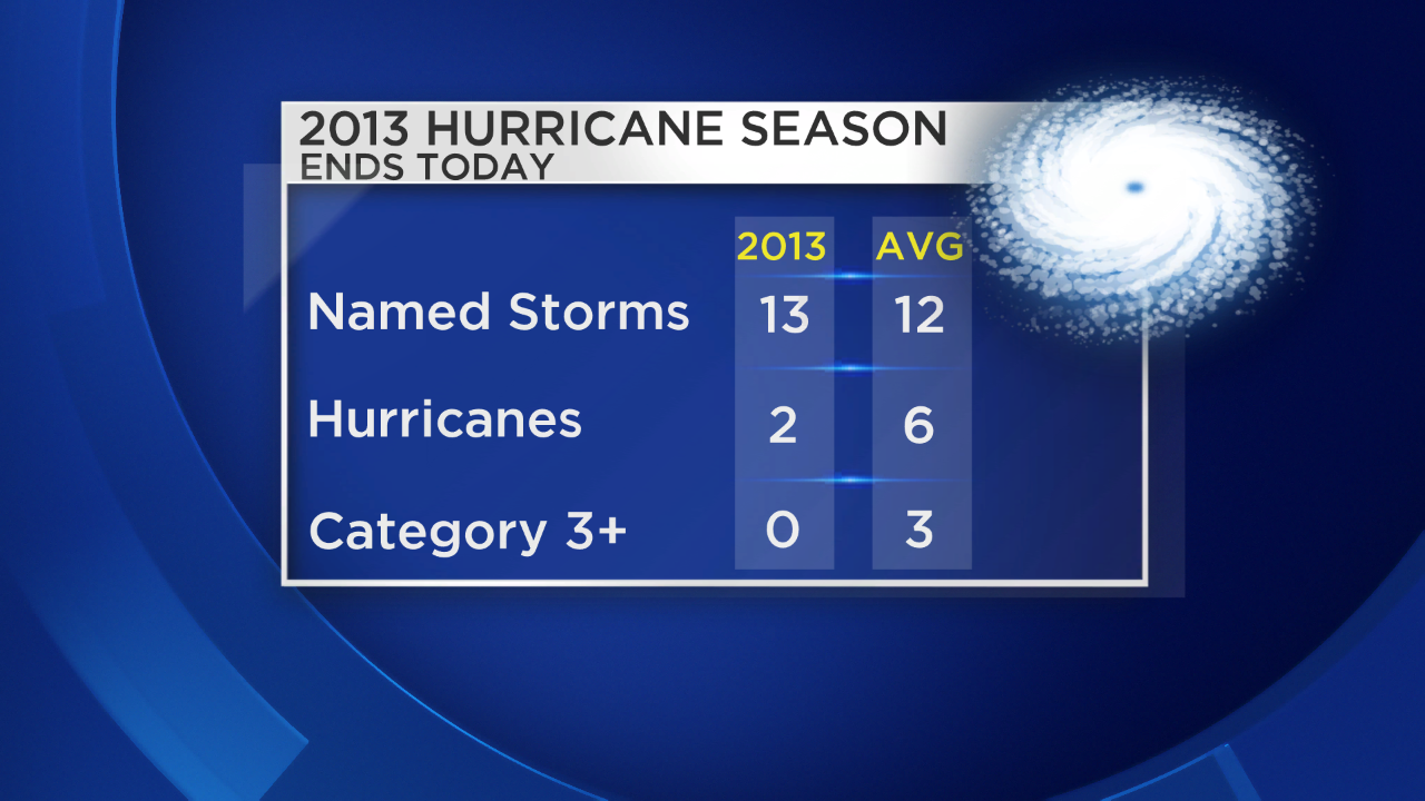
Speaking of quiet…how about this hurricane season?? It comes to an end today and here's where we stand compared to climatology. Despite a near normal number of named storms, thankfully, there were only 2 hurricanes and neither became major (Cat 3+).
We can also say goodbye to meteorological fall…we flip the page to December tomorrow! The question is…what does this winter hold for us? Join the entire WBZ Accuweather Team tonight at 7:30 PM for our half hour special, "Eye On Weather: A Winter Preview". You can also join us online for a live chat between 7:30 and 8:30 PM!
-Danielle