As July Ends... No Heat in Sight
It has been a hot month no doubt. For Providence and Hartford, their hottest July on record. Considering July is usually the hottest part of the summer, that is really impressive and shows you the extent of the warmth we just lived through. Boston had 12 days at or above 90, but a sea breeze tomorrow may prevent Boston from having a top 5 warm July. But that is all behind us now thankfully and now we can just enjoy the weather which has become so gentle and refreshing.
High pressure is sitting to the west of New England this evening and wrapping in light NW flow. Temps will be dropping into the 50's overnight in many suburbs. So open the windows, give the AC's and fans a rest and let the cool air settle into your home. Today was so nice we will do it twice! Wednesday looks like another sparkling day with light west winds and highs around 80-85 degrees. Winds will likely turn onshore during the afternoon to keep many beaches in the 70's. Dewpoints will remain at very comfortable levels as the high slides offshore and off the coast.
By Thursday, the high will still remain close enough that we will still be able to squeeze in a mostly dry day. Partly sunny skies with SE winds at the surface, where highs will still hover around 80-85 degrees especially inland. A deepening trough over the Great Lakes will help to spin a piece of energy from the Midwest to the mid-Atlantic and up into New England in the form of showers and thunderstorms, but these will mostly wait for the end of the day to push into the region...mainly at night. Showers Thursday night are likely which could linger into early Friday. Skies will begin to brighten by Friday afternoon, but another shortwave pushing through in the upper flow could trigger another brief shower or thunderstorm later in the day.
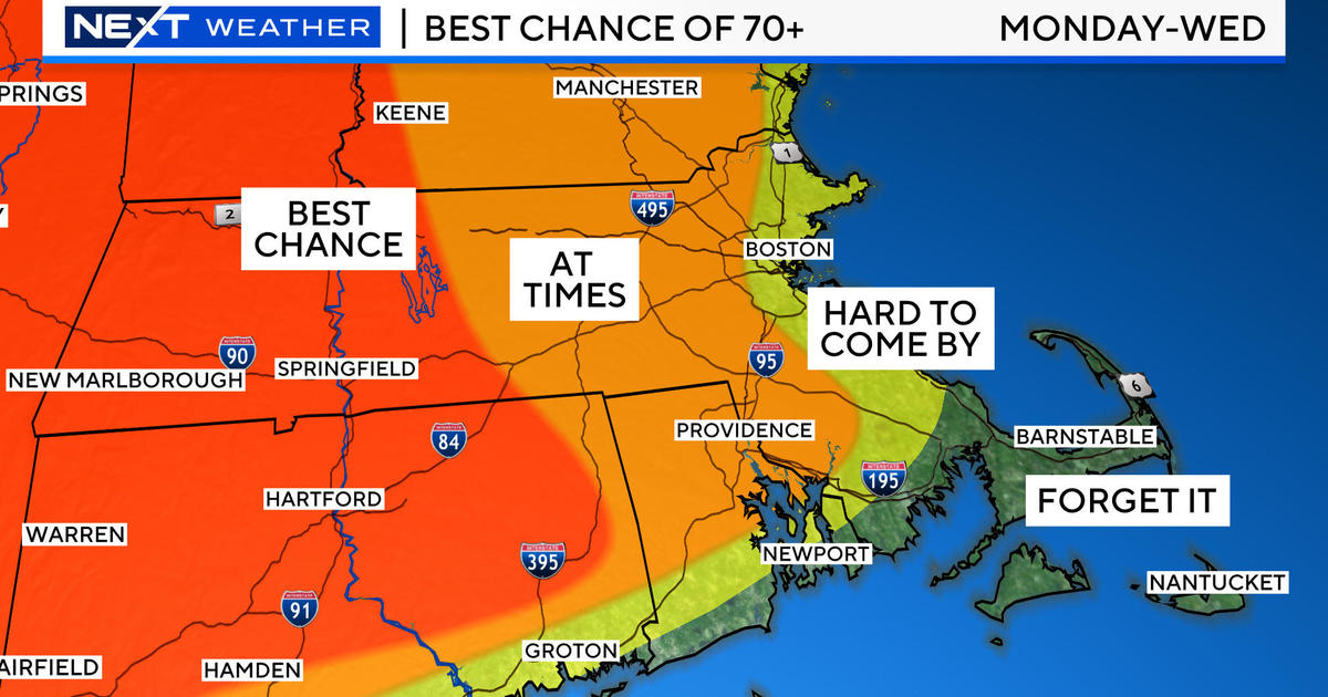
An upper level trough will sit over this weekend and into next week. This will make for seasonal temps or slightly below normal feel to the air. It will come with cooler air aloft, for some daytime cumulus to form. Any shortwave rounding the base of a trough into New England could trigger a brief pop up shower or T'storm. Most of the weekend will be dry with pleasant dry humidity with temps in the 70's and Lwr 80's. Even cooler air will be steered into the Northeast for next week keeping temps in the 70's! What a way to kick off August!
This upper level trough means business. It is part of a wholesale pattern change. Our weather will be directly influenced by the polar Jetstream and a polar vortex sitting over Hudson bay in Canada. This large upper level vortex will spin reinforcing shots of cooler air into the eastern half of the nation for much of the first half of August with a persistent upper level trough in place. This will help to keep temps on the cooler side for the first 2 weeks of August and keep away any bad humidity. Eventually, this summer will just run out of time to heat up again as this summer continues to fly by. Someone put on the brakes!


