Cold Start, Mild Finish This Weekend
Cold High pressure behind a departing front is steering in the coldest air of the early cold season tonight through early Saturday with light NW winds. A widespread killing freeze is likely overnight with many areas spending a few hours in the 20's around dawn Saturday. After a frosty cold and clear start, Saturday will be filled with sunshine with highs around 50-55. Temps running below normal, but light winds in the sunshine will make for a very nice afternoon...despite the unseasonal chill in the air. High clouds will begin to increase in the afternoon hours.
These clouds are in advance of a warm front, the leading edge of warmer air which will start to push back into the Northeast. Skies will become mostly cloudy with a few showers developing along this front pushing into Northern and western New England late Saturday night . Low pressure will be tracking into the Great Lakes steering warmer SW winds towards the Northeast.
Sunday morning will start with clouds and a few showers...especially in Northern New England. After a cloudy damp start, clouds will begin to break from midday into the afternoon in SNE as the warm front lifts northward. SW winds and some partial sunshine will allow temps to climb into the 60's. It will be cooler across the north with cloudy skies and a few lingering showers thanks the warm front stuck over them.
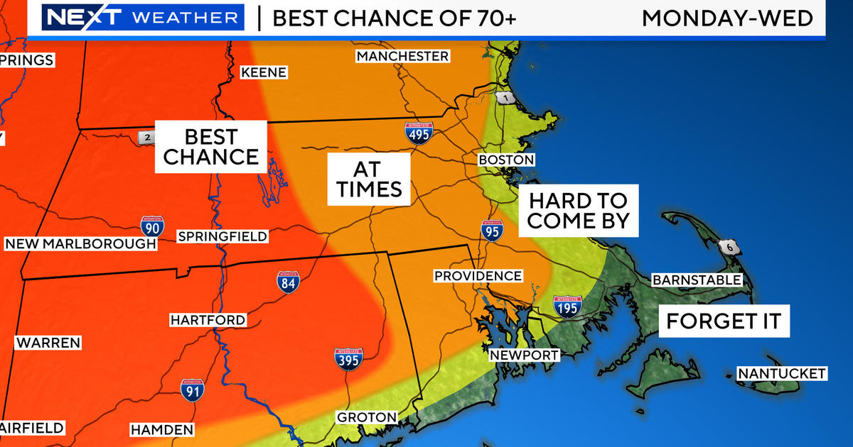
SW winds will be picking up Sunday through Monday ahead of an approaching cold front which will push through Monday Night and early Tuesday. Monday will se a bit of sunshine with increasing cloudiness. Temps will warm to 70-75 degrees with winds blowing over 20 mph. Scattered showers will push through late in the day...but mostly night and early Tuesday morning.
Behind this front, is nothing unusually cold or warm. High pressure follows in for the midweek with fair weather, light onshore wind with temps in the Lwr-mid 60's with a cool flow at the coast. A deep upper low will barrel in towards the Great Lakes on Thursday. This will likely help to spin in some showers and unsettled weather our way by next weekend. I do not think will have any threat for snow in our northern mountains from that disturbance this time around. But the time has come...and our chances become greater for accumulating snowfall with each passing day.


