Heavy, Wind-Swept Rain Tuesday Could Make For Messy Travel
BOSTON (CBS) -- Boston managed to hit 70 plus degrees at least three times last week (the first 70 degree days of the year)! After a weekend with some ups and downs, the weather was smooth sailing for Marathon Monday.
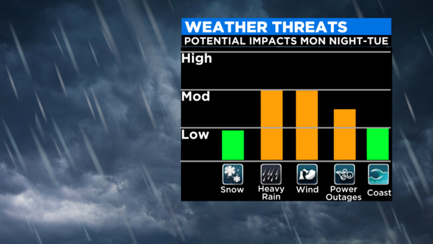
However, if you have travel plans Tuesday, you may want to hold off if you can. Our next weather system is bringing everything including heavy rain, elevation snow, strong winds and the potential of some minor coastal flooding.
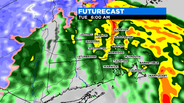
Monday was dry and really fantastic for the marathon. Showers developed north and west of the area after 10 p.m. Monday with steady precipitation moving into the area around midnight.
In most areas, it will be a heavy, wind-swept rain on Tuesday. However, across the higher terrain through central and western MA into VT and NH, snow is possible. Heavy rain will continue through the early morning commute, before tapering to showers by midday. By the evening, just an isolated shower or two is possible.
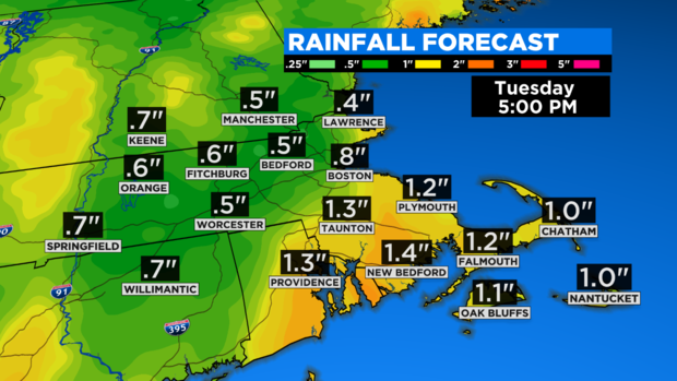
Rainfall amounts will range from about .5" to 1.5" of rain, with the highest totals across southeast MA. Some minor snow totals are possible above 1000 feet as this storm system moves in overnight. If there is a shift in the track, snowfall amounts may have to be adjusted. Patchy coatings to 1" are possible over northern and western MA, with 1-3" across parts of the Berkshires into NH. Higher terrain will likely see higher amounts of 3-6".
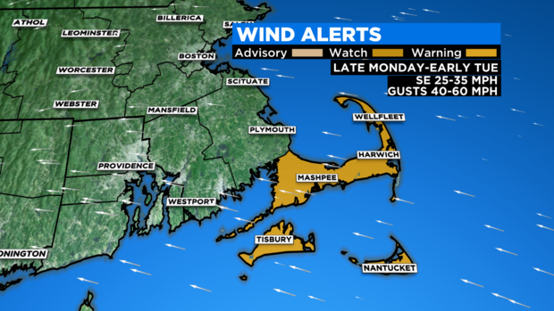
A High Wind Watch is in effect for Barnstable, Dukes, and Nantucket counties from late Monday until early Tuesday morning. Southeast winds will range from 25 to 35 mph, but could gust as high as 50 to 60 mph, with the strongest wind gusts possible along the coast. The peak of the wind gusts are expected between 2 and 8 a.m. Tuesday. Inland areas can expect gusts up to 40 mph. Scattered tree damage and power outages are possible. As the storm departs, winds will shift and gust up to 35 mph in the afternoon.
There may be minor coastal flooding or splash over along the eastern MA shoreline roads around and just after the early Tuesday high tide (1-2 AM). The highest risk of any coastal flooding would be for Boston Harbor and the North Shore. A greater coastal flooding risk is possible if the peak surge occurs closer to the time of high tide.
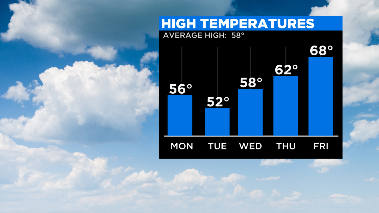
I expect travel delays on Tuesday, but as this system moves out, generally dry and milder weather returns to finish off the week. Continue to stay with WBZ as we'll be updating information as new data arrives ahead of the storm.