Storm Bringing Heavy Rain, Ice To Some Areas
BOSTON (CBS) - Winter is down but not out. The days are rapidly getting longer, the sun angle is increasing, and signs of spring are popping out all over. From ants crawling across the deck, to magnolia buds bursting, it sure seems as though Mother Nature is ready to turn the page.
But alas, spring in New England isn't all that simple. Inevitably, there are some bumps in the road.
The National Weather Service has issued a Winter Weather Advisory for most of Worcester County, northwestern Middlesex County and the Berkshires through noon Thursday.
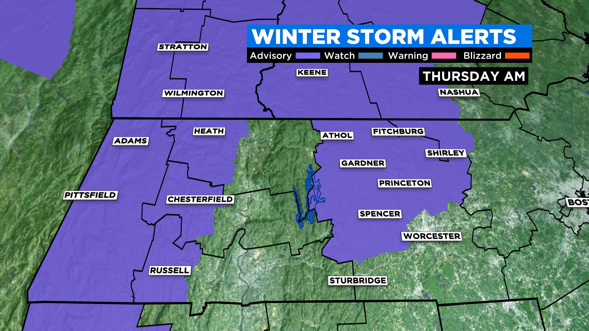
This is in anticipation of some light sleet and freezing rain at the beginning of our next storm system. The areas highlighted in the advisory are the typical spots where we tend to have precipitation-type issues very early and late in the winter season.
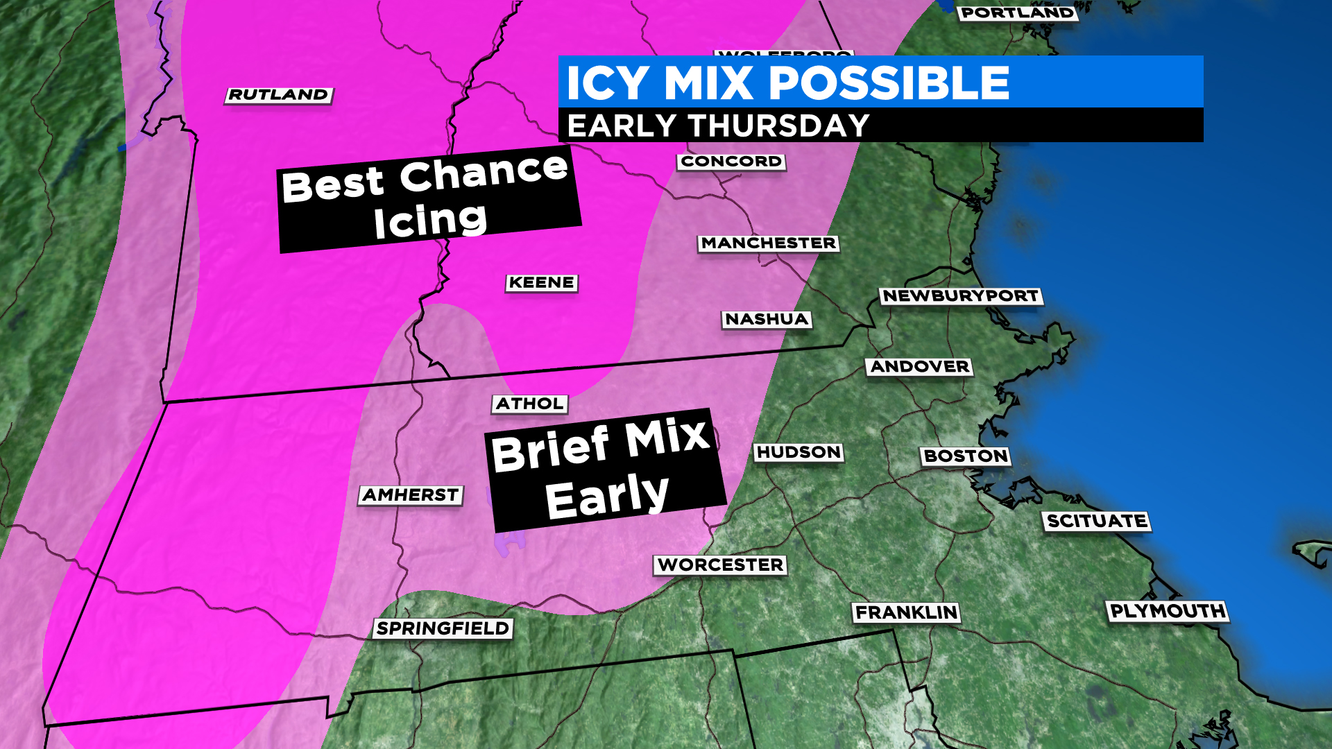
The main concern is for those living in areas around or above 1,000 feet in elevation. For the remainder of the area, this will be an all rain event.
TIMELINE:
During Thursday morning the rain area will fill in and become heavy across most of southern New England. Thursday is essentially a washout. Expect about an inch of total rainfall, perhaps with some areas getting as much as 1.5 to 2 inches. The icing will be low impact and, as temperatures warm during Thursday morning, even the highest elevations in southern New England will transition to a plain rain.
There will be a second wave of rain late Thursday into early Friday. There is no icing concern with this batch of rain and it will taper off in the hours before dawn on Friday. Friday will likely turn out to be the pick of the week with sunshine emerging and temperatures climbing to near 60 in the afternoon.
WHAT'S NEXT:
New England will remain in an unsettled pattern through the weekend. While neither Saturday nor Sunday will be a washout, both days will likely see increasing clouds in the afternoon with a chance of scattered showers. Temperatures will be seasonal, likely in the upper 40's and low 50's.
Early next week, we get yet another Arctic shot of air. Highs on Monday will be stuck in the 30s and lows by Tuesday morning will drop into the teens in most locations. This is awfully cold air for late March and could lead to some damage to early blooming, tender plants.
Forecast got you down? I will leave you with a look on the bright side. We are now in a stretch of nearly six months with sunsets later than 7 p.m.!


