Up To 3 Inches Of Snow Possible For Much Of Massachusetts
BOSTON (CBS) - Here we go again. Like a never-ending series of bad movies sequels, the snow is about to "strike back." Just about every time we get a surge of warmth and another snowpack "extinction," within 24-48 hours another round of snow arrives. Old Man Winter has been knocked down (again), but not out!
Spring snow is a different animal than mid-winter snow. Yes, I realize that by the calendar it isn't officially spring yet, but meteorologically speaking, spring is here. The sun angle right now is equal to that of early October. Thus, any snow that falls during the daylight hours is going to have a very difficult time accumulating, especially on the roads. Another factor on Wednesday, it isn't going to be all that cold. Temperatures during the day will be mainly between 32-36 degrees. This time of year, with temperatures that "mild" there is really only one way to get snow to accumulate - it has to come down hard. It looks like the most intense snow rates on Wednesday will occur at the beginning of the event, in the early to mid-afternoon. So, it will be a battle between the snow rates and the sun angle/temperatures. I think we will see white roads under the most intense snow areas, but not everywhere.
Another big factor in early and late season snowfall is elevation. The Worcester Hills and Berkshires often end up with the highest snow totals in these events simply because temperatures are a few degrees colder given their elevation. It may be 34-36 degrees in the coastal plain and 30-33 degrees several hundred feet up. Some hilly towns might see a few inches difference just a few miles away.
WEDNESDAY TIMELINE:
Afternoon: The snow overspreads the entire area. The intensity ramped up by 2 p.m. and some of our most intense snowfall comes by 6 p.m. Again, under the most intense bands, some accumulation is likely on roads. In the lighter areas, much of the daytime snow will either melt on contact or just slowly accumulate on the grass.
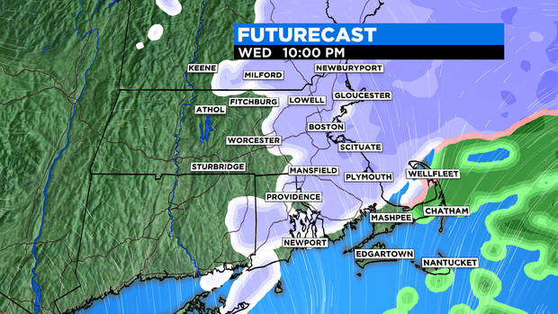
6 p.m. - Midnight: With the loss of daylight, and temperatures dropping a few degrees, the snow (typically) will stick a bit more readily. However, the intensity will be waning after 6 p.m. The best dynamics will be leaving our area and the snow will become lighter and spottier as the night wears on. So, there will likely be some additional (light) accumulation, especially between 6 and 8 p.m. Between 8 p.m. and midnight, the snow gradually tapers off from west to east, with just a few flurries left near the coast at the end.
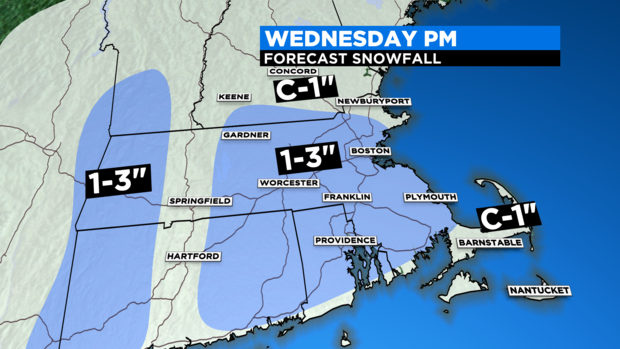
HOW MUCH:
We are expecting a general coating to 3 inches for most of southern New England. Best chance of 3 inches would be in the higher elevation of Worcester County and the Berkshires. It is also more likely that the higher end totals would be on the grass and not pavement.
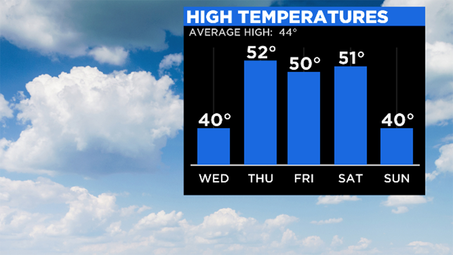
If you are compelled to shovel, I would wait until later Wednesday night or Thursday morning. Honestly, if you can do so safely, I might just leave it. Temperatures will be in the 50s on Thursday and Friday and the snow will once again be quickly vaporized.
Follow Terry on Twitter @TerryWBZ