Parts Of Massachusetts Hit With A Foot Of Snow Friday; Arctic Blast Coming Next Week
BOSTON (CBS) -- Classic New England.
We haven't been able to buy a snowflake this season. We were approaching records for latest first inch of total snow and latest first inch from a single storm. And then, just like that. . . Boom. The single biggest snowstorm in Boston since December of 2020. As of Thursday, Boston had 0.4" for the 2021-2022 season, nearly a foot below the average to date. 24 hours and 11.2" later, Boston sits at 11.6" for the season, less than an inch away from average.

11.2" from Friday's storm is easily our biggest storm of 2021 and 2022. You have to go back to the December 16-17 storm of 2020 (12.7") for our last storm of this size. Friday's snow in Boston was also enough to make this January the snowiest in 4 years (and to think we have more than 3 weeks to go)! We haven't had this much snow in January in Boston since 2018 when we totaled 17.8." Strange when you consider that the city averages just over 14" in January, but we have had some lean years.
Who Has The Most? Check The Snow Totals List
Oddly enough, Boston is actually now outpacing Worcester this season. At last check Worcester had just 6.2" on Friday, bringing their season snow total to a measly 10.0." Don't worry Worcester, you'll get your swagger back, it is just a matter of time.
Friday's storm was all about that band, that band, that band (anyone get my reference here "All About That Bass"). We sort of knew that there would be some heavier banding and that is why we had higher amounts (4-8") in and around Boston in our forecast. What we didn't see, and what the models also failed to predict, was just how juicy that band would be. We had just about a perfect setup unfold early on Friday with aggressive lifting in the atmosphere right in the crucial and best snowmaking zone. What resulted was big ol' fat dendrites, the best type of snowflake for quick accumulation.
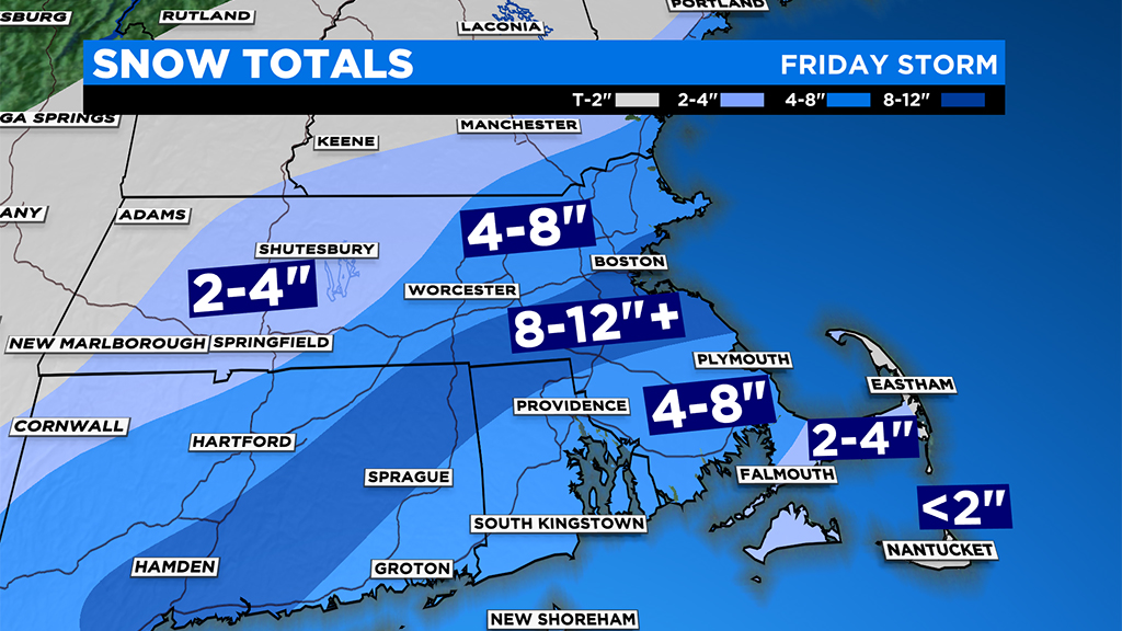
In a "typical" snow storm you generally get about 10" of snow for every 1" of liquid precipitation, a ratio of 10-1. This storm was a bit different and featured a huge fluff factor. Boston only had about .48" of liquid. . . so, in a normal event you would expect that to equate to about 4.8" of snow. However, thanks to the colder temperatures and ideal snowflake production on Friday, Boston's ratio was closer to 25-1! That is some serious fluffernutter!
Same can be said for all those communities just to the south of Boston like Milton, Norwood and Walpole. They were "fluffed" to the tune of 10-14" of snow, most of which fell in only 4-5 hours. Areas outside of the intense snow band had a more reasonable snow storm with generally 4-8" on either side and lower amounts (2-4") toward the Outer Cape and distant areas north and west.
With weather forecasting "stuff happens." Or in this case I guess you could say "fluff happens." There are almost always a few surprises with every storm. Models have come a long way in recent years but we still cannot forecast down to the smallest scales. Thankfully, this one was predicted well enough in advance and accurately enough to allow schools and businesses to close and for most folks to stay off the roads.
So what's next?
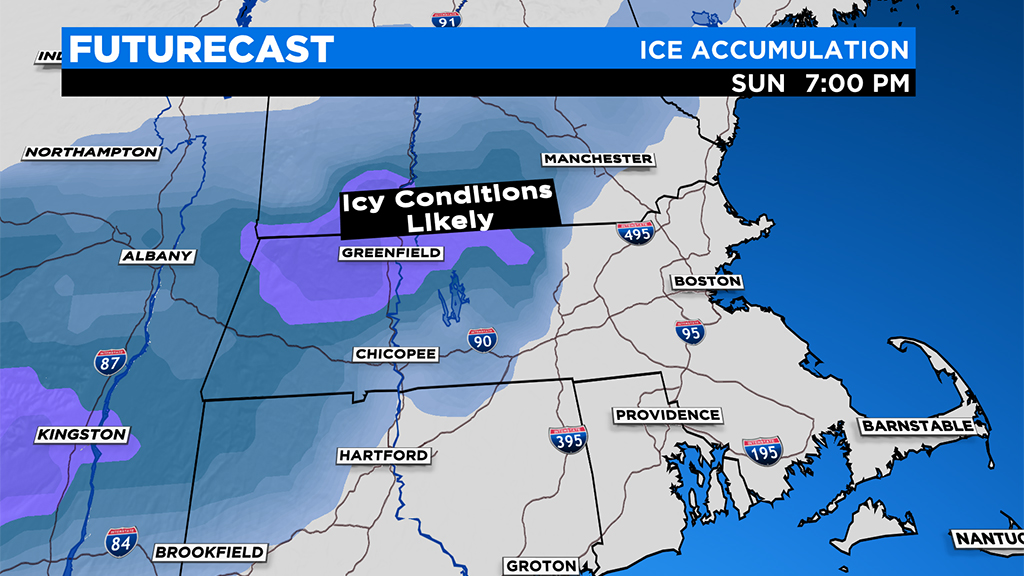
Not a lot of melting that's for sure. A chilly Saturday followed by a sloppy Sunday. Looks like a mix of rain, freezing rain and sleet on Sunday. Highest impact of icing will be to the northwest of 495 and in elevated areas of southern New England.
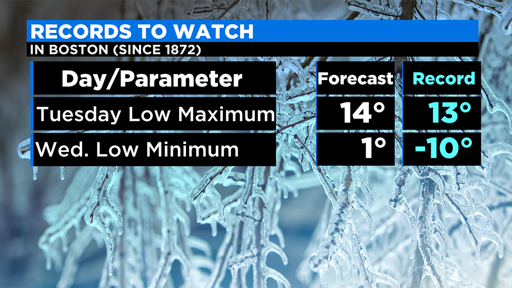
Then, we get a blast of cold straight from the Arctic next week. Tuesday will be, by far, the coldest day of the young season with highs in the single digits and teens and wind chills well below zero all day. New England will be the most anomalously cold region of the entire northern hemisphere on Tuesday! (Cold compared to average)
That may be followed by some snow showers and another shot of bitter cold Thursday into Friday.
Sure looks like January may be our harshest winter month this season. No more snow storms in sight for now but certainly plenty of cold aimed in our direction for a while.
Stay tuned! We will have frequent updates on WBZ-TV, CBSBoston.com, and CBSN Boston.