Flooding A Major Concern As Tropical Storm Henri Approaches Southern New England
BOSTON (CBS) - It's all about the tropics right now, and not much of the news is good. Fred's remnants brought a drenching 2-5" of rain across much of the area, particularly north and west of Boston Thursday. Now our attention turns to Henri, which could send an already drenching summer into the infamous category if things don't change in the next couple of days.
I think a look at the "wettest summer on record" leaderboard is instructive at this point. In Worcester, the top years are 1955, 1938, and 2011 (this summer is now just shy of 5th). This is a collection of infamous tropical years in New England with extremely damaging floods. In 1955, it was twin trouble in Connie and Diane. Two systems that arrived within a week of each other and brought a tremendous amount of water in a short amount of time. Some towns received over 20" of rain. To this day, those August floods are up there as one of the absolute worst on record in southern New England.
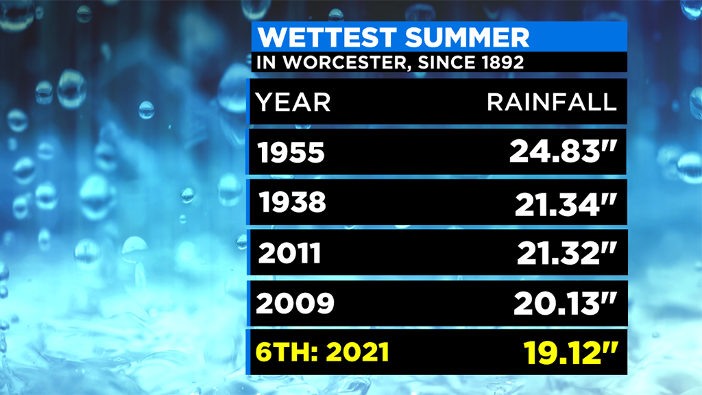
The year 1938 is known for a disastrous hurricane that struck in September, but the floods that came with powerful winds were a result of a soaking summer before the hurricane motored up the coastline. For the Connecticut River, only 1936 had a higher water level (more flood controls were installed after these very damaging years). And in 2011, a wet summer stretch was followed by Tropical Storm Irene. The burst of heavy rainfall wiped out roads and bridges across western New England and New York, delivering the worst flood in Vermont since 1927.
So you see a theme. What happens *before* a storm matters. And we've definitely primed our area over the past two months. Some towns have received over 20" of rain during that time. Water tables are high, rivers are unusually high for late August, and we just had a large rainstorm three days before another tropical system is going to threaten. Not a great combination.

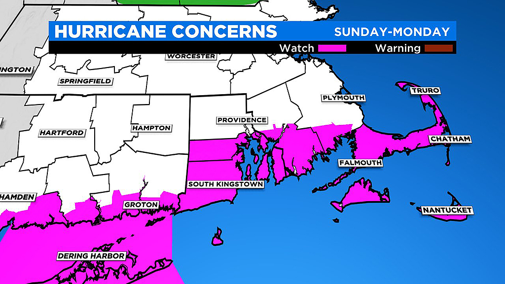
This is a big concern with Henri, and it all comes down to what happens once it gets close to southeastern Massachusetts. At this point, there is increasing confidence of a track over southern New England on Sunday into Monday.

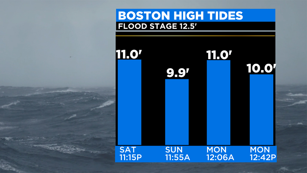
Either way, coastal flooding looks to be a risk. The timing is anything but optimal, with the moon giving us our highest tides of the month Saturday night and Sunday night. It would only take a foot or two of surge to start flooding, and a period of onshore winds at tropical storm force would bring more surge than that. Especially if spread out over a couple of tide cycles (that left hook/slower track).

Bottom line is that we often focus on winds with tropical systems, and yes that is a risk as well. Early estimates call for Henri to be at tropical storm or category 1 hurricane strength on arrival, weakening as it spins nearby. But water seems to be our biggest threat for now, both from rain and from the ocean.
So make sure the sump pumps are working, generators are in good condition, and batteries are ready to go. It's also a good idea to prepare, even if nature throws us a last-minute curveball that brings a much better and lower-impact forecast. Make sure there's no debris clogging storm drains or gutters. And we will keep you updated on any developments as the storm approaches!