Snow In Boston Area Friday Likely Just Coating To 2 Inches Before Weekend Warmup
BOSTON (CBS) - The trend is our friend, especially if you don't want snow Friday.
Over the last 24 hours, weather models have been fairly aggressively trending downward with snowfall amounts here in southern New England. This doesn't come as a great surprise given all the factors that needed to line up perfectly for a significant snow accumulation to occur.
Essentially, our area is on the very northern fringe of this storm system. In order for us to receive a meaningful and impactful accumulation, we need for the colder air to come in fast enough while still maintaining the intensity of the precipitation on the very northern fringes of the storm.
In a sense, we have to "thread the needle" just right with regards to timing and track, fairly typical of a mid-to-late March snow threat.
The latest data appears to show a much weaker northern extent to the system. The severe weather to the south is actually drawing away the needed energy to maintain the intensity up our way, also a common occurrence with some of these "spring-like" systems.
Therefore, we are lowering the snow amounts and calling for a less impactful event overall.
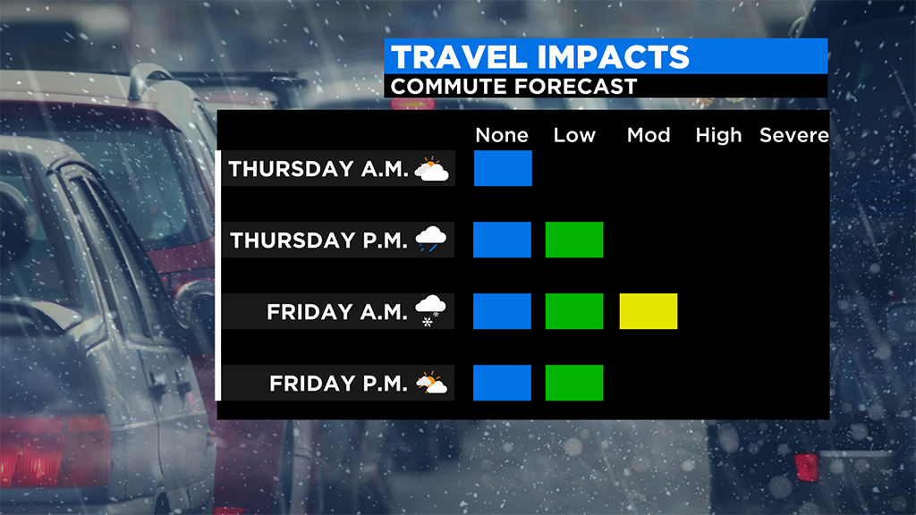
TIMELINE:
Thursday afternoon and evening: Light rain arrives from the west, becomes steady, light to moderate by sunset.
Thursday 7 p.m. to midnight: Temperatures drop and the rain changes to snow from northwest to southeast. Berkshires first to change between 7 and 9 p.m. Most of central and western Mass. changes to snow between 8 and 10 p.m. Eastern Mass., north of Plymouth, changes to snow between 10 p.m. and midnight.

Friday 12 a.m. to 5 a.m: The colder air continues to slowly push southward, bringing snow and a mix all the way to the South Coast. Whatever snow accumulation we do get will occur mainly in this window of time. At this point it appears the snow will be generally lighter in intensity and somewhat scattered as the northern fringes begin to fall apart.
Friday after 5 a.m: The storm makes a quick exit out to sea and by dawn, most of the precipitation is done. We will see sunshine appearing from west to east by late morning and early afternoon.
SNOW AMOUNTS:
Widespread coatings to 2 inches for most of southern New England.
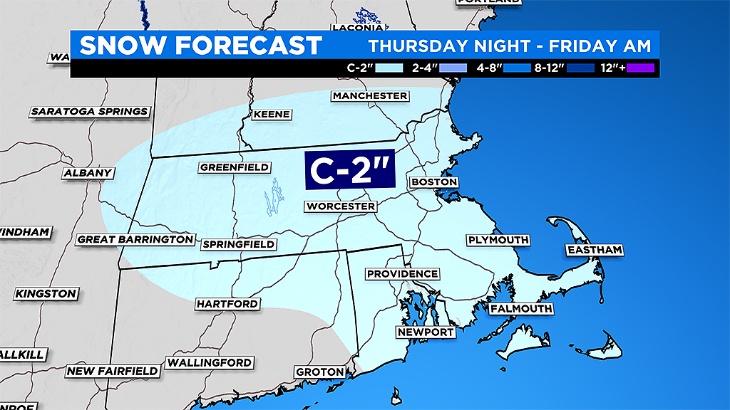
While many areas receive nearly nothing but a dusting on the grass, a few spots in narrow bands could get as much as inches.
WIND:
North-northeast wind gusts will peak between 40-to-50 mph over coastal Plymouth County, Cape Cod and the Islands between about midnight and 10 a.m. Friday.
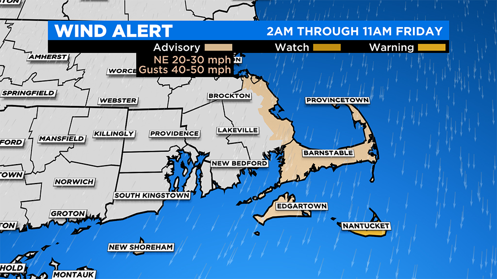
Elsewhere, winds will peak with gusts between 20-to-40 mph, highest closest to the shoreline.
HELLO SPRING!
With temperatures topping 50 degrees this weekend and perhaps 60 at times next week, any snow that does accumulate won't be sticking around long. In fact, most will have vanished by the end of the weekend. Thereafter, there is no additional snow in sight and overall temperatures look fairly mild for a while.
Follow Terry on Twitter @TerryWBZ