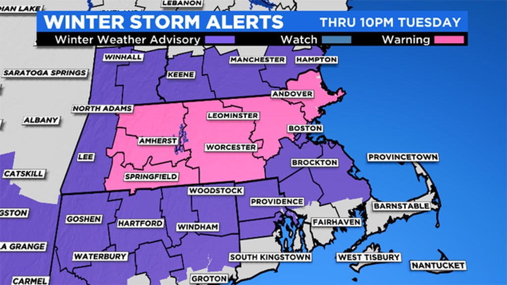
Widespread 3-6 Inches Of Snow Likely In Massachusetts, Southern New Hampshire
BOSTON (CBS) - Here we go again.
February always reminds me of that final peak you need to climb to get to the top of the mountain. The end is in sight, but it just seems like boulder after boulder. Technically the shortest month on the calendar, but easily feels like the longest.
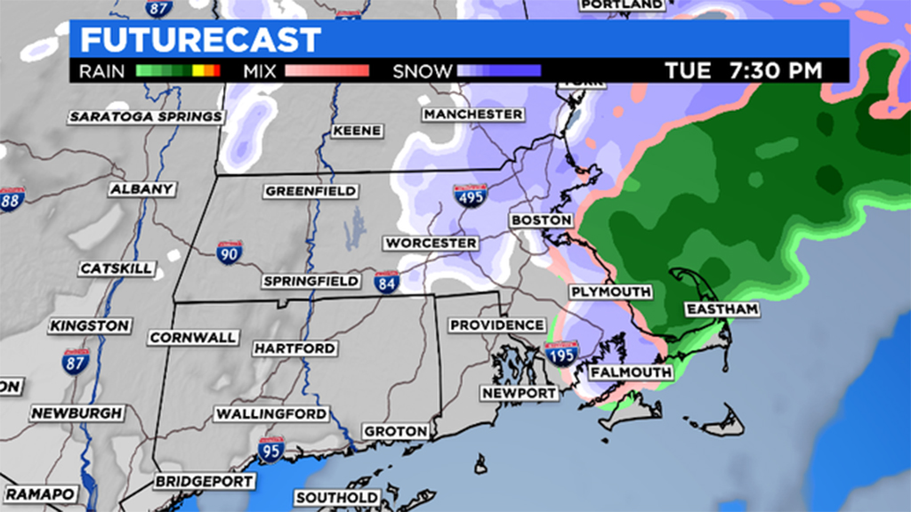
Tuesday's storm will have some similarities to Sunday:
-Majority of snow falls in the daylight hours
-Start time mid to late morning, 8-11 a.m.
-Cleanup time between 7-10 p.m.
-Snow, hazardous travel the only real impact, no wind or coastal concerns
There will be some noticeable differences from Sunday however:
-Highest snow totals north and west of Boston (not to the south)
-More rain/mixing south of Boston this go around
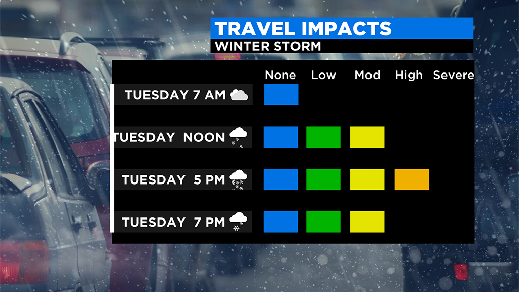
TIMELINE:
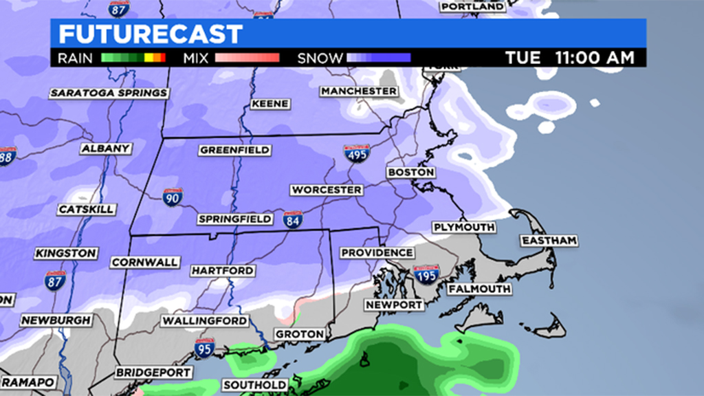
Other than a few early morning flurries, the start of the steady snow begins around 7 a.m. in western Massachusetts, 9 a.m. in Worcester County and around 10 a.m. in eastern Mass.
The heaviest snow and majority of accumulation occurs in the afternoon and evening, between noon and 7 p.m.
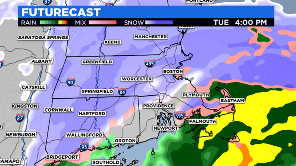
It tapers off from west to east, 6-to-7 p.m. in western Mass., 7-to-8 p.m. in central Mass., and 8-to- 9 p.m. in eastern Mass.
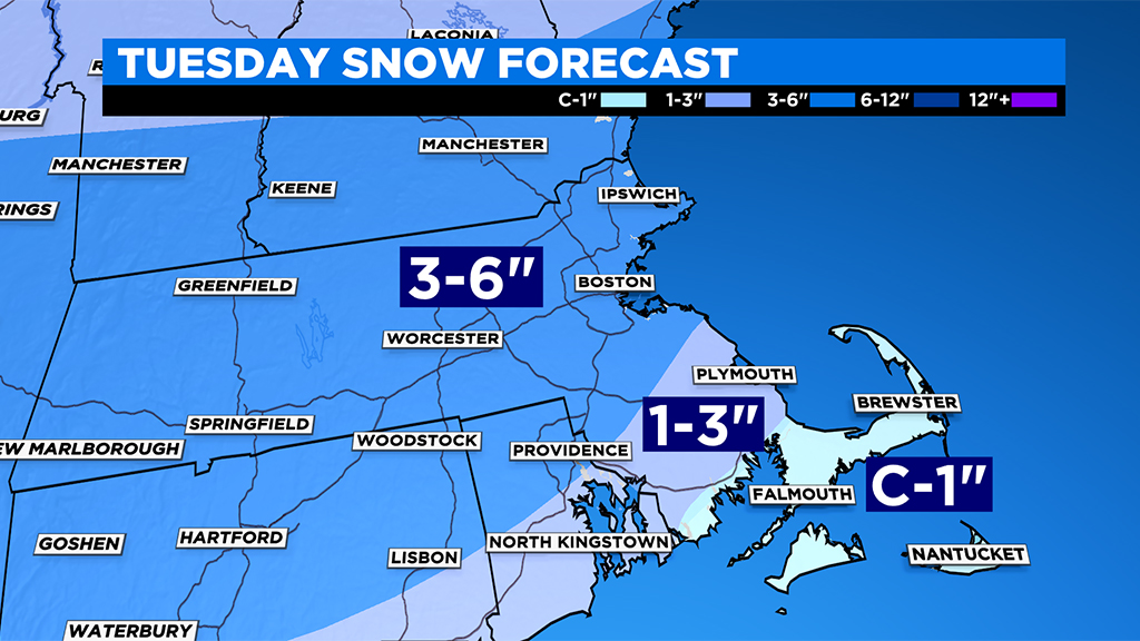
HOW MUCH/CONSISTENCY:
Coating to 1": Cape and Islands…very heavy and wet down there, washed away
1" to 3": Cape Cod Canal north to Plymouth/Marshfield and inland areas of southern Plymouth and Bristol counties, again very heavy and wet and mostly washed away by rain in the afternoon
3" to 6": all areas north of Plymouth and Providence, including Boston, Worcester and north through southern New Hampshire, much lighter and fluffier snow consistency the farther north and west you go
WHAT'S NEXT?
First the cold, nothing like what will be descending upon the Midwest this week, but lots of daytime highs in the 20s Wednesday through Friday in southern New England.
For now, it appears that the storminess on Thursday and Friday will slide far enough to our south that we may only get some passing flurries at times.
The next significant storm threat looks to be Sunday, but it's way too early for specifics on that one, but needless to say you may be shoveling for the second straight Sunday!