Super Bowl Sunday Storm Will Likely Bring Heavy Snow To Southeastern Mass.
BOSTON (CBS) - February never seems to disappoint. All you winter/snow lovers that were complaining in January, wondering if winter was done…I think we have your answer.
For the second time in a week, we are tracking a snowstorm for southern New England, this one coinciding with Super Bowl Sunday.
Some "good news" points to hammer home:
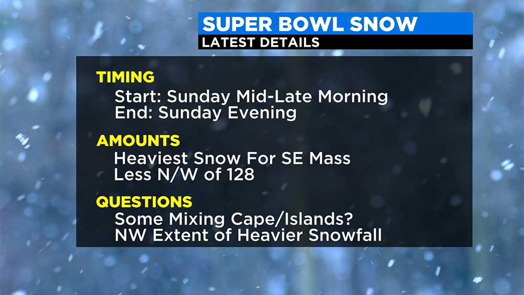
-This will be a quick mover, in and out of here in about 8 hours
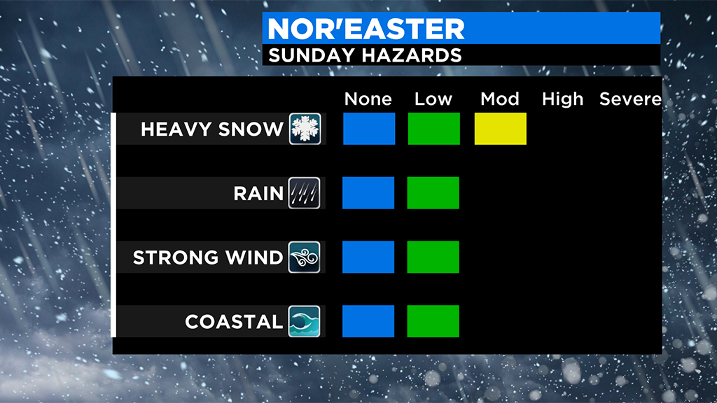
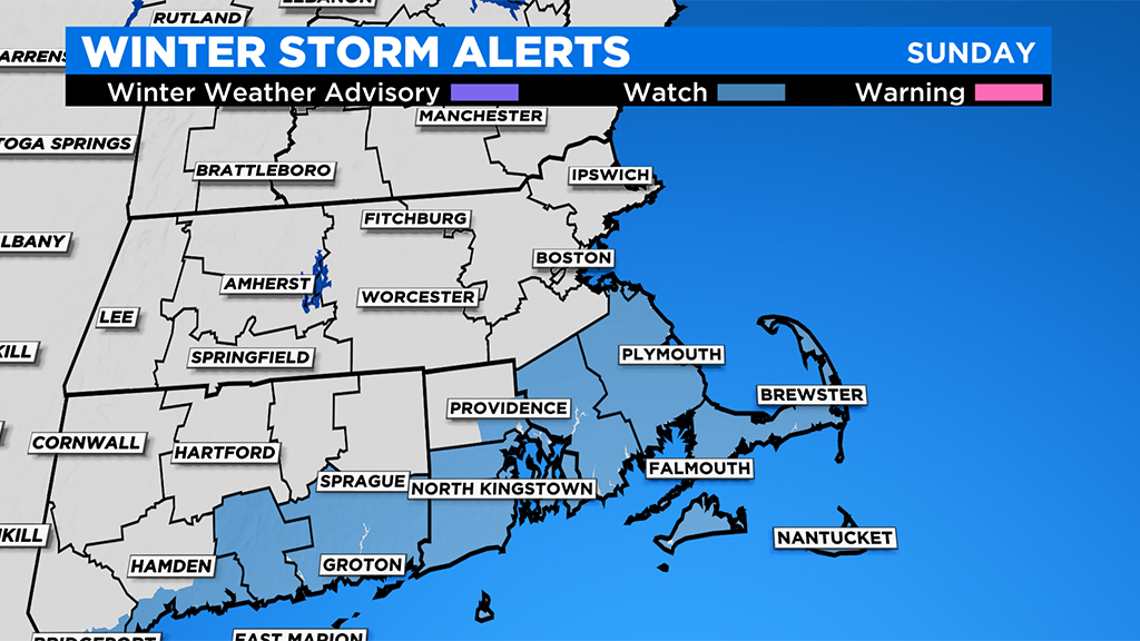
-The impacts will likely be limited to snowfall accumulation and traveling, no real wind, coastal flooding, power outage concerns. (highest wind gusts essentially confined to Cape/Islands)
-Mainly a light and fluffy snowfall for those north and west of Boston…lighter amounts up there too so very easy to move around. Can't say the same south of Boston…much heavier consistency and higher snow amounts in that area
-If you are thinking about waiting to snow blow after TB12 hoists the MVP trophy, conditions won't be too bad…snowfall long over, winds not too gusty…temperatures in the 20s
TIMELINE:
Snowfall arrival…around 7-8am on the South Coast, 8-9am Boston, 9-10am up through MA/NH border.
Steadiest snow and most of accumulation…10am-6pm
Snow tapers off from west to east between 5pm and 7pm
AMOUNTS:
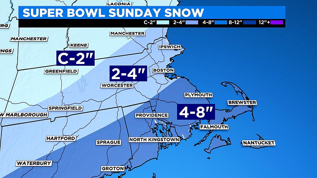
Coating to 2" northwest of Route 2, mainly in far northwestern Massachusetts, southern Vermont and New Hampshire
2-4" 495 belt including Lawrence, Lowell, Marlboro and Worcester…also 128 belt including Boston
4-8" Most of southeastern MA including Plymouth to Providence, South Shore, South Coast, Cape Cod and Islands
WINDS:
Not a huge concern but still gusty in southeastern MA.
20-40mph (northeasterly) along the South Shore
30-50mph (northeasterly) Cape Cod and Islands
WHAT COULD GO WRONG:
Still some questions with regards to the northerly extent of the heavier snow shield. Not out of the question that areas north of the Pike could get in on higher snow totals.
Also, there is a chance that parts of the Cape and Islands could get some mixed precipitation, therefore lowering their final snow totals.
WHAT'S NEXT:
An active pattern next week with storm chances around Tuesday and again late in the week. At the same time, an Arctic airmass descends upon the Midwest with the coldest air of the winter in the U.S. When or if that frigid air moves east to New England remains to be seen.