Super Bowl Sunday Snow In New England? Too Early To Tell
BOSTON (CBS) – It's a nor'easter! It's a miss! No wait, it's back!
The Twitter-verse and other social media has been a buzz this week with rampant rumors of a Super Bowl Sunday snowstorm. And from the number of questions we have received on email and otherwise, I felt it was probably time to address the elephant in the room.
As a rule, our WBZ weather team doesn't like to deal in speculation or hype. Sure, if there is something possible within the next seven days we will make mention of it or more than likely place a "watching storm" label on the 7-day.
But trust me, if we were to take every run of every model and put it on TV, it would make your head spin. In any given 7-10 day period in the middle of winter, there are any number of storm possibilities being indicated on even more models than we have time to digest.
I don't begrudge snow lovers and weather hobbyists for getting excited and posting such things on their Twitter feeds. But, one of our main jobs as TV forecasters, is to try and cut through the model noise and figure out what's real and what is model fantasy-land.
Problem is, the atmosphere is a very complex place, and even weather models doing trillions of calculations can have a hard time figuring out what this chaotic ocean of air above us will do next, nevermind 7 days from now. Take for instance, this Sunday.
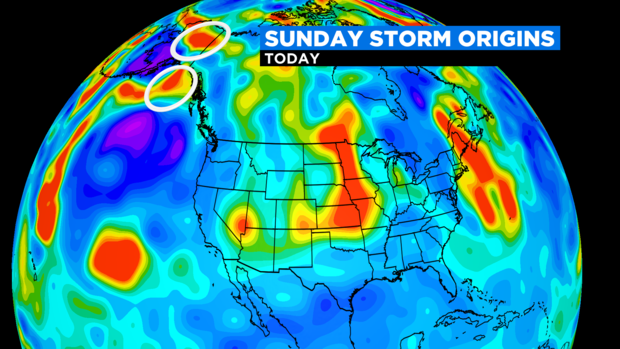
As of this writing, the "pieces of energy" for the Sunday storm are strewn across Alaska and northwest Canada. Over the next several days, this energy will travel thousands and thousands of miles, interacting with other pieces of atmospheric energy, not to mention mountain ranges and various topography.
And the big question that needs to be answered relative to a Sunday snowstorm versus a miss is how will these two main pieces on energy interact? One will ride the northern Jetstream through Canada, while the other will sink far south almost into the Gulf of Mexico. As they both approach the East Coast this Weekend, several scenarios still remain.
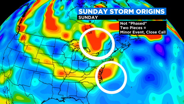
1) The most likely scenario and what we thought was the final solution yesterday, they stay completely separate and the main storm on the south pushes harmlessly out to sea. I'd say the odds of this are about 50%.
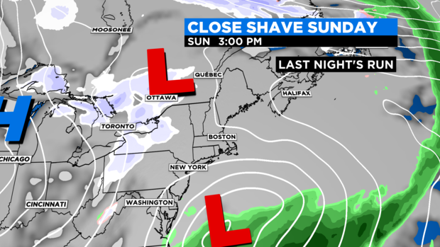
2) Many models today show the northern stream tugging the southern stream closer to the Northeast on Sunday. Not connecting for a party, but close enough to make meteorologists nervous and perhaps some light snow in Southern New England. Odds of this occurring are about 30%.
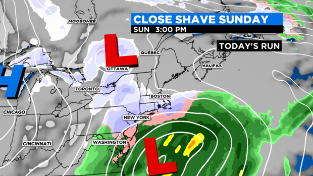
3) The final scenario, which many models started the week with a few days ago, is one where the two merge and "phase" as we like to say, and that is how you get a full blown nor'easter. While this is still the most unlikely scenario, I'd say the odds of this happening went from about 10% yesterday to about 20% today.
Ok, so that was just a long way of saying we still don't know exactly what is going to go down here on Sunday. Let's play the "what if" game for a moment.
IF the storm were to come close enough to bring snow to New England on Sunday, the timeframe to watch would be late morning through nighttime.
IF the storm followed today's model trend and gave us a close call, the best chance of significant snow would be over southeastern MA (closest to the storm center).
And lastly, IF we had a phasing, well, all bets are off, we could have our second nor'easter in less than a week. I don't know about you, but I'd like to watch TB12 without worrying about power outages and snow blowing.
So, stay tuned. My guess is by Friday afternoon we should be able to forecast with much more confidence.
Follow Terry on Twitter @TerryWBZ