Sunday Night Weather In Mass. Features Severe Thunderstorms, Powerful Winds
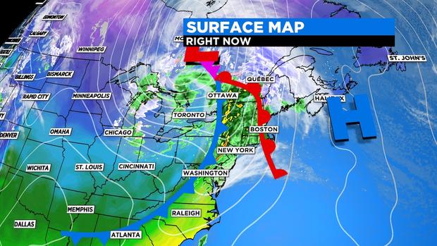
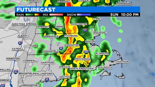
BOSTON (CBS) -- After a dry finish to the weekend, a powerful cold front moved through Massachusetts on Sunday, sparking showers and embedded thunderstorms, along with strong to damaging wind gusts.
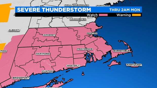
A SEVERE THUNDERSTORM WATCH was put in effect for the area (until 2 a.m on Monday).
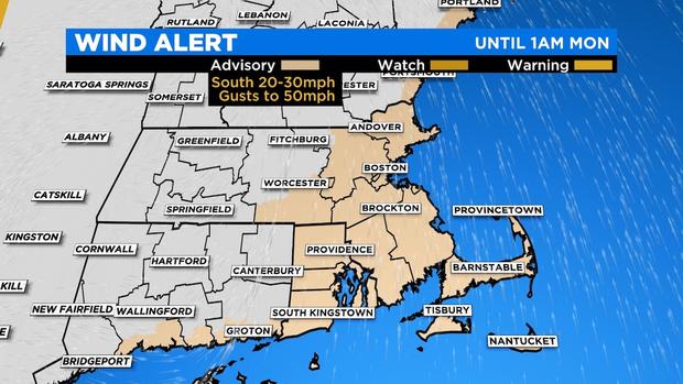
A WIND ADVISORY was also issued on Sunday ahead of the cold front passage. It was in effect until 1 a.m. on Monday. Southerly winds ahead of the front gusted 50+ mph in some areas. The strongest winds coincided with the passage of the front between 9 p.m. to 1 a.m. from west to east.
Gusty downpours impacted the Patriots game at Gillette on Sunday night.
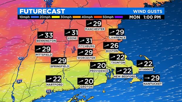
As the front pushes off the coast early Monday, winds will then turn out of the west and remain blustery through the day. Despite highs in the upper 40s to low 50s, the wind will make it feel 10 degrees cooler.
A second, less potent front will slide through the area on Tuesday. This front may stir up the clouds and allow for a short-lived sprinkle or flurry. Any activity will be isolated to scattered and shouldn't amount to much. This front, however, will introduce a blast of cold air into area midweek.
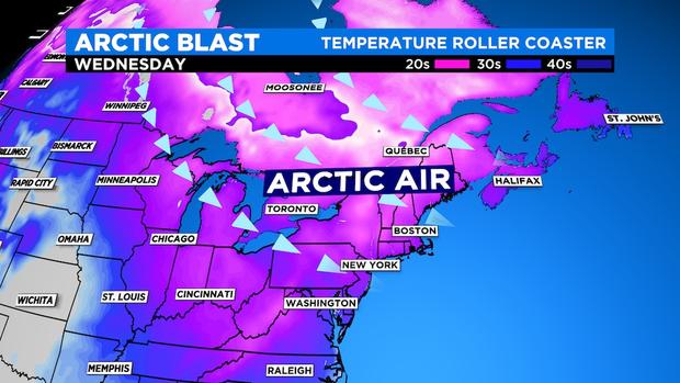
Those 70s we enjoyed last week are going to be way in the past by the time we get into Wednesday. Highs will struggle to get out of the mid-30s. BRRRR....