High Heat, Humidity And Potential Tropical System Ahead
BOSTON (CBS) - "It's not the heat...it's the humidity". I am sure you will hear that phrase a few hundred times in the next several days as what is likely our most humid summer stretch is upon us.
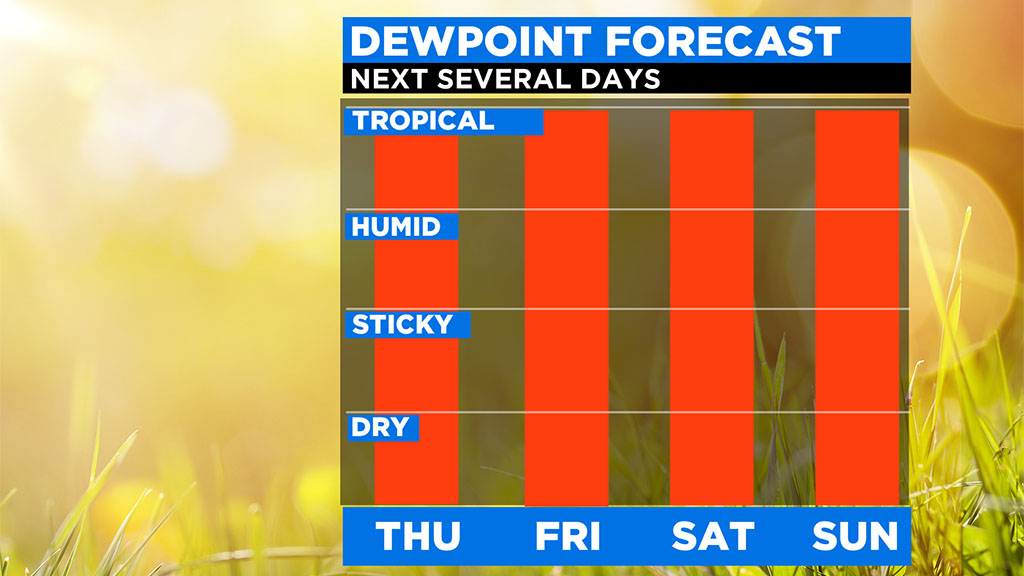
You may have noticed a change in the air when you stepped outdoors today. Not a searing heat, but more of a heavy feel to the air. The air mass that has parked itself on top of New England and much of the East Coast is downright tropical in nature. Dew points through the Weekend will range between 70-75 degrees. That is just about as humid as it gets here in New England, anything over 70 is generally considered oppressive and very uncomfortable.
Very high dew points essentially mean that the air around us has a lot of water in it. This makes us uncomfortable because our skin is constantly attempting to regulate our temperature. When the air is dry and we are sweating, the evaporation of our sweat helps to cool our body temperature. When the air is humid, our sweat does not evaporate nearly as readily and we can tend to overheat. So, on days like Wednesday and the next several days, it is important that you lessen strenuous activities outdoors and drink plenty of fluid.
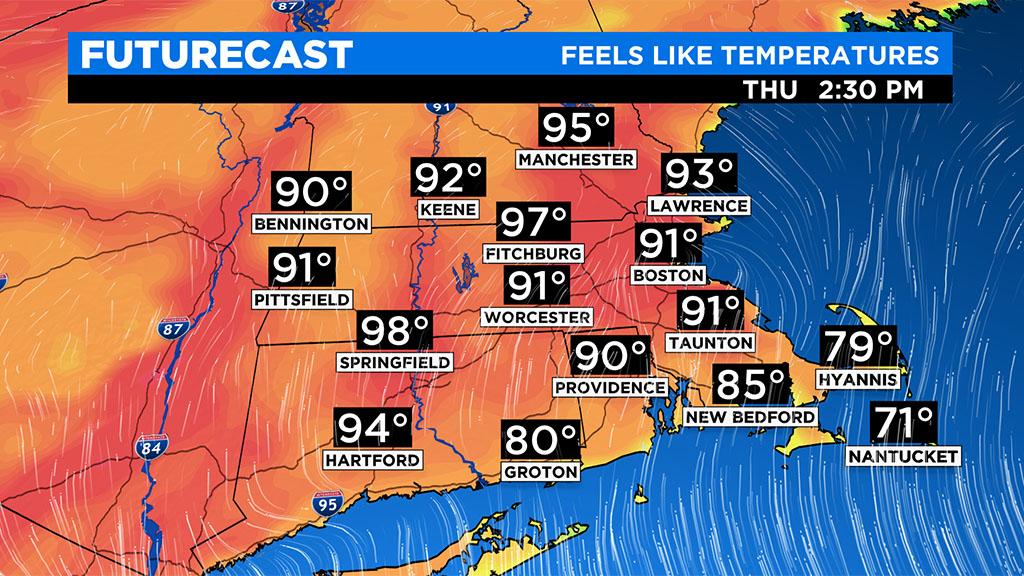
Thursday may actually be the most uncomfortable day of the bunch with a combination of high temperatures (low 90s) and high humidity (70+) creating a heat index (feels like temp) between 95-100 degrees.
In addition to the high humidity, we also have a potential tropical system to watch here in New England at the end of the week. Currently there is a rather anomalous low-pressure area spinning around the Carolina's. Models indicate that this low will emerge over the Atlantic Ocean by Friday, off the Mid Atlantic Coastline. Warm, Gulf Stream waters will likely give this system an infusion of energy, perhaps enough to spawn a Tropical Depression or Tropical Storm for a brief period of time. Should this occur, it would be Tropical Storm Fay, our 6th named storm already this season, the quickest ever to 6 named storms in our recorded history.
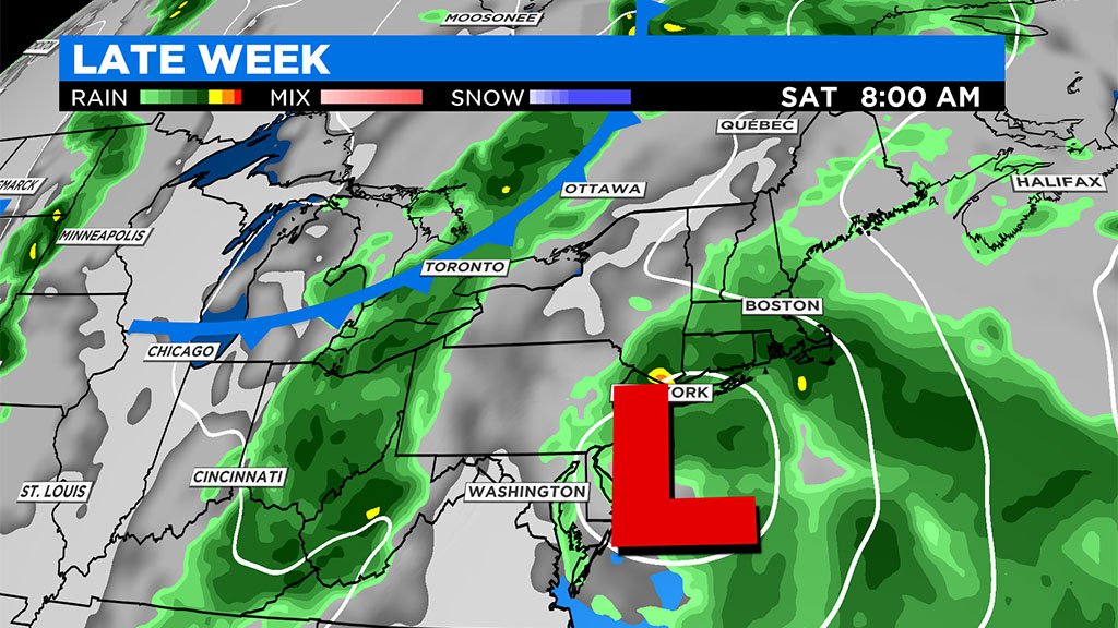
Whether the storm gets a name or not, the effects will be similar...some gusty winds along the Mid-Atlantic and southern New England coastlines, perhaps as high as 30-40mph, some rough seas through the Weekend, and finally, a whole lot of rain.
Latest weather models are showing a more inland track, over Long Island and into central or western New England. This would shove the heaviest rain to our west, but we would still likely see some bands of heavy rainfall ion eastern MA. late Friday into Saturday morning. Tropical-like systems similar to this one also have a history of producing some severe weather and potentially even a spin-up (weak) tornado. Far from a certainty, but something to watch for as the storm passes by on Saturday.
Many areas are still rather dry in Southern New England and could use a good slug of rain. Timing is still a bit uncertain but it appears that late Friday night through midday Saturday is the time to watch for the heaviest rainfall.
If you are planning to be outdoors this weekend, I would hedge towards later Saturday or Sunday. Cannot rule out a scattered storm either of those timers either but the overall coverage will be much lower.