Rain, Hint Of Snow, And Possible Record Cold To Start Mother's Day Weekend
BOSTON (CBS) - 2020 is quickly becoming the year of "What is going on?"After a mild and all be it non-existent winter, April and May have stepped up to show us some snow potential.
TIMING:
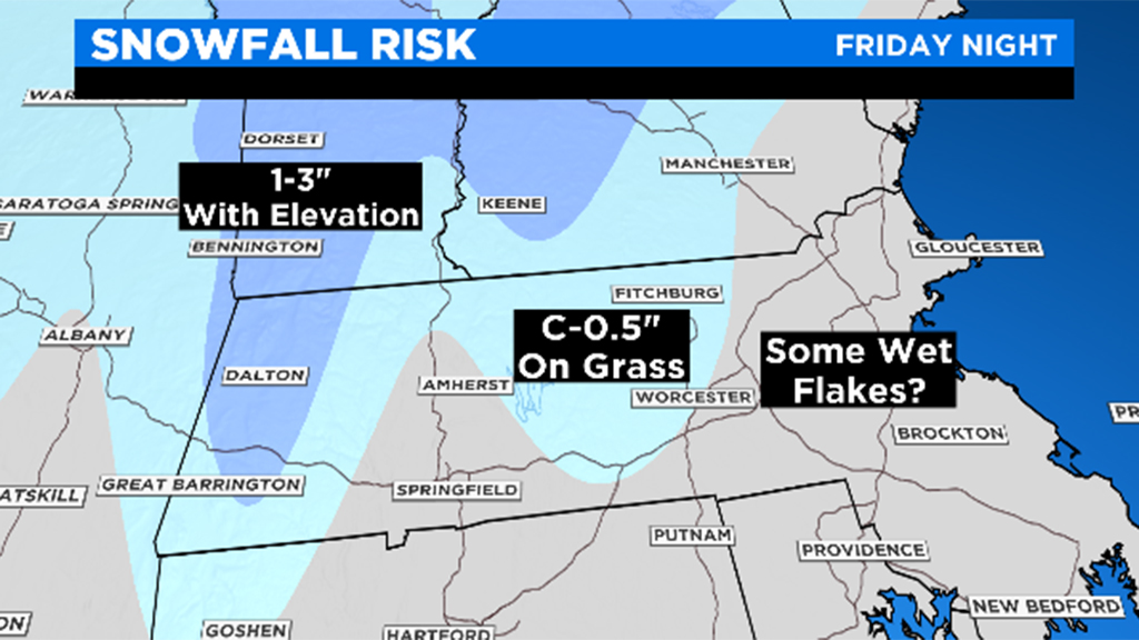
Friday afternoon we'll begin to see clouds increase as a wave of low pressure slides towards southern New England. By 8 p.m., rain arrives in eastern Massachusetts. In fact, most of this event (if not all of it) will be rain for those east of I-495. Snow moves into the higher elevation of the Worcester Hills from midnight-to-4 a.m. By sunrise Saturday, lingering rain showers will be left over and the flakes will have wrapped up.
ACCUMULATION:
Best case for any of this snow to stick is towards Route 2 in Worcester County and areas north. A coating to half-inch is possible on grassy surfaces but this shouldn't leave much behind. Higher elevations of Western Mass. and Vermont likely see the 1-3" range.
RECORD BREAKING:
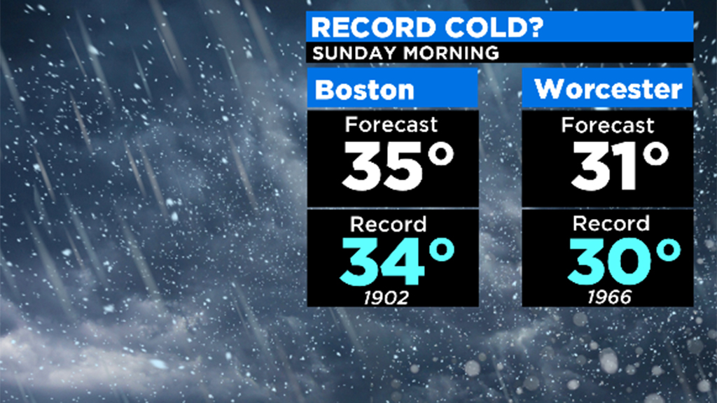
Snow goes hand-in-hand with cold and we'll be closing in on record breaking territory. We'll fall back to the 30's prior to sunrise Saturday morning. While I think we'll stay just above the record lows, no doubt it will be a chilly, raw start.
WIND:
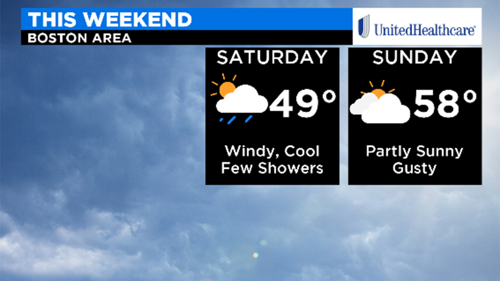
Gusts up to 45 mph are likely on Saturday afternoon as this system moves northeast. This could result in some tree damage as leaves are now returning. A breeze holds through Mother's Day but shouldn't be as strong.
MOTHER'S DAY:
This is looking better than Saturday! More clouds than anything else, but with no rain and certainly no flakes, things should be looking up to celebrate Mom on Sunday.